Yangon Township Map Book (2025) is available now!

Price: 35,000 MMK
A geographic information system (GIS) is a framework for gathering, managing, and analyzing location data. Rooted in the science of geography, GIS integrates many types of data. It analyzes spatial location and organizes layers of information into visualizations using maps and 3D scenes.
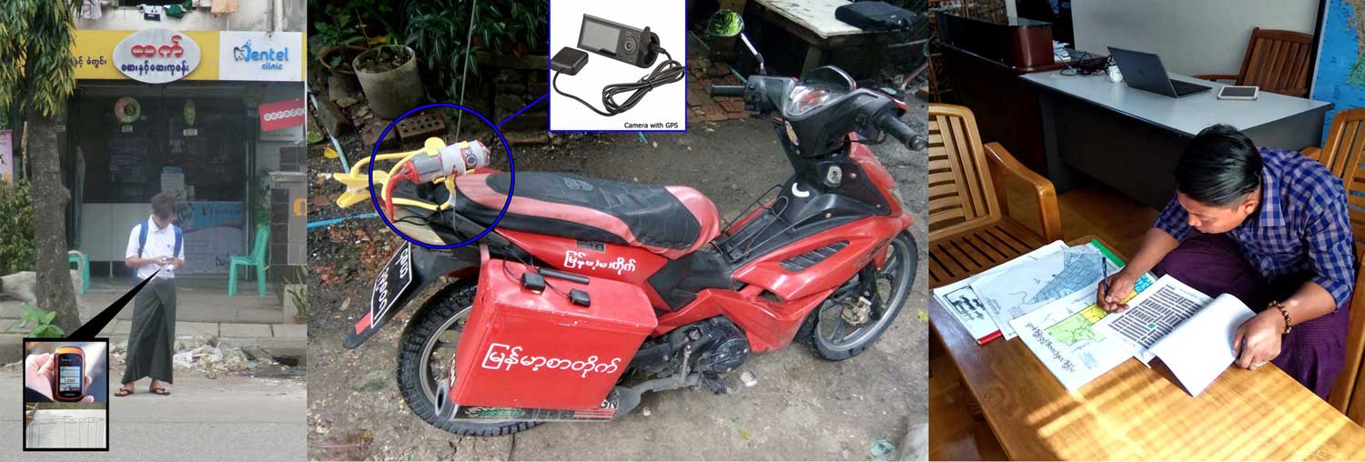
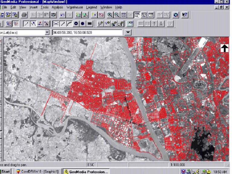
We at DPS have been involved in Map making and data warehousing with Geographical Information System (GIS) from day one. Our first project was to acquire Satellite Maps in 1998 (at that time satellite maps were reserved for military and oil and gas exploration only in Burma). Then we set up Ground Control Points using Trimble Pro XR survey GPS. We completed Yangon Streets in UTM in 1998. At that time, our major customers included the US Government and MEGA Life Sciences. Now our GIS Data includes the whole Myanmar Road Network, Village Points, Address Points (AP), and Points of Interest (POI). APs are mainly used by Ride Hailing Applications and Navigation systems such as Grab Taxi and TomTom. DPS has some 300,000 APs for Yangon, Mandalay, and other major cities. POIs are used by City Guide Maps, Ride Hailing, and Distribution companies. DPS has 60,000 POIs with rich attributes for Distribution and Retail companies as well as Banking/Insurance applications.
Do you want to build your own database for your company? (Our services)
- Data Collection & Survey Service.
- GIS Map and Database Consulting Service.
- Utility Mapping Services.
- Telecom Mapping and GIS Service.
- Banking Sector Mapping.
- Distribution Services.
- Internet Service Provider Mapping.
- Video Record Data Survey for Restricted Areas (POI, AOI).
- House Number Data Collection Survey Services.
- Ground Survey Services.
Yangon GIS Map Soft Copy ( Existing Data )
- Updated data extends to Yangon Region Boundaries.
- Address Database with House numbers guaranteed quality.
- Village Tracts & Village Layers.
- Township Boundaries & Towns.
- Railway Networks & Industrial Zones.
- Points of Interest – POI Layer:
- Bus Stops (2000+), Government Offices (370+), Schools (340+)
- Factories, Banks, Condominiums, Hotels, Restaurants
- Monasteries, Pagodas, Churches, Gas Stations, Hospitals, Parks
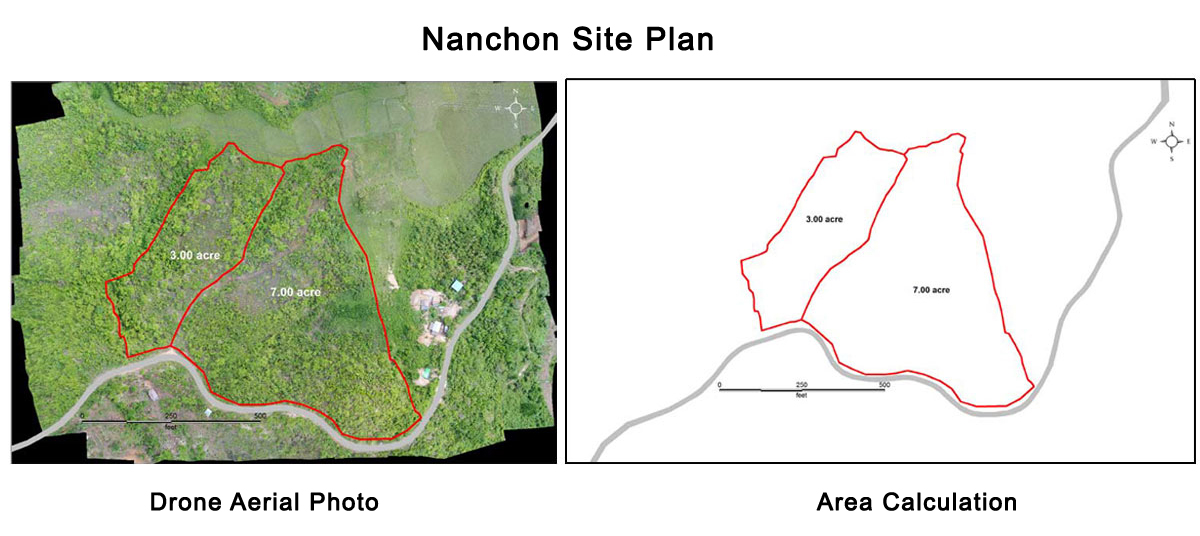
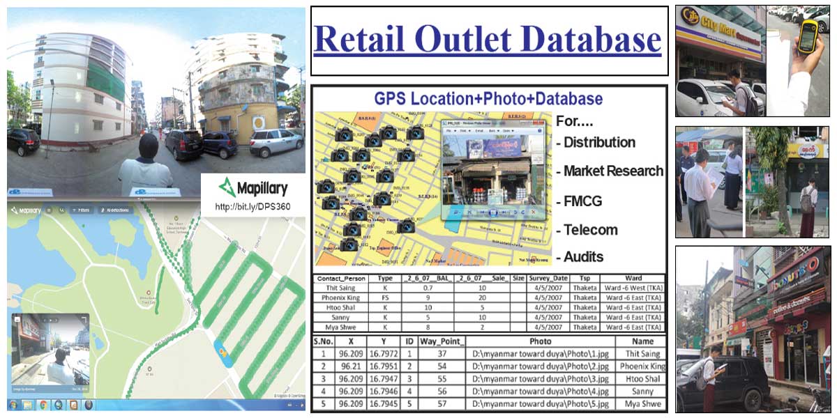
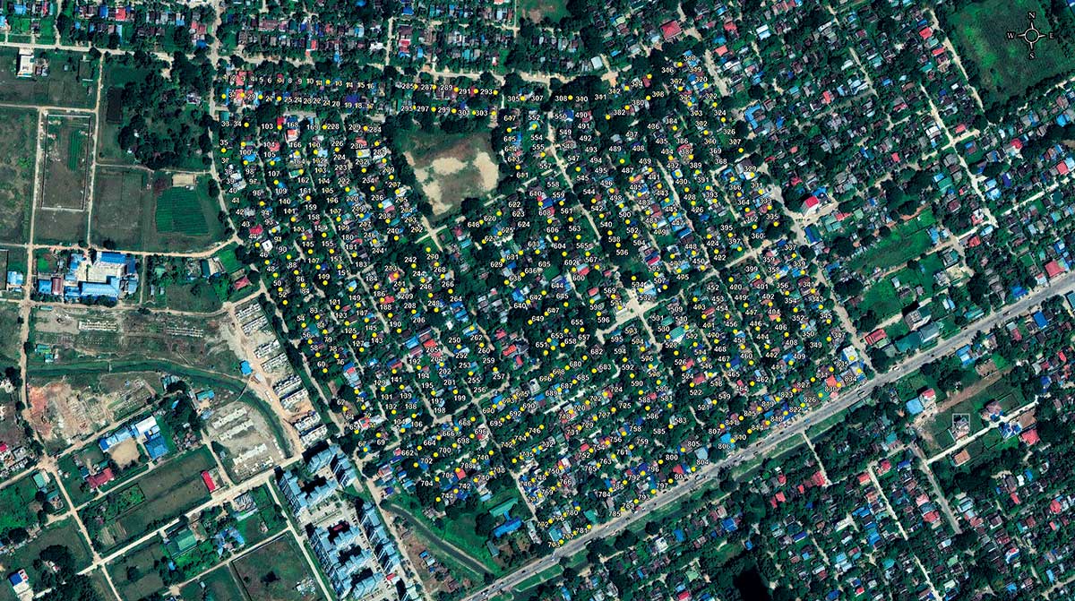
Since 2018, we have been collecting POIs for Yangon and Naypyidaw, and APs for Yangon, Mandalay, and Naypyidaw, mainly serving ride-hailing platforms like Grab Taxi.
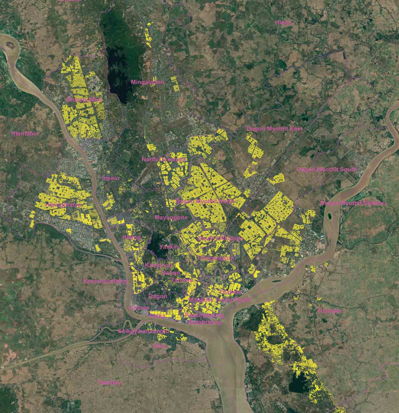
Yangon POIs Coverage Map
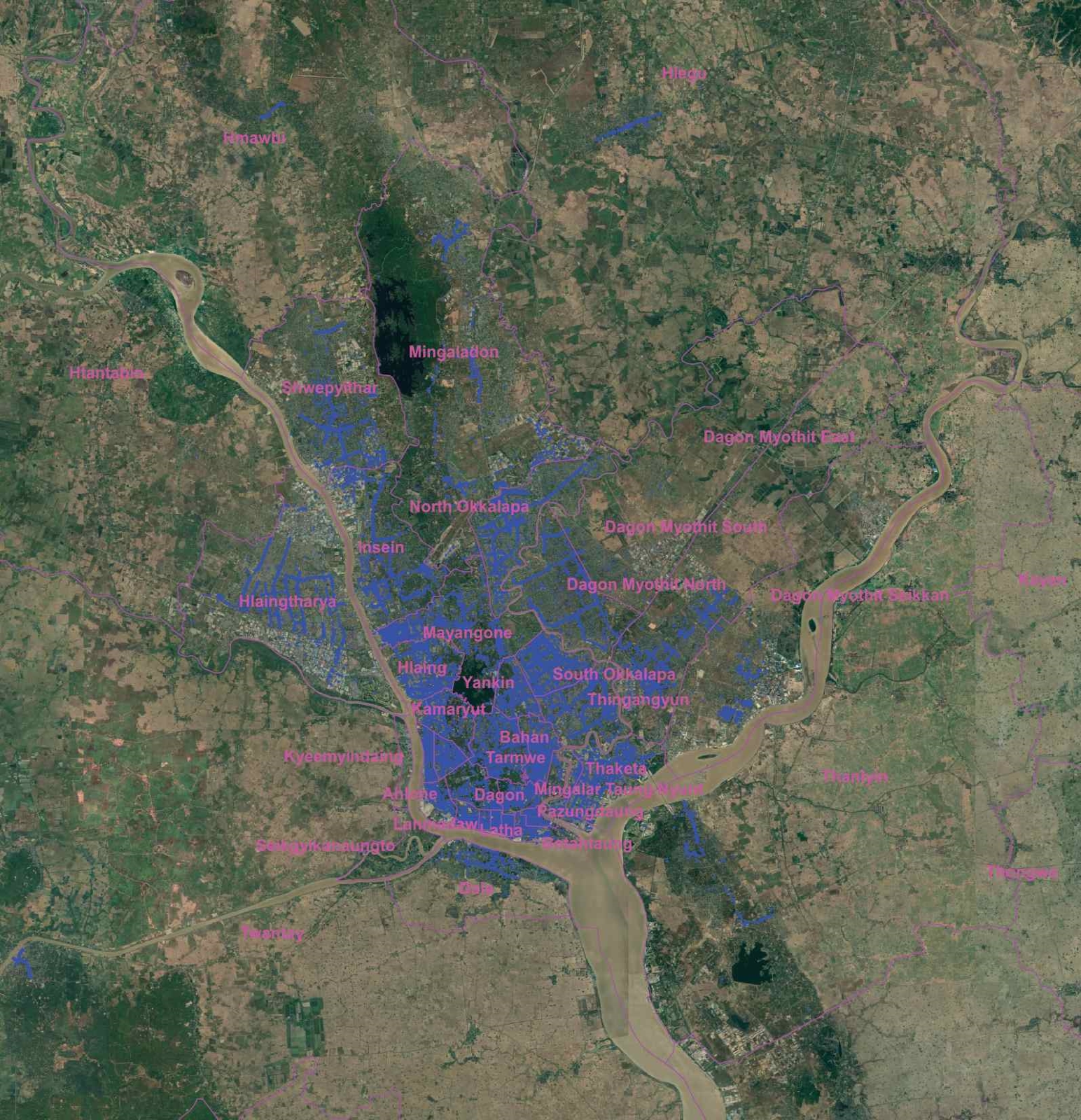
Yangon APs Coverage Map