Mapping Myanmar since 1995 · Accurate maps, GIS data and field surveying
About DPS Map

Local knowledge. Geospatial precision. A clearer view of Myanmar.

DPS Design Printing Services Co., Ltd. is a Myanmar mapping and GIS company building practical maps, location databases and field-survey solutions for public services, businesses and communities.

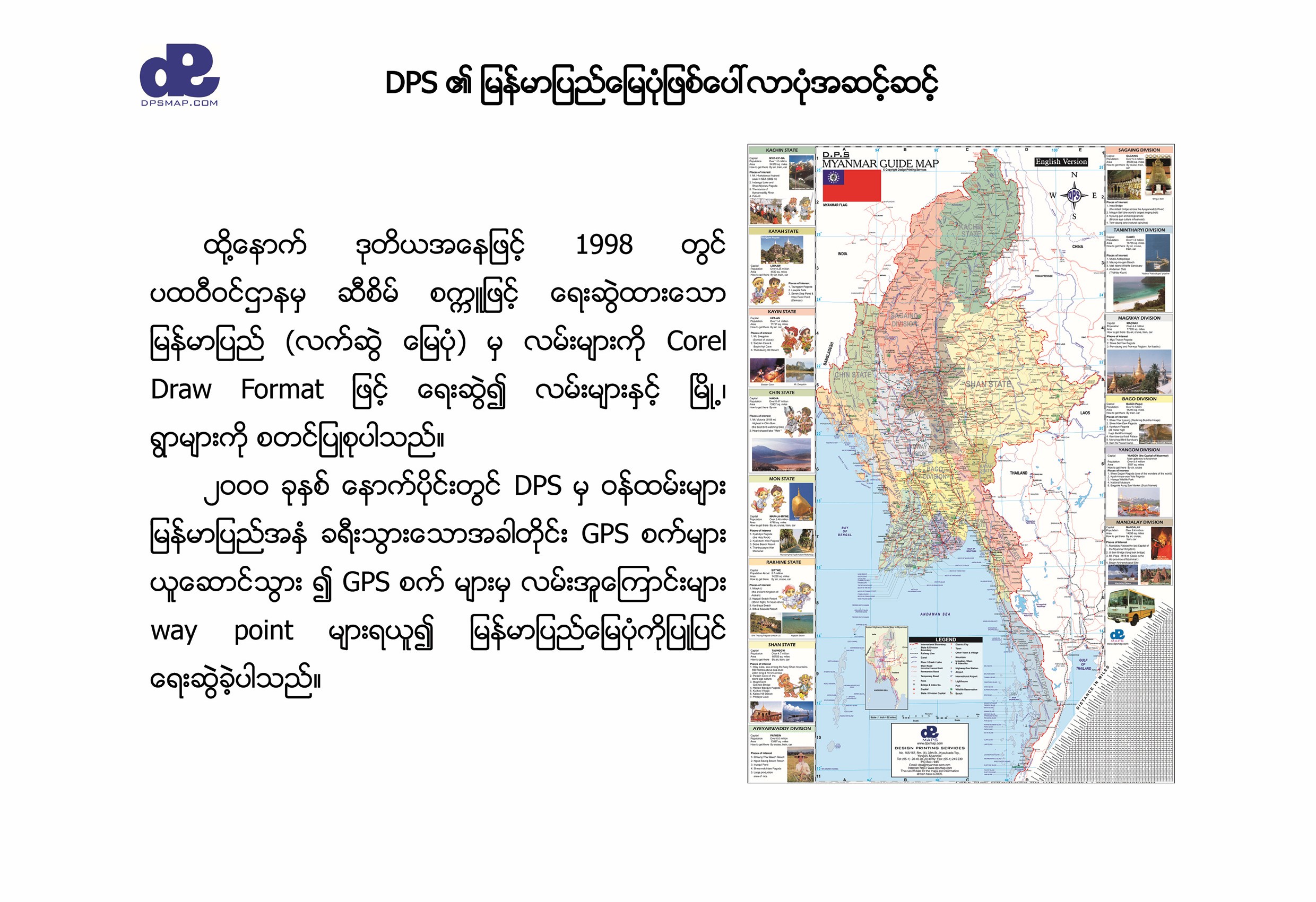
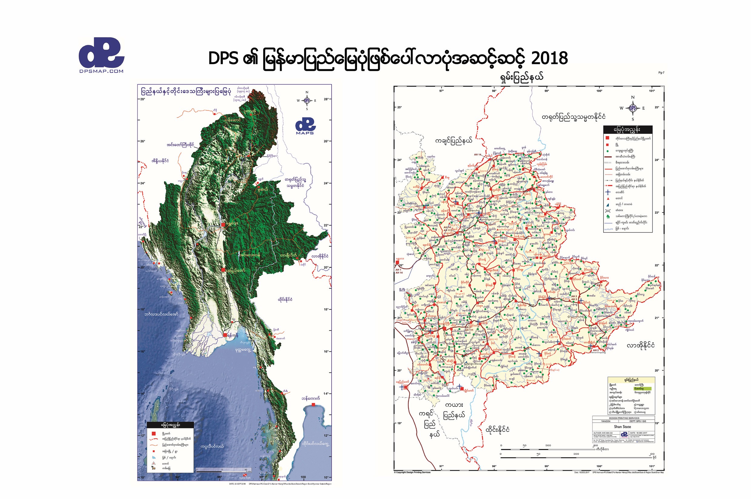
Myanmar and Shan State maps from 2018
Decades of map production, GPS surveying and local data development.
1995Company established
511,181Address points
60,000+Points of interest
34POI categories
From the Archives

Myanmar Works Hard to Keep the Internet Out

In downtown Yangon, Internet entrepreneur Aye Min Oo is busy selling space on a Web site that he cannot access. To woo advertisers who are also forbidden to access the World Wide Web in military-ruled Myanmar, formerly Burma, he transports his tourist-oriented Web site's pages the old-fashioned way.

“I travel around Yangon and demonstrate the pages on the hard drive of my laptop,” he said. “We e-mail new pages to the webmaster in Belgrade. Hopefully, some day we will see it online here ourselves.”

Aye Min Oo's roundabout access to the Internet may not be ideal, but it is a rare privilege in isolated Myanmar, a Southeast Asian country of 48 million people where some of the world's toughest Internet restrictions are vigorously enforced.

The measures, aimed at fending off the online campaigns of exiled Burmese opposition groups, restrict e-mail access to fewer than a thousand people who are close to the ruling party, the State Peace and Development Council (SPDC).

Access to the World Wide Web is strictly banned, and unauthorized use of a modem is punishable by 7 to 15 years in jail.

Just one other Web site operates consistently from the country, which has been widely condemned for human rights violations and the suppression of democracy. It is the government's own site, which is only available outside the country. It features tourist and army news in four languages, along with regular fiery criticism of opposition leader Aung San Suu Kyi, whose National League for Democracy party won a 1990 election that the military refused to recognize.

In the decade since then, thousands of democracy activists have been jailed or have fled the country once known as the “rice-bowl of Asia,” now one of the world's poorest.

Among Yangon's tiny, struggling expatriate and business communities, where the daily struggles are with boredom and marginalization, the lure of the Internet has been hard to resist. Dialing into foreign servers is an obvious if illegal route for frustrated staff members at embassies and other organizations.

Credit: The New York Times
Who We Are

From Yangon's first digital street data to nationwide geospatial resources

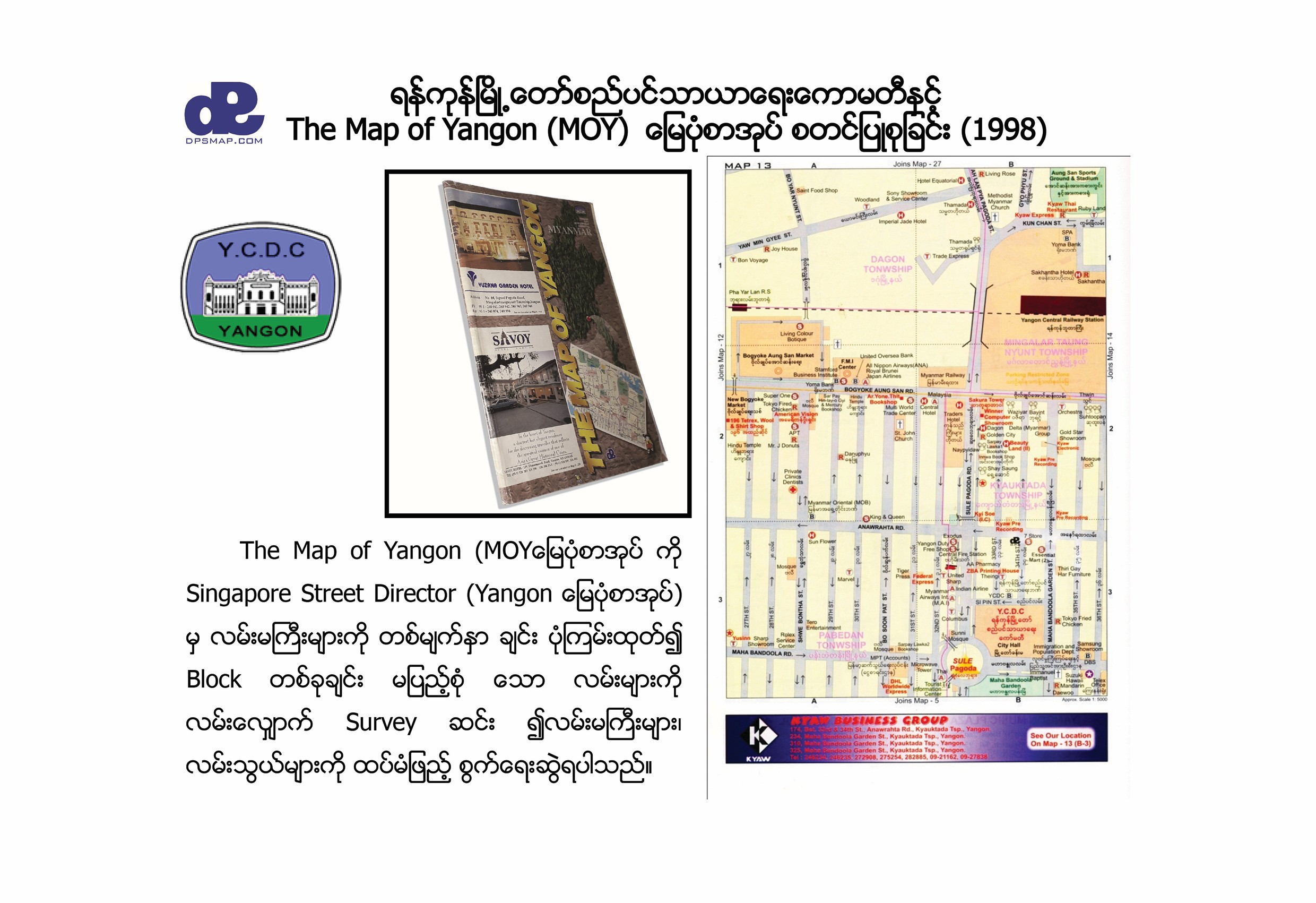
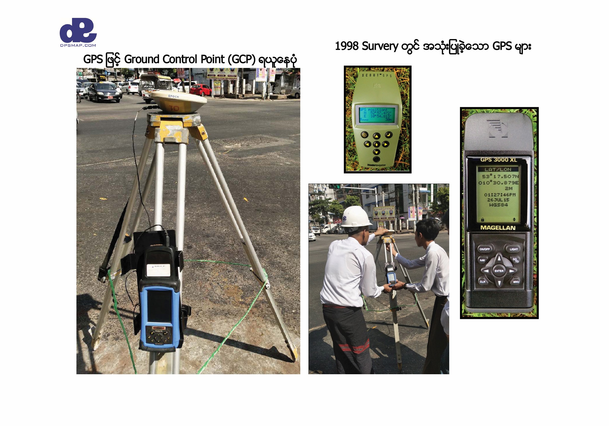
DPS Design Printing Services Company Limited was incorporated in 1995 and published its landmark Map of Yangon, also known as the Street Directory of Yangon, in 1996. At a time when map printing was tightly controlled, the DPS team began digitizing Yangon using Garmin and Magellan GPS equipment, combining technical mapping knowledge with deep local understanding.

The resulting Yangon GIS warehouse brought together streets, schools, clinics, government offices, waterways and business points of interest. That foundation developed into DPS's core strengths: GIS database creation and updating, digitization, data entry, GPS field surveys, address collection, map publishing and compatible vehicle-tracking maps.

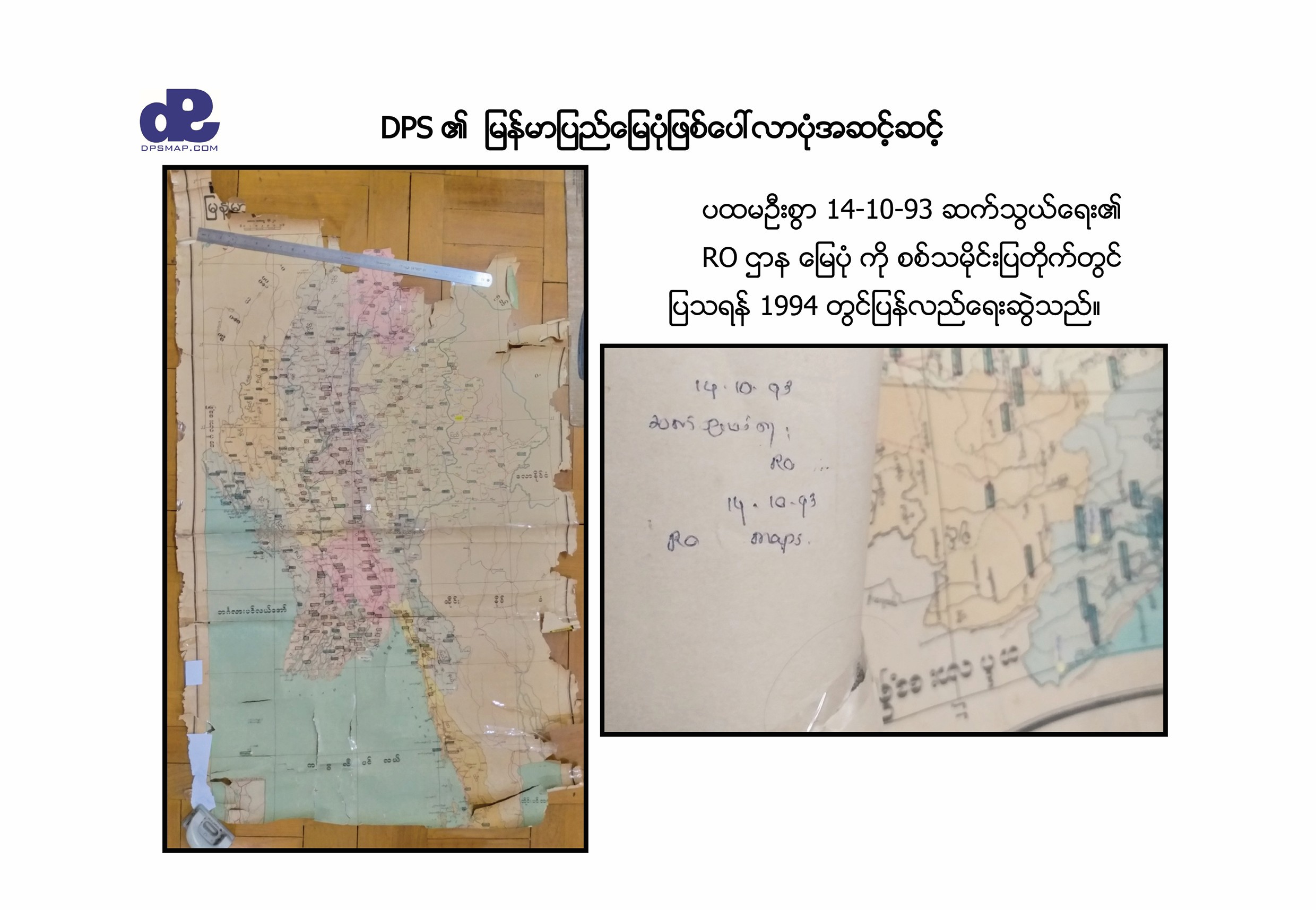
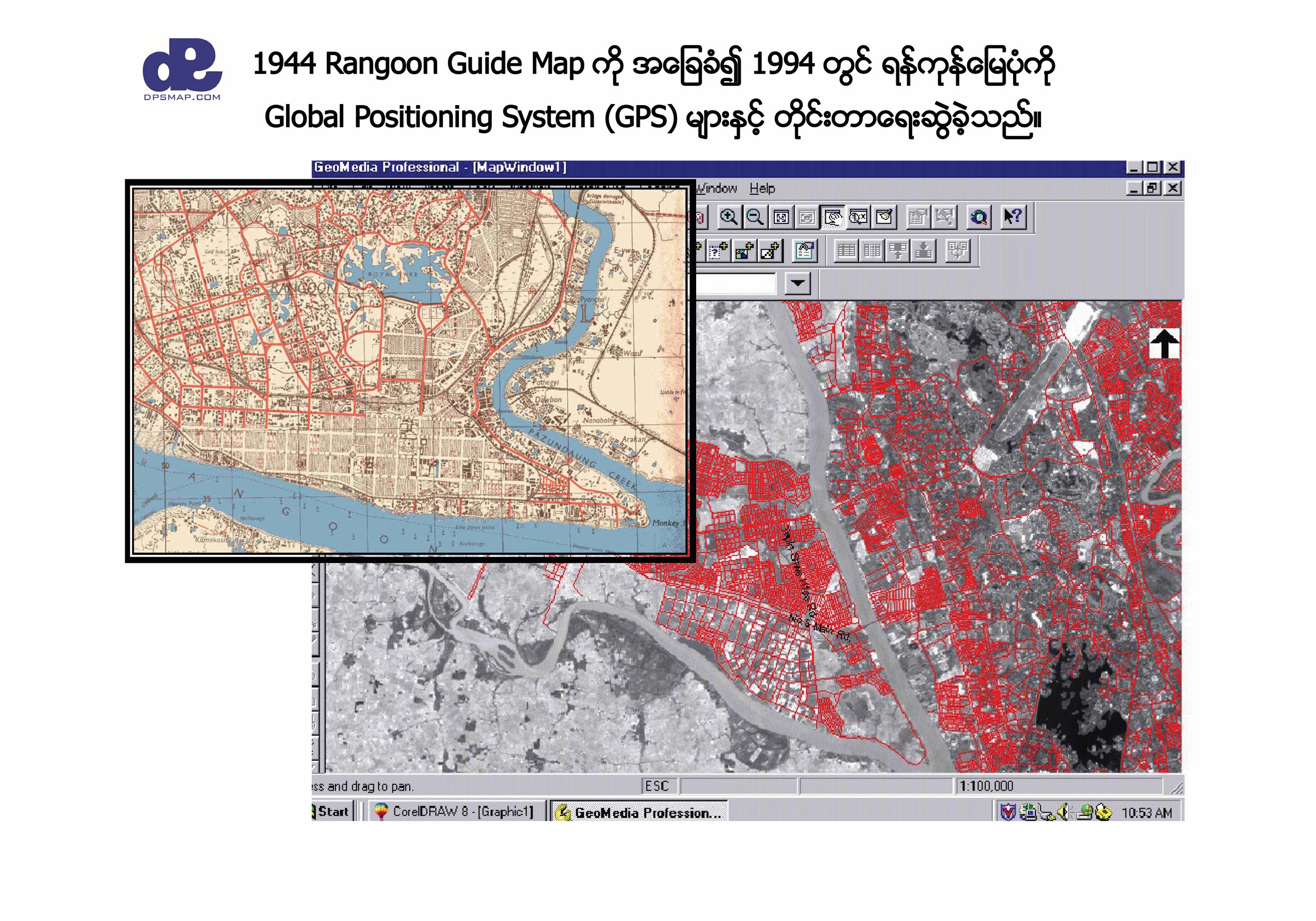
Historic Rangoon guide map digitization and GIS work
Purpose

Maps that help people understand, decide and act

Our Vision

To establish DPS Map as Myanmar's leading comprehensive geospatial resource - a crucial tool that empowers informed decision-making and efficient operations for NGOs, city planners, government agencies, businesses and the general public.

Our Mission

To provide accurate, up-to-date and user-friendly geospatial information that facilitates informed decision-making, promotes sustainable development and enhances quality of life for all stakeholders.

Our Journey

Three decades of mapping progress

From early GPS digitization to field-verified address databases, DPS has continuously expanded how location information can serve Myanmar.

DPS established

Design Printing Services Co., Ltd. began its mapping and guide business.

Landmark Yangon map

The Street Directory of Yangon was published.

Satellite maps and GPS

Satellite imagery, ground control points and GPS surveys strengthened digital map production.

Post-Nargis mapping

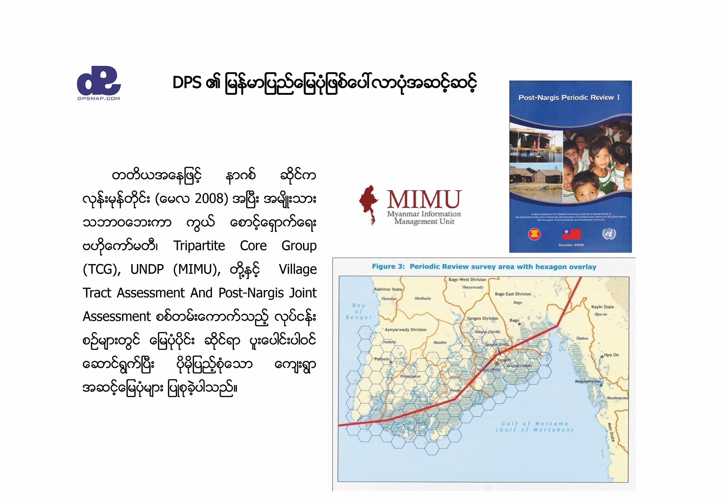
Mapping supported assessment and coordination work with humanitarian information partners.

Public-health mapping

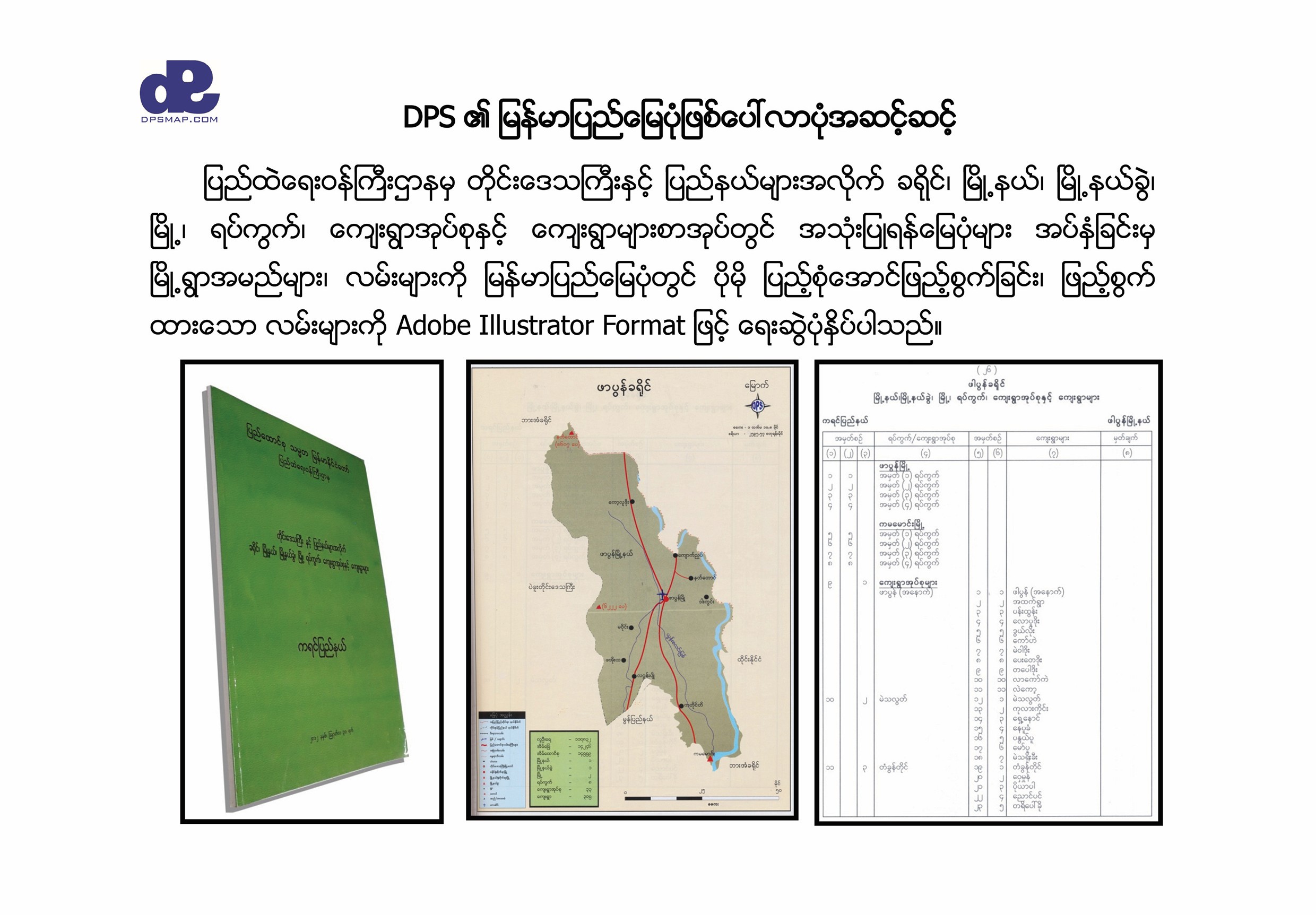
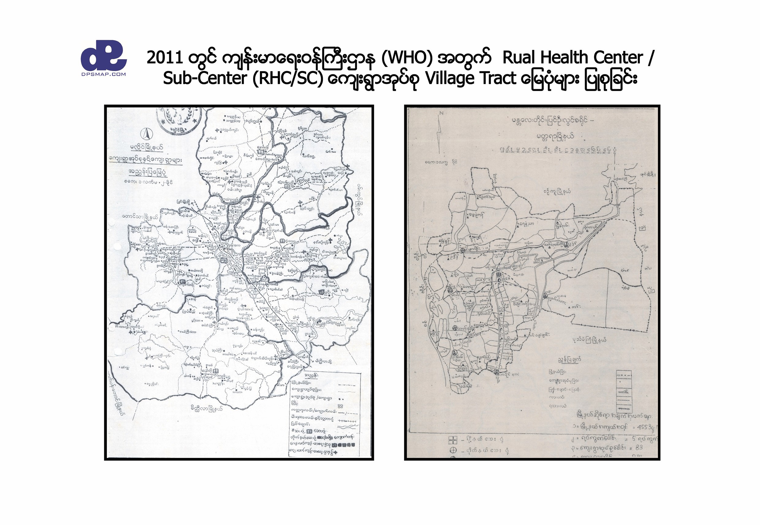
Village tract and rural health-centre maps were prepared for health-sector work.

Yangon Township Map Book

A city reference produced in collaboration with YCDC, continuing DPS's publishing legacy.

Why Choose DPS

Data built on the ground, designed for real operations

DPS turns complex location data into practical tools for distribution, banking, engineering consultancy, local government, NGOs, navigation and urban development. Its coverage includes Myanmar's road network, village points, address points and richly attributed points of interest.

Address points support navigation and ride-hailing applications, while more than 60,000 POIs can serve city guides, retail and sales coverage, delivery planning, banking, insurance and public infrastructure. DPS continues enriching attributes for future retail, navigation and autonomous-vehicle applications.

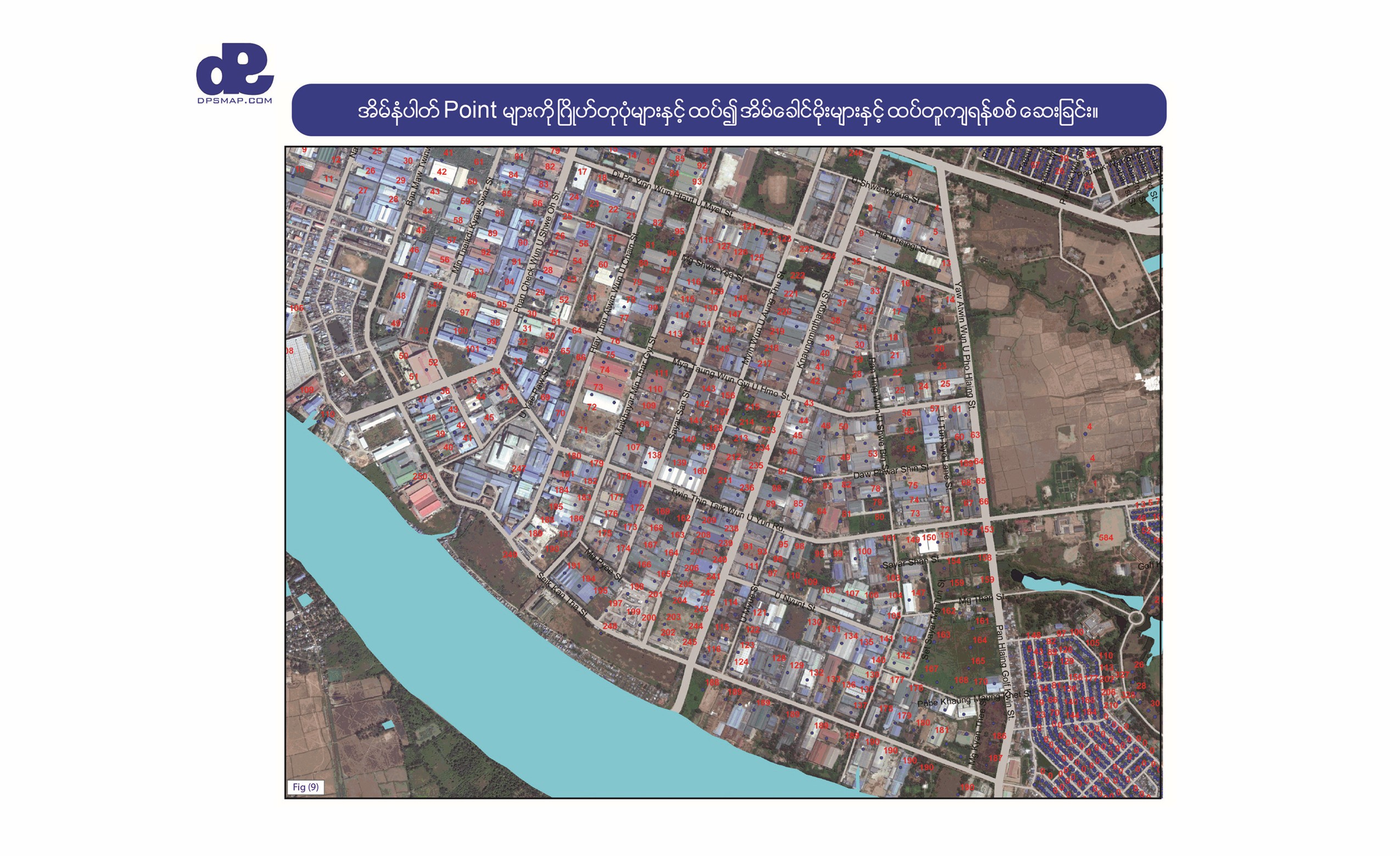
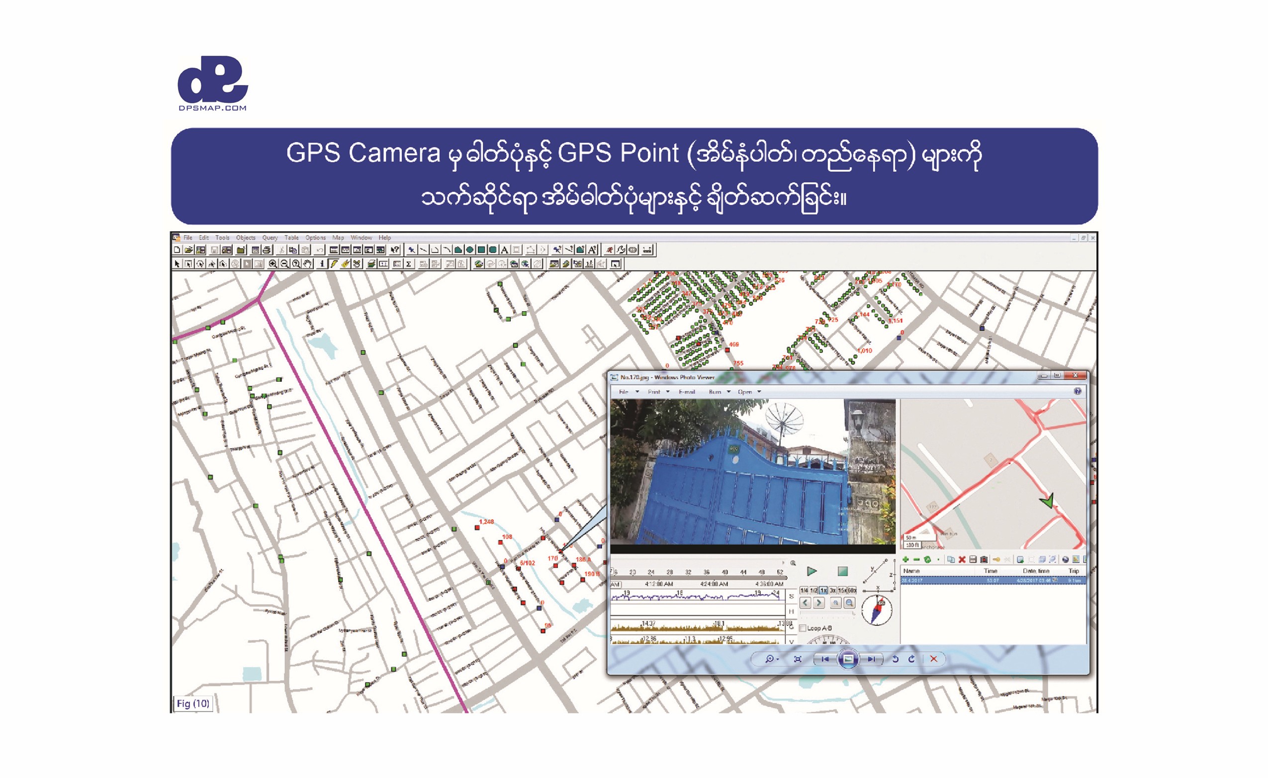
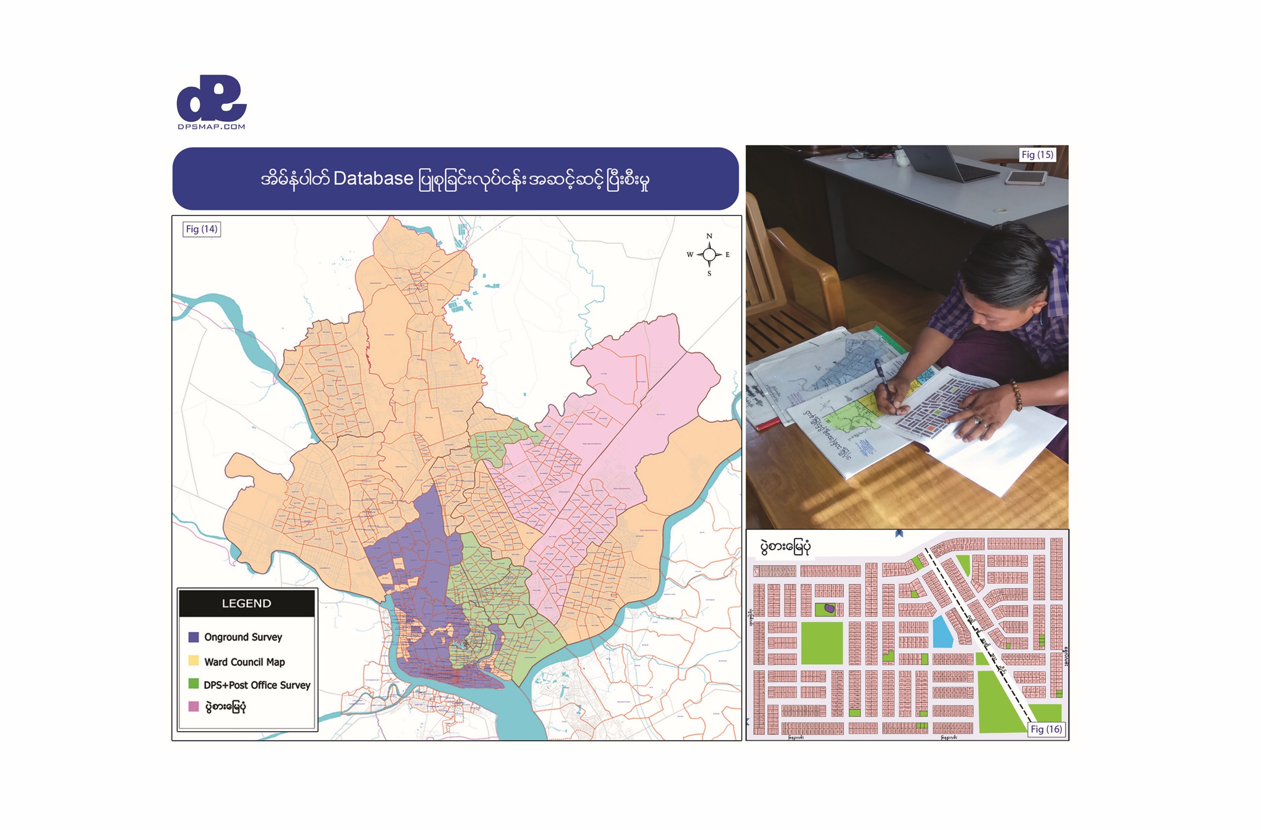
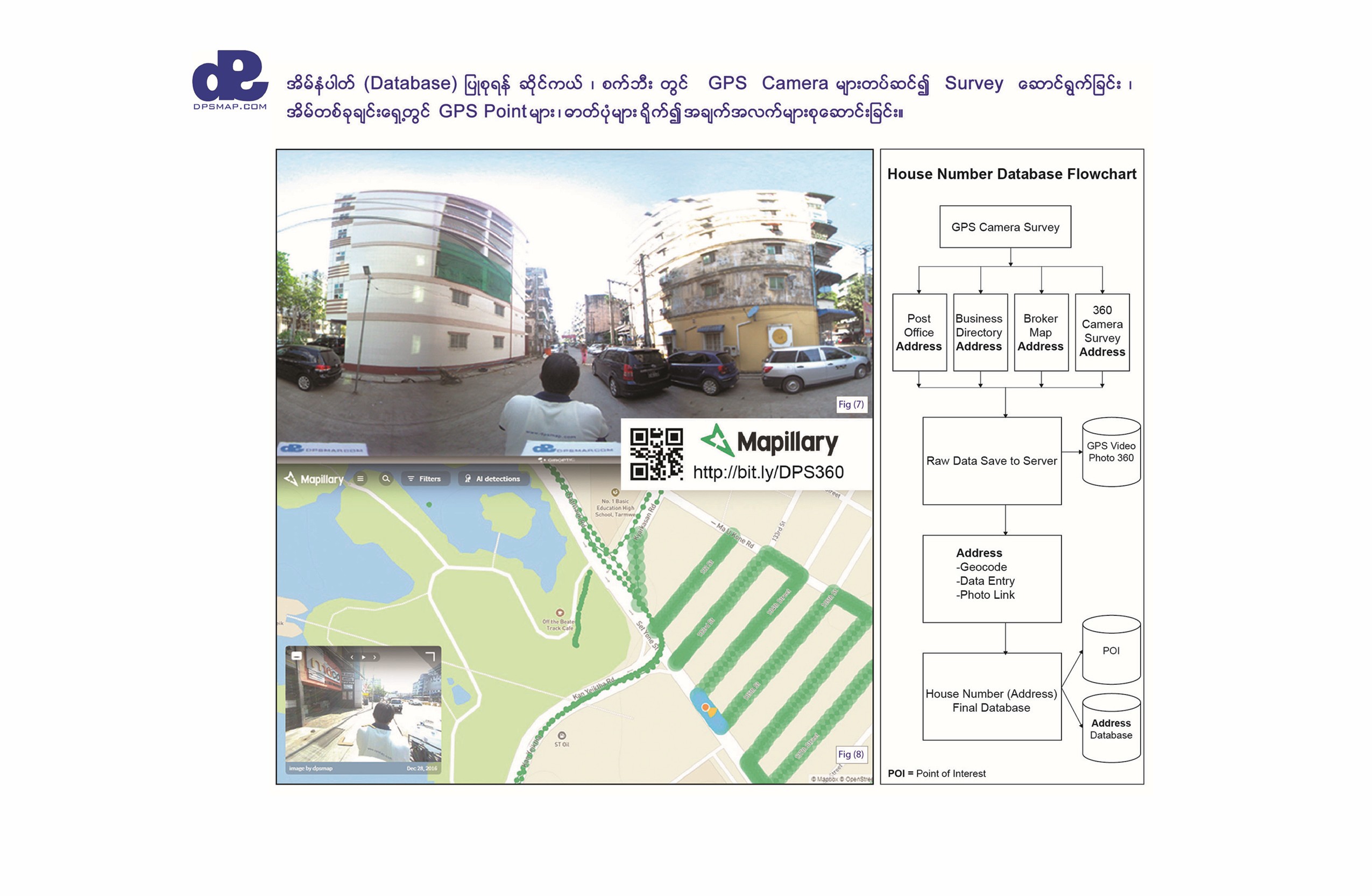
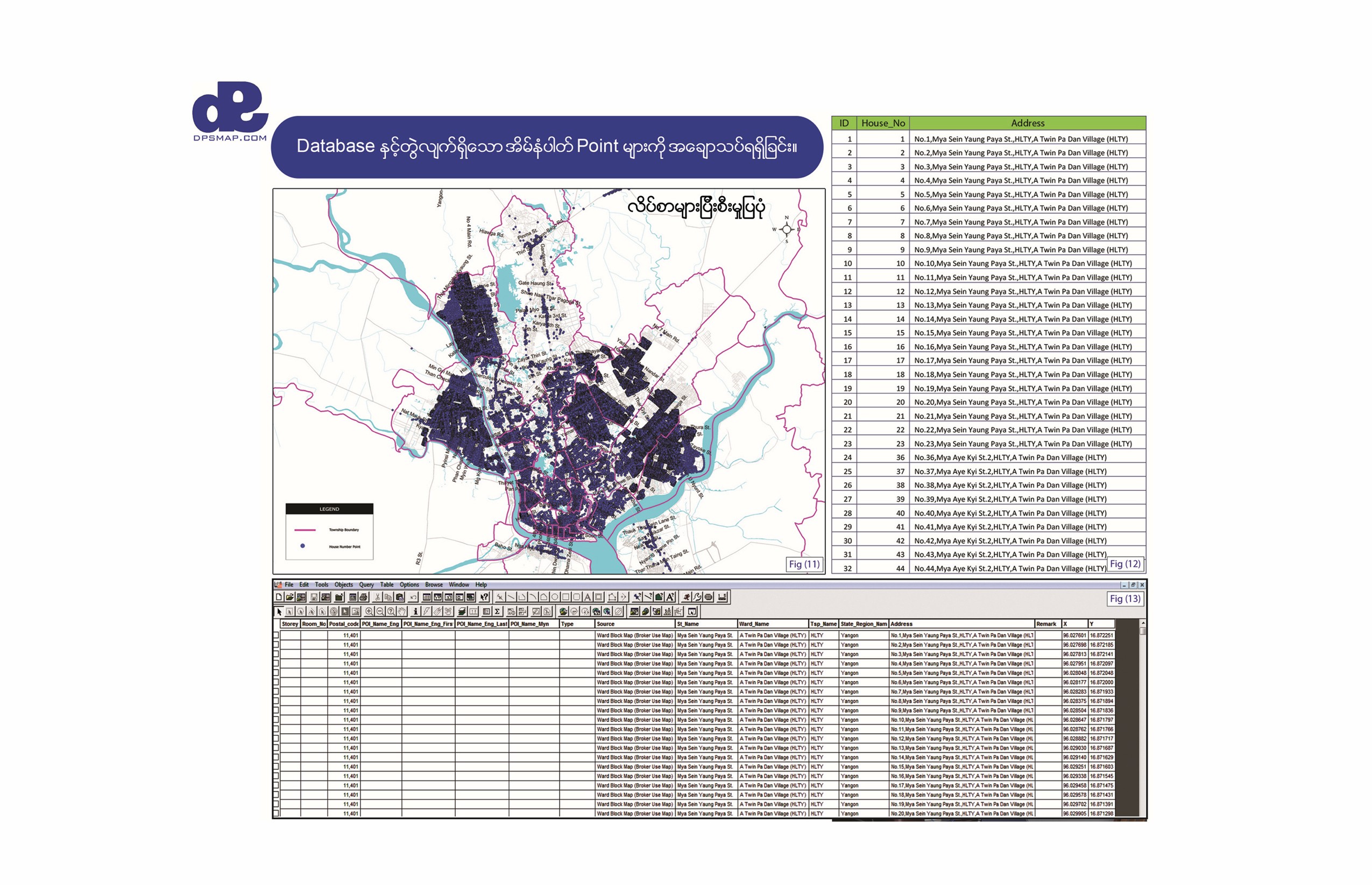
Each collected address point can be connected to a structured record containing fields such as house number, street, ward, township, state or region, latitude and longitude. This turns field observations into a searchable database that can be mapped, checked, updated and delivered for operational use.

Core geospatial layers

  • Road networks
  • Address points
  • Village locations
  • Points of interest
  • Administrative boundaries
  • Infrastructure data
  • Custom survey data
  • Printable map layers
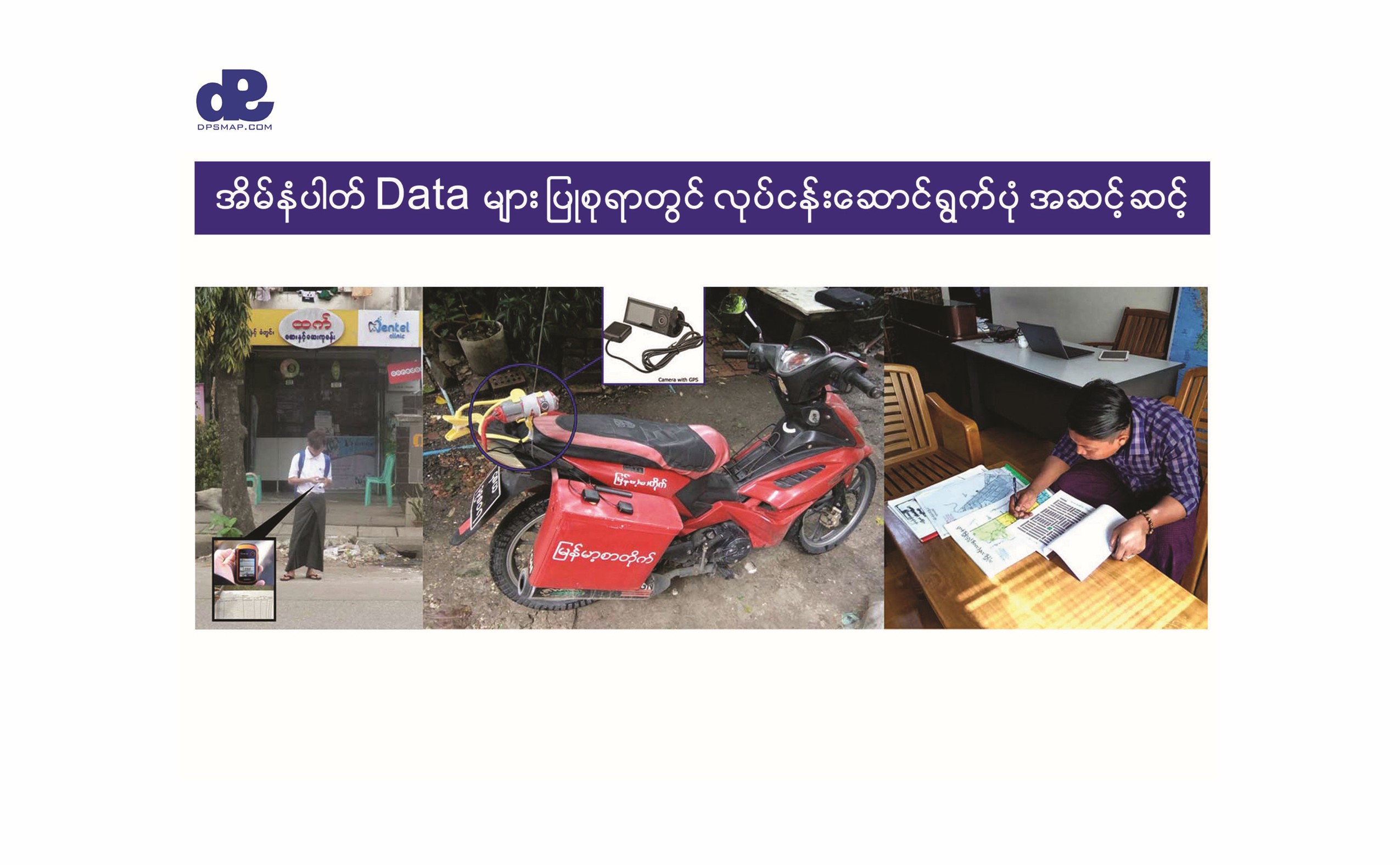
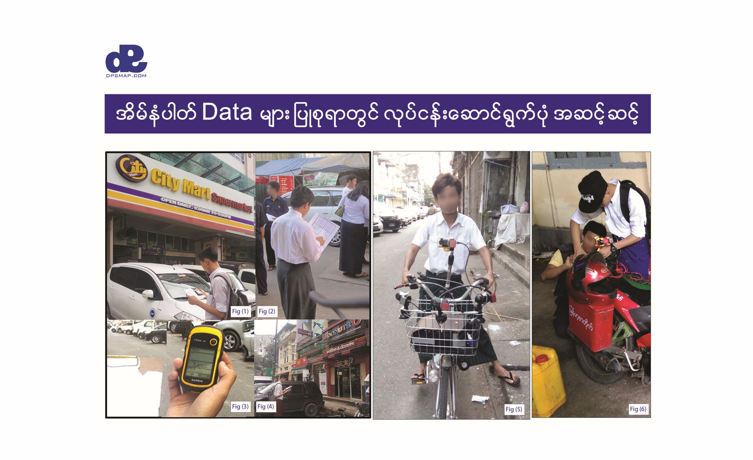
DPS GPS field survey and mapped address points
DPS structured address database and geospatial records
What We Do

Services from field data to finished products

DPS combines surveying, GIS, design and publishing so clients can move from raw location information to clear operational outputs.

Map Plotting

High-resolution, customizable wall maps for meeting rooms, offices, planning spaces and project sites.

Read More →

GIS Mapping

GIS database development, digitization, spatial analysis, satellite-map work and custom data layers.

Read More →

GPS Tracking

Tracking solutions ranging from essential fleet visibility to compatible vehicle trackers with real-time camera options.

Read More →

Data Collection

Address-point surveys, shop and outlet databases, POI collection, GPS camera surveys and distribution data.

Read More →

Design & Printing

In-house design and production for leaflets, business cards, promotional materials and branded print products.

Read More →

Website Services

Practical company websites, online shops and content-led digital experiences at accessible rates.

Read More →
Work in the Field

A visual record of mapping Myanmar

The archive documents DPS's transition from historic paper references to GPS survey, satellite imagery, digital GIS production and field-verified databases.

Support Our Mission

Help grow Myanmar's geospatial knowledge

DPS creates, updates and shares town, regional and national maps, including POI and infrastructure data used in planning, research and emergency response. Contributions help improve data quality, expand coverage, maintain accessible resources and train the next generation of GIS professionals.

Start a conversation

Talk to DPS about mapping, data, surveying, Form 105 overlays, printing or custom project needs.