Pathein Township & Port
The commercial hub and river port known for traditional handcrafted Pathein parasols and Shwemokehtaw Pagoda.
Ayeyarwaddy Region occupies the deltaic plain of the Ayeyarwaddy River, renowned as the granary of Myanmar, famous for coastal beaches, riverine networks, and agriculture.
Ayeyarwaddy Region is bordered by Bago Region to the north and east, Yangon Region to the east, and the Bay of Bengal to the south and west. Its fertile soil and extensive river waterways make it Myanmar's leading producer of rice and fishery products.
Pathein serves as the capital and major port city, famous for traditional Pathein umbrellas and cultural heritage. The region is also home to world-renowned beach destinations such as Chaungtha and Ngwesaung.
Population
Capital City
Townships
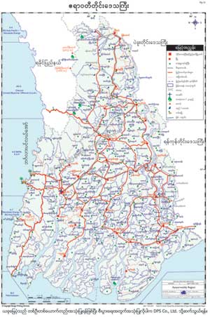
To download the full and complete Ayeyarwaddy Region Map:
Prominent economic hubs and beach resorts in Ayeyarwaddy.
The commercial hub and river port known for traditional handcrafted Pathein parasols and Shwemokehtaw Pagoda.
Miles of pristine sandy coastline along the Bay of Bengal with international beach resorts and water sports.
Vital agricultural trading centers and waterway transport nodes across the lower delta.