Shitthaung Pagoda (Temple of 80,000 Images)
Built in 1535 by King Min Bin, featuring a massive central stupa, defensive stone walls, and inner gallery labyrinth with 80,000 Buddha images.
Mrauk-U is an economically and culturally important ancient capital of Rakhine State, renowned for its magnificent stone pagodas and fortress architecture.
Mrauk-U served as the capital of the Mrauk-U Kingdom from 1430 to 1784. During its golden age, it was a thriving commercial hub and trading port in Southeast Asia, comparable to major European cities.
The ancient city is protected by extensive stone fortification walls, moats, and natural hill barriers, featuring famous heritage sites such as Shwethayar, Koe Thaung, and Dindaw-kan pagodas.
Founded Year
Royal Capital
Stone Fortress
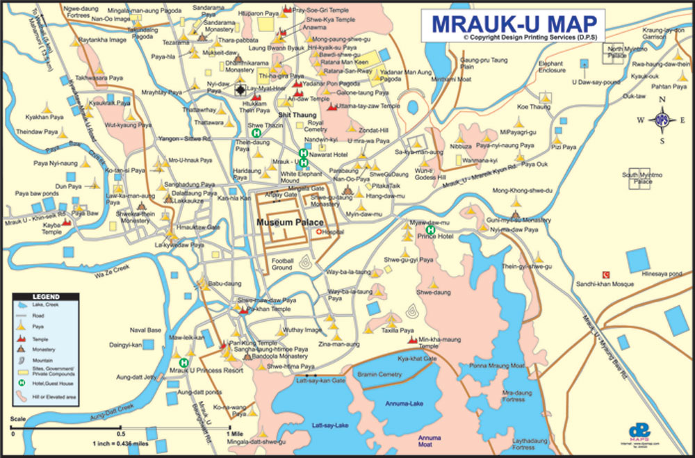
To download the full and complete Mrauk-U Map:
Unrivalled stone architecture and Buddhist heritage in Mrauk-U.
Built in 1535 by King Min Bin, featuring a massive central stupa, defensive stone walls, and inner gallery labyrinth with 80,000 Buddha images.
The largest temple in Mrauk-U, constructed by King Min Dikkha in 1553, housing 90,000 Buddha statues along stone tiered walls.
Bunker-like stone ordination hall designed as a fortress refuge during wartime, decorated with 180 stone relief sculptures.