English
 Myanmar

Tanintharyi Region
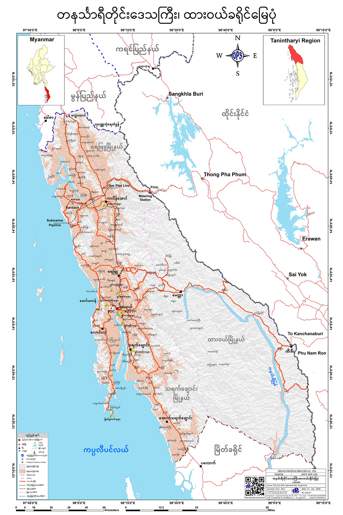
ထားဝယ်ခရိုင် မြေပုံ
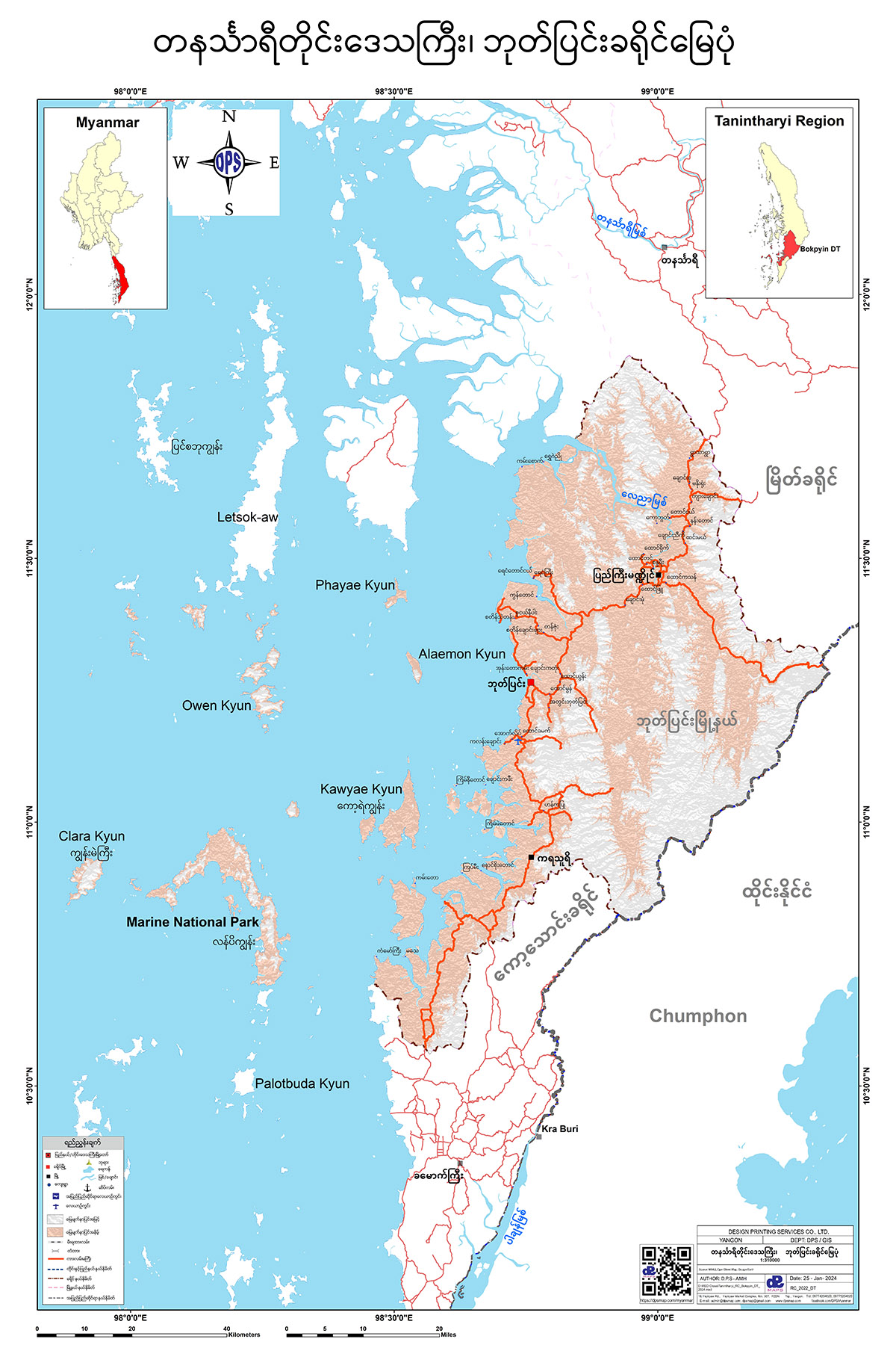
ဘုတ်ပြင်းခရိုင် မြေပုံ
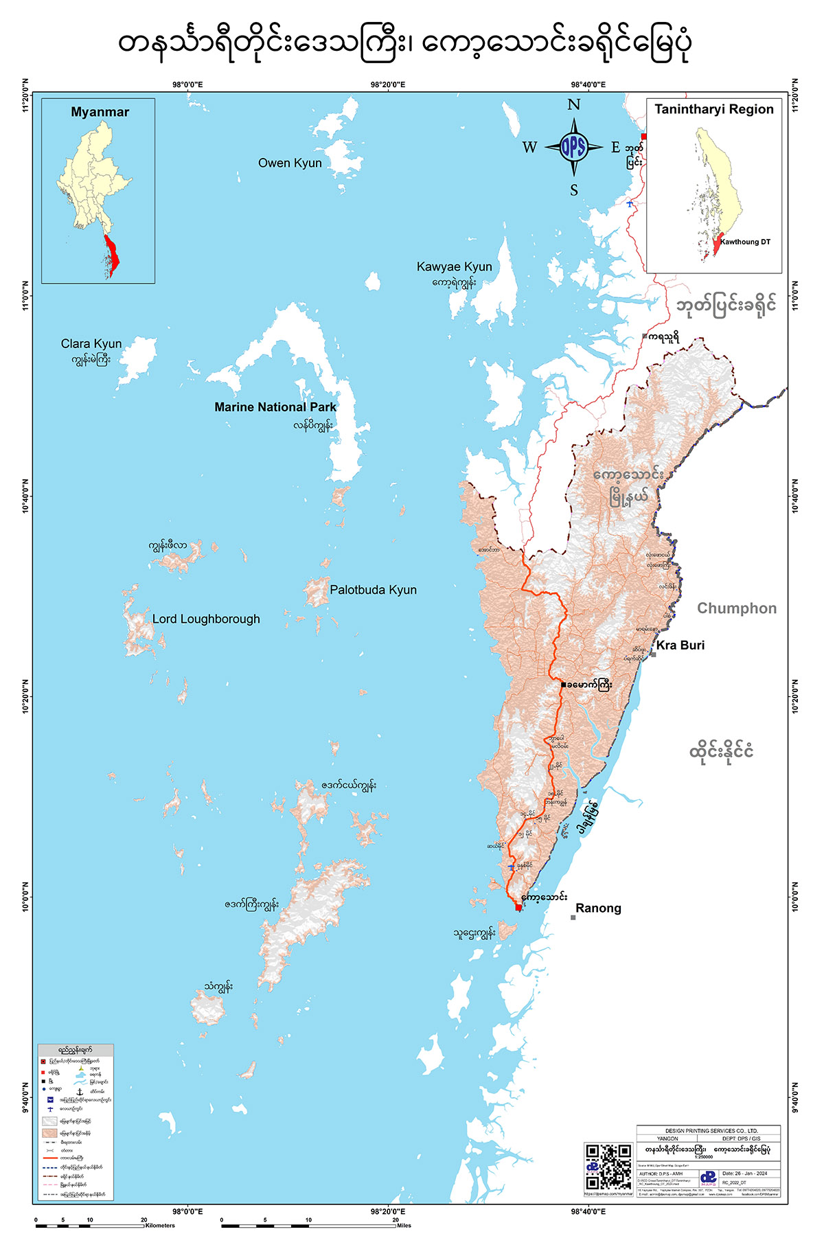
ကော့သောင်းခရိုင် မြေပုံ
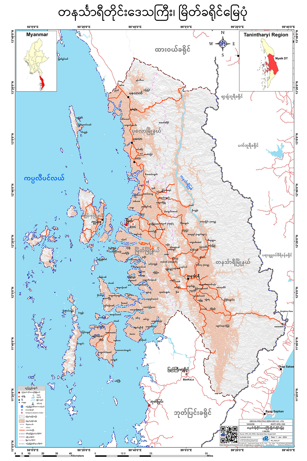
မြိတ်ခရိုင် မြေပုံ
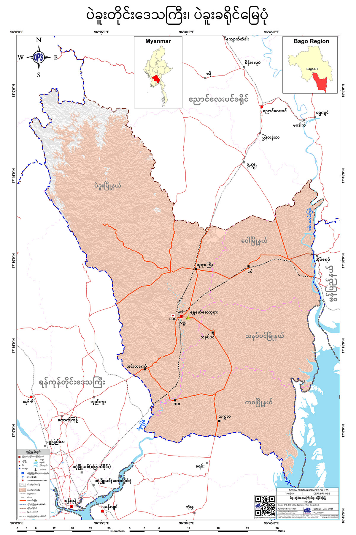
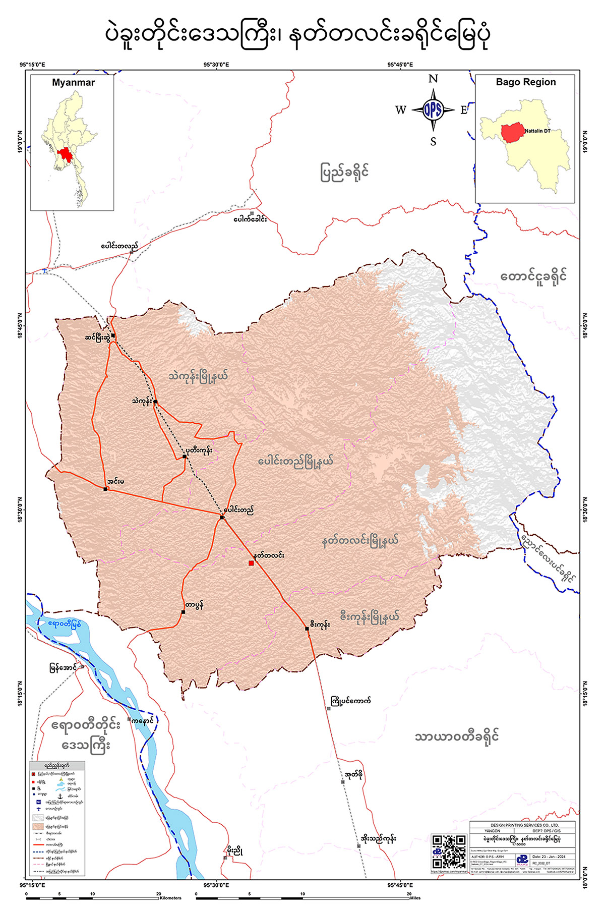
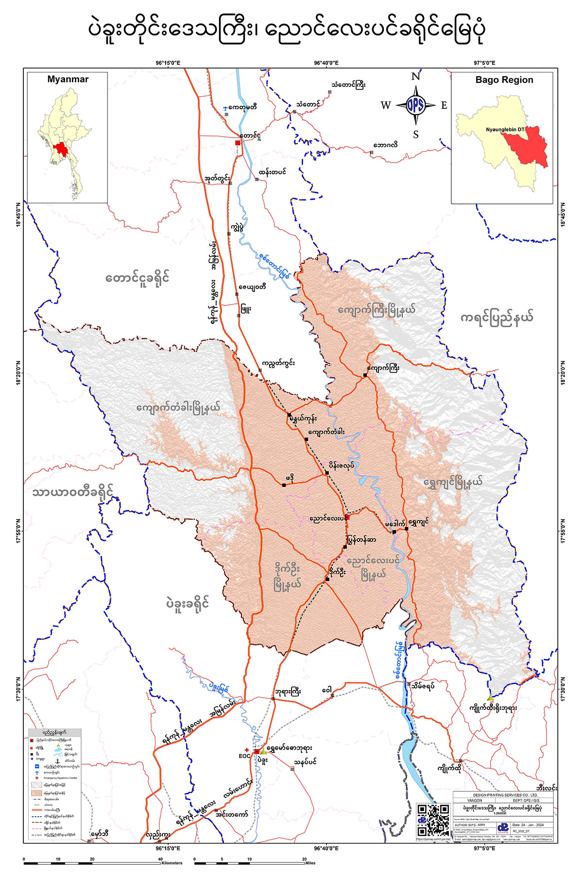
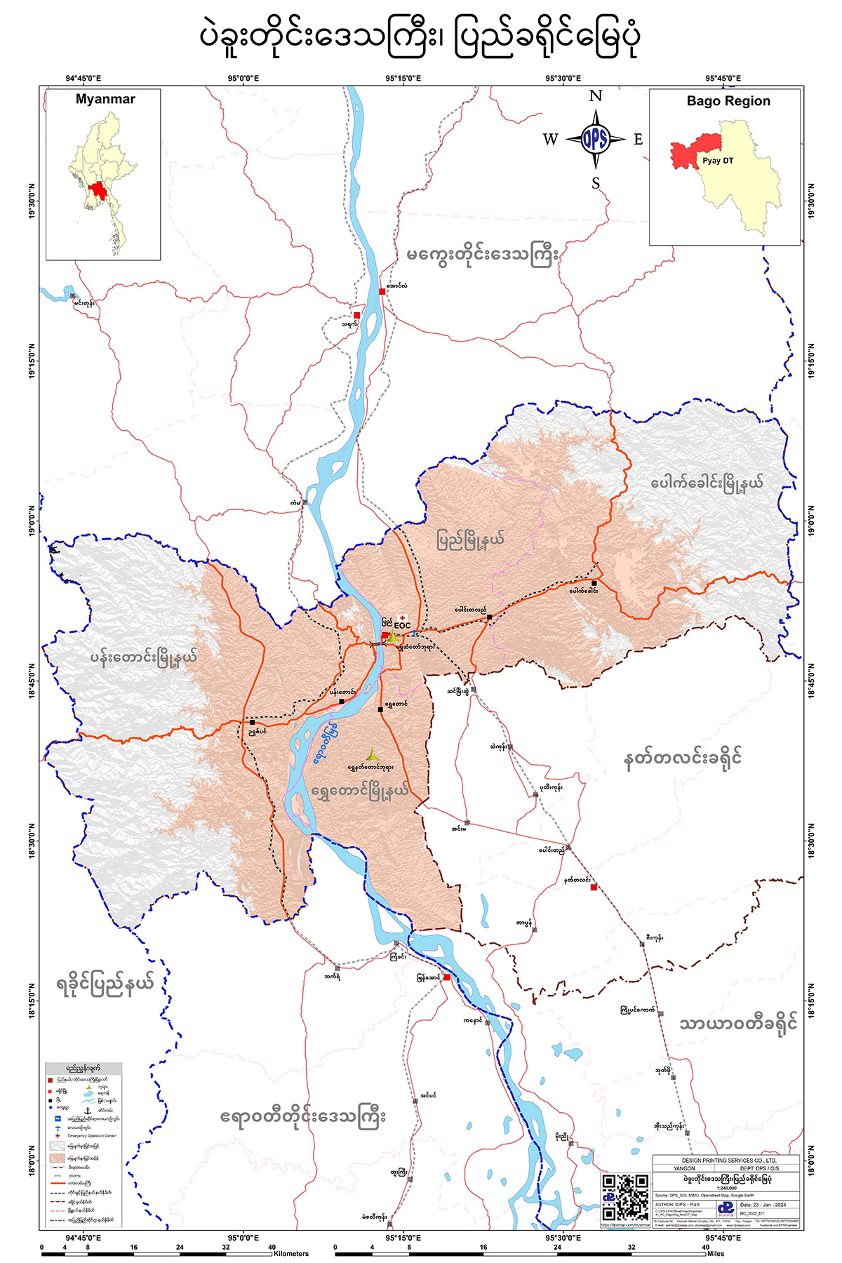
Bago Region
ပဲခူးခရိုင် မြေပုံ
နတ်တလင်းခရိုင် မြေပုံ
ညောင်လေးပင်ခရိုင် မြေပုံ
ပြည်ခရိုင် မြေပုံ
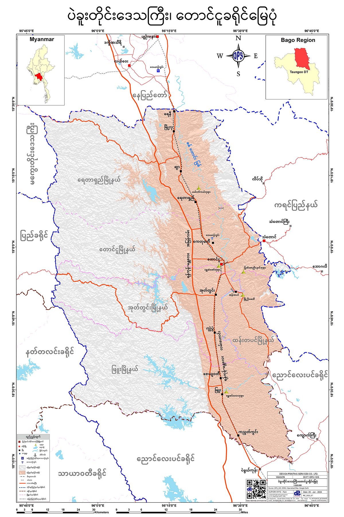
တောင်ငူခရိုင် မြေပုံ
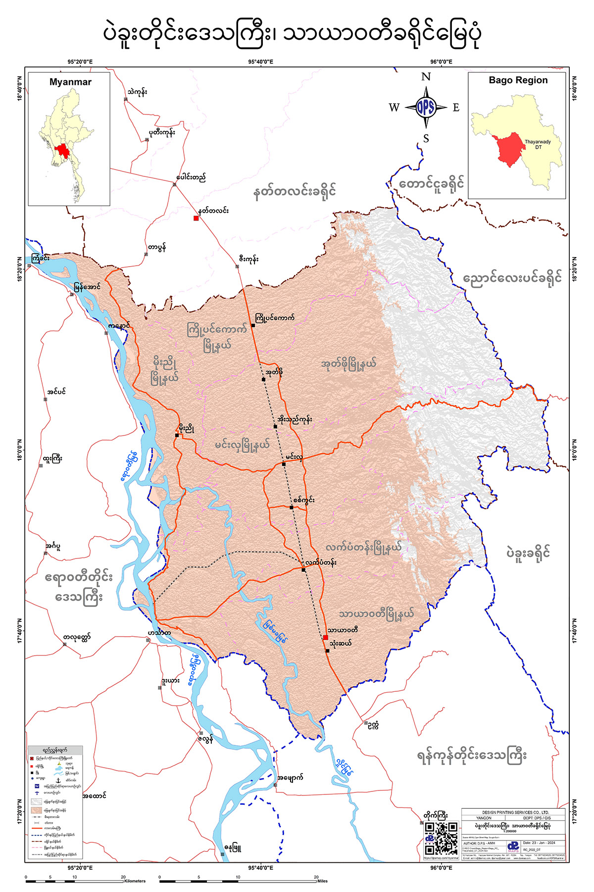
သာယာဝတီခရိုင် မြေပုံ

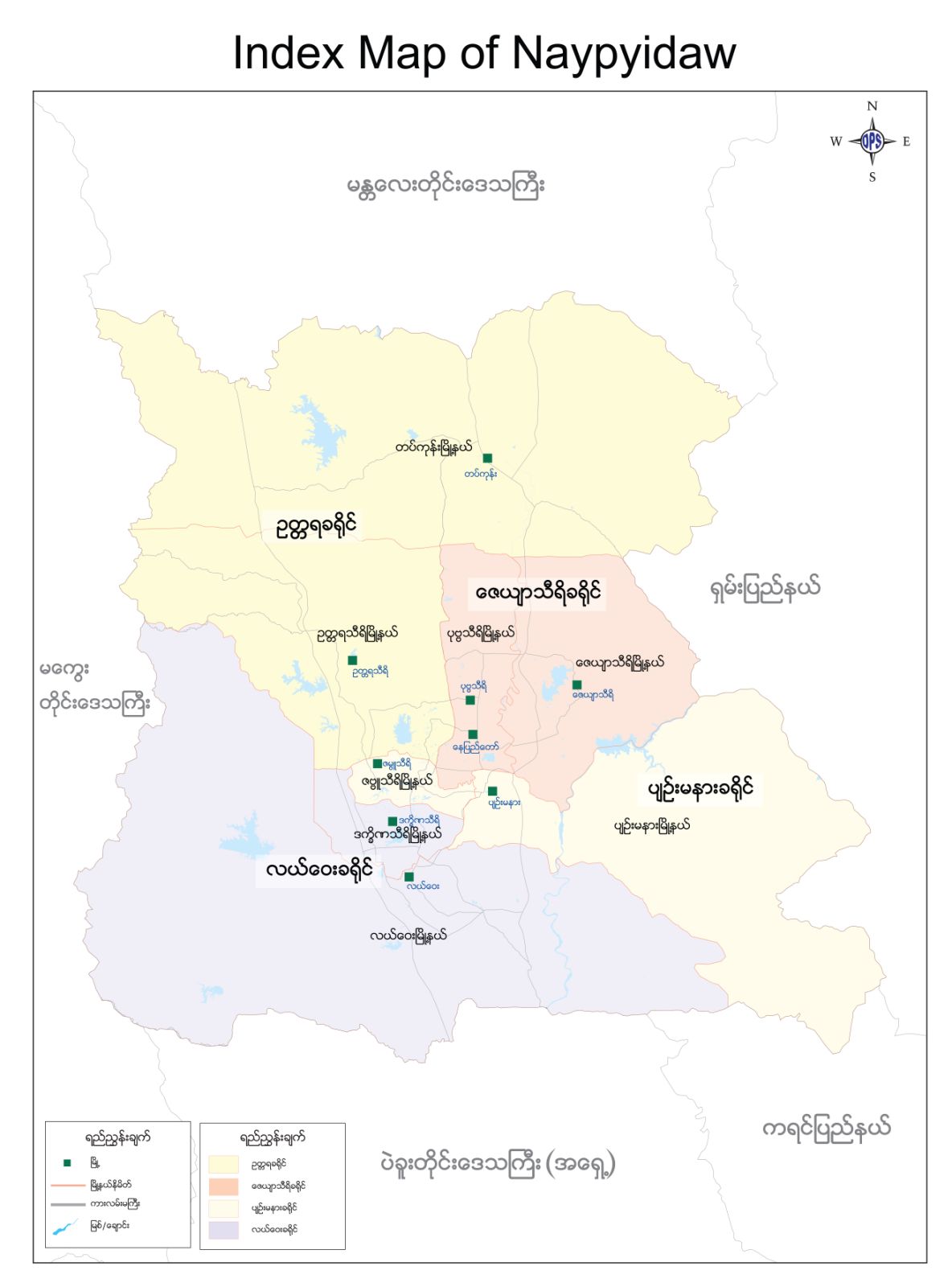
Naypyitaw Central
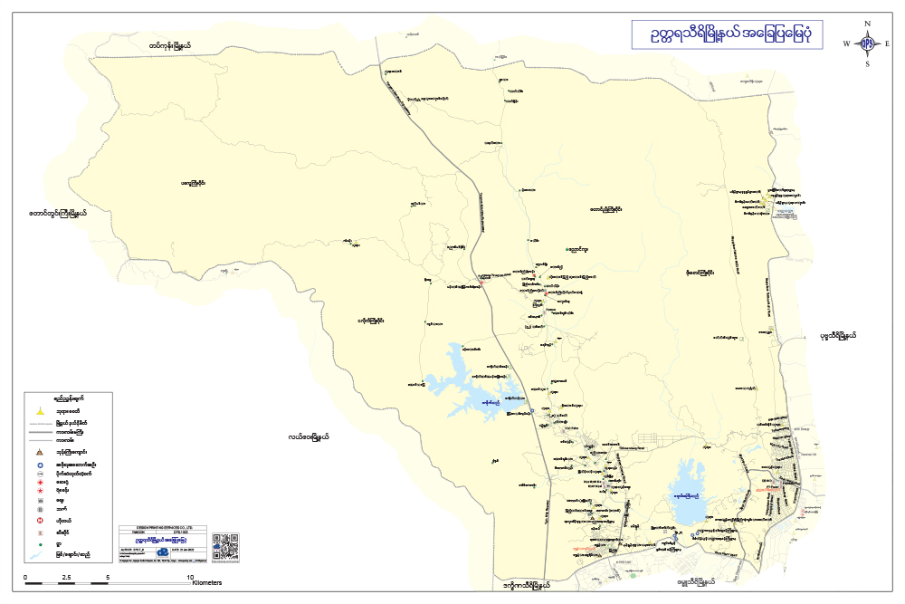
ဥတ္တရခရိုင်
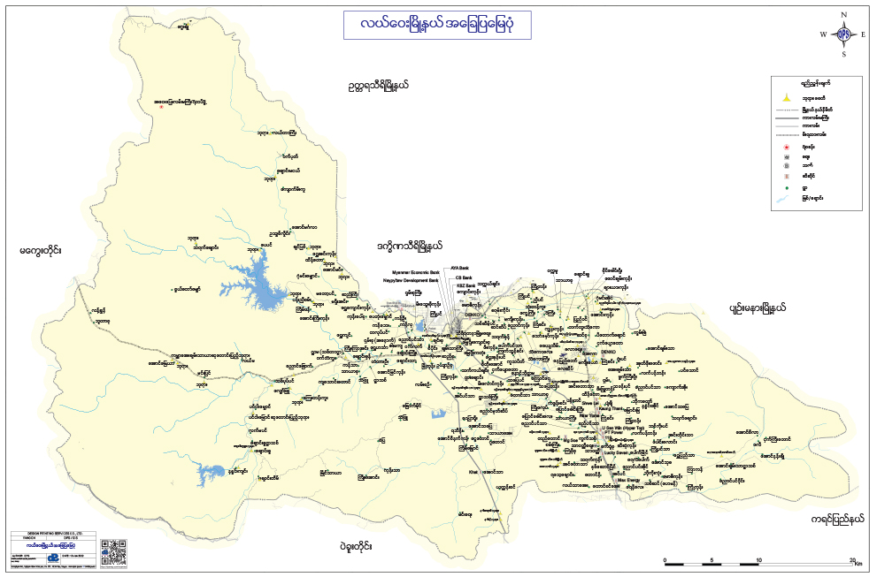
လယ်ဝေးခရိုင်
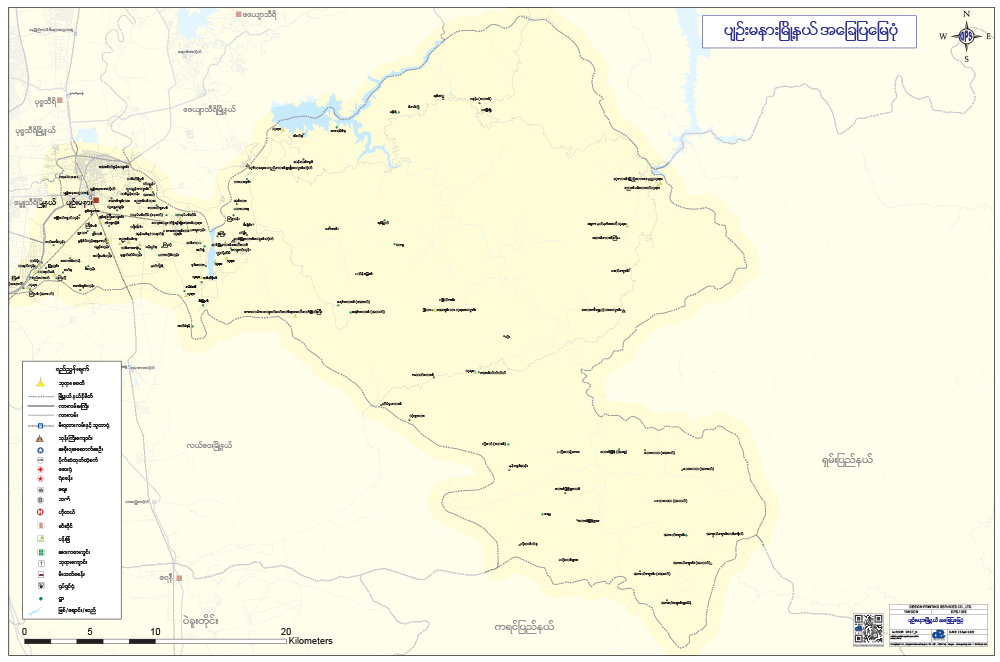
ပျဉ်းမနားခရိုင်
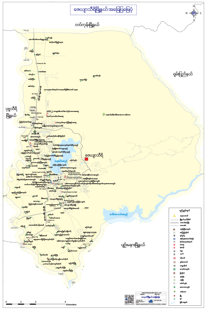
ဇေယျာသီရိခရိုင်
Nay Pyi Taw Central, Index of NayPyiTaw
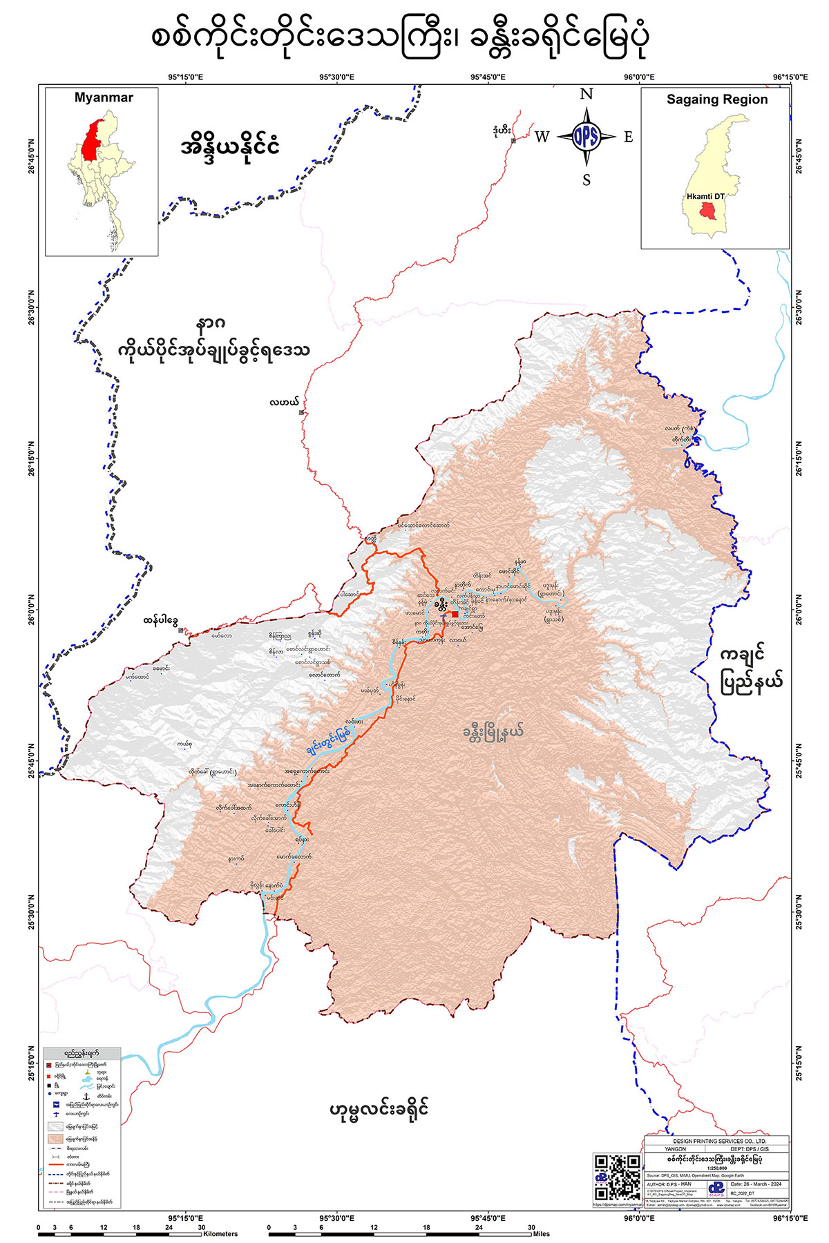
Sagaing Region
ခန္တီးခရိုင် မြေပုံ
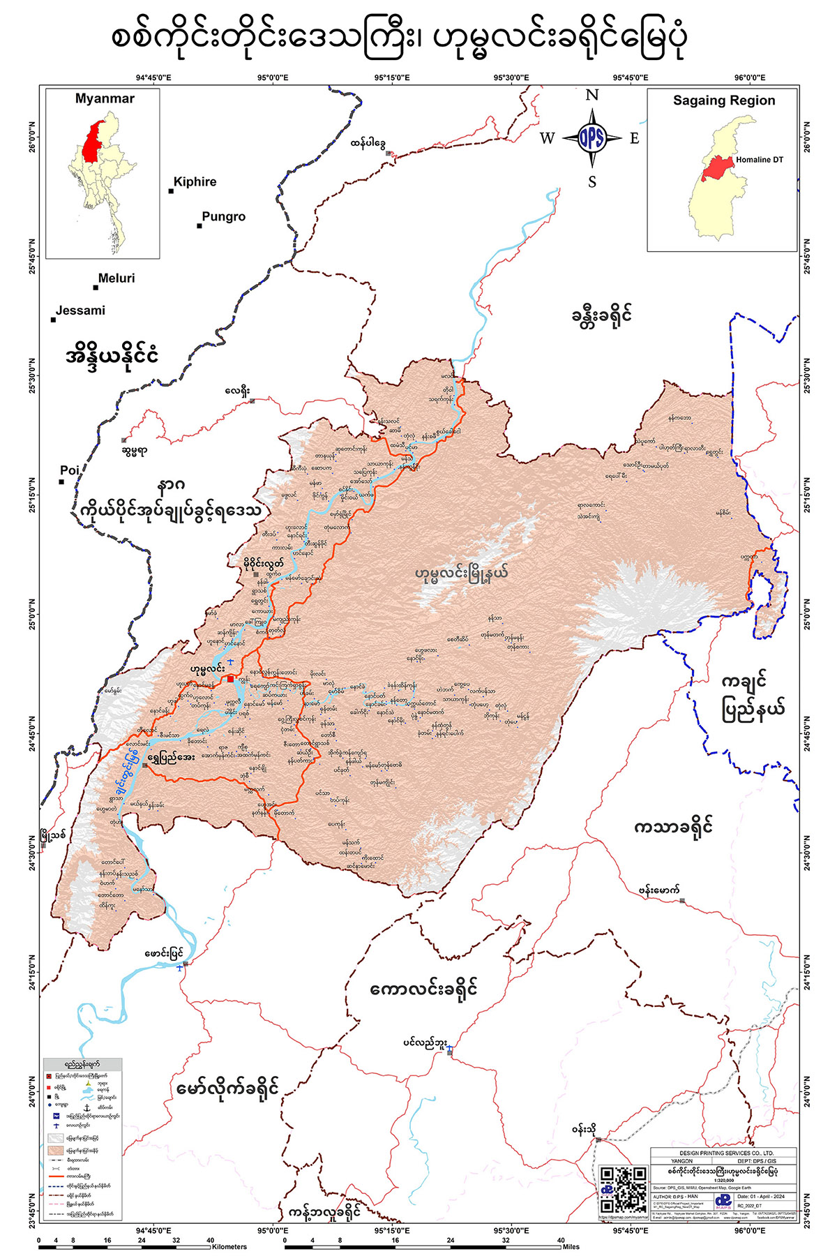
ဟုမ္မလင်းခရိုင် မြေပုံ
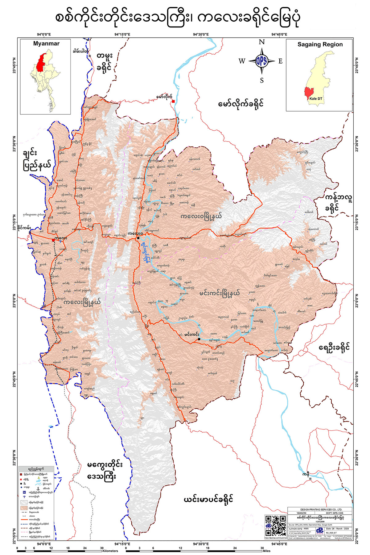
ကလေးခရိုင် မြေပုံ
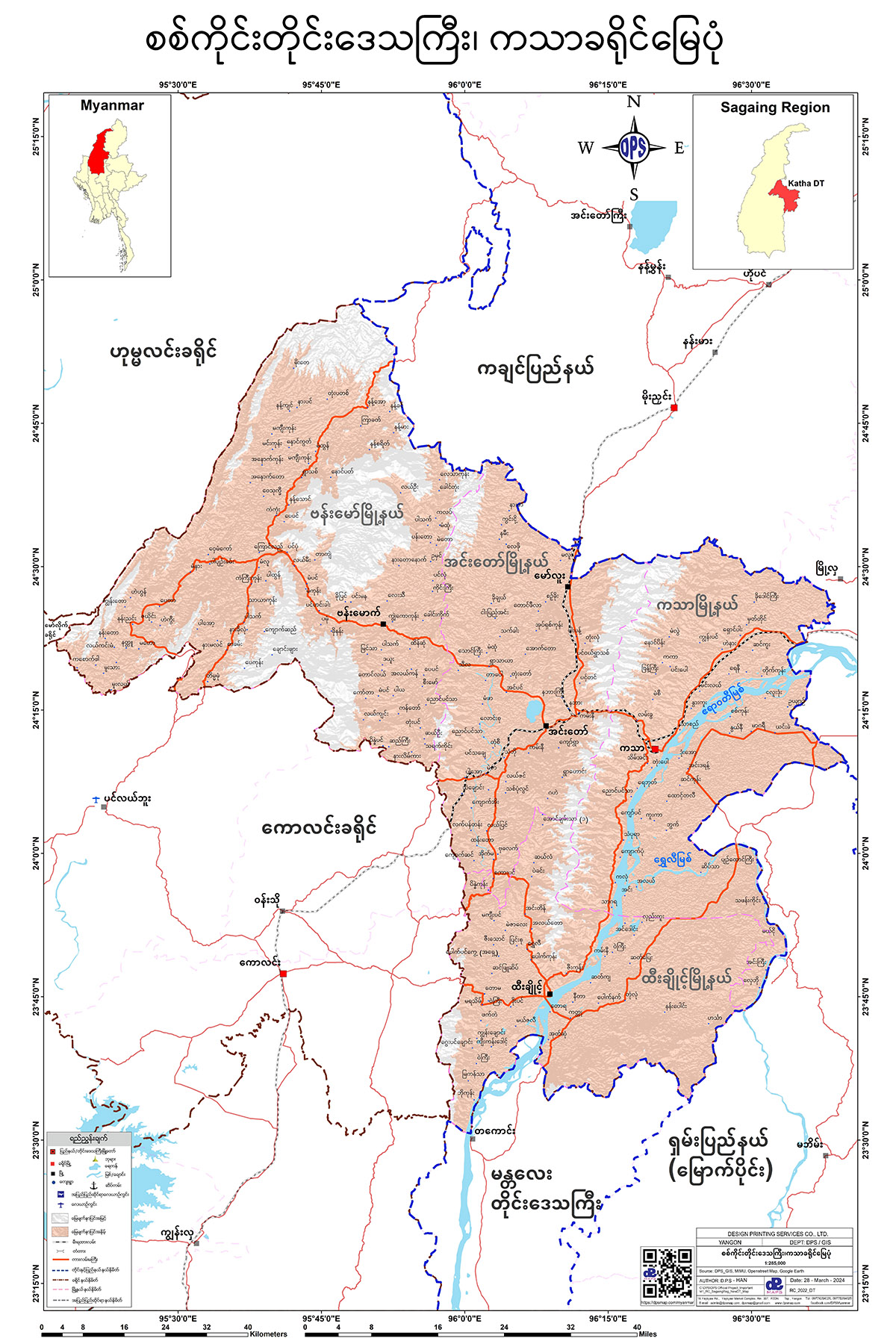
ကသာခရိုင် မြေပုံ
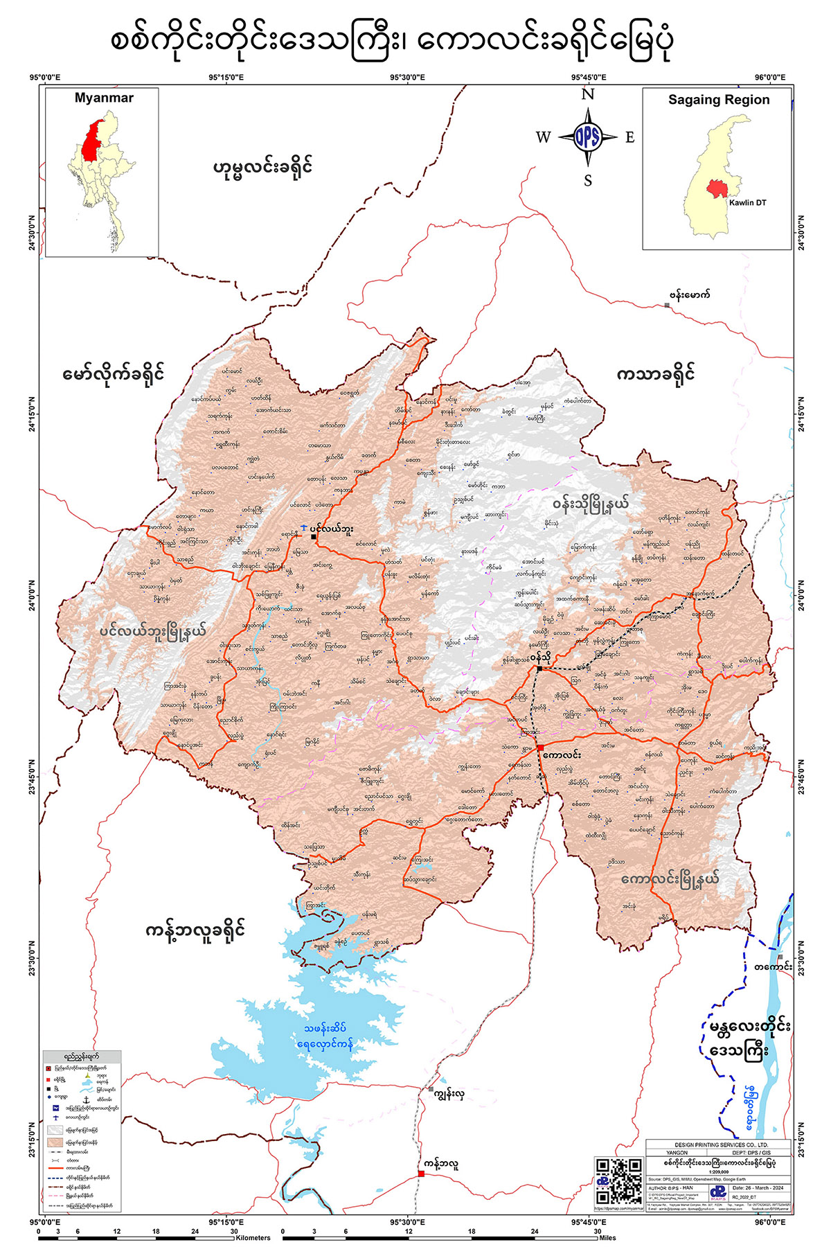
ကောလင်းခရိုင် မြေပုံ
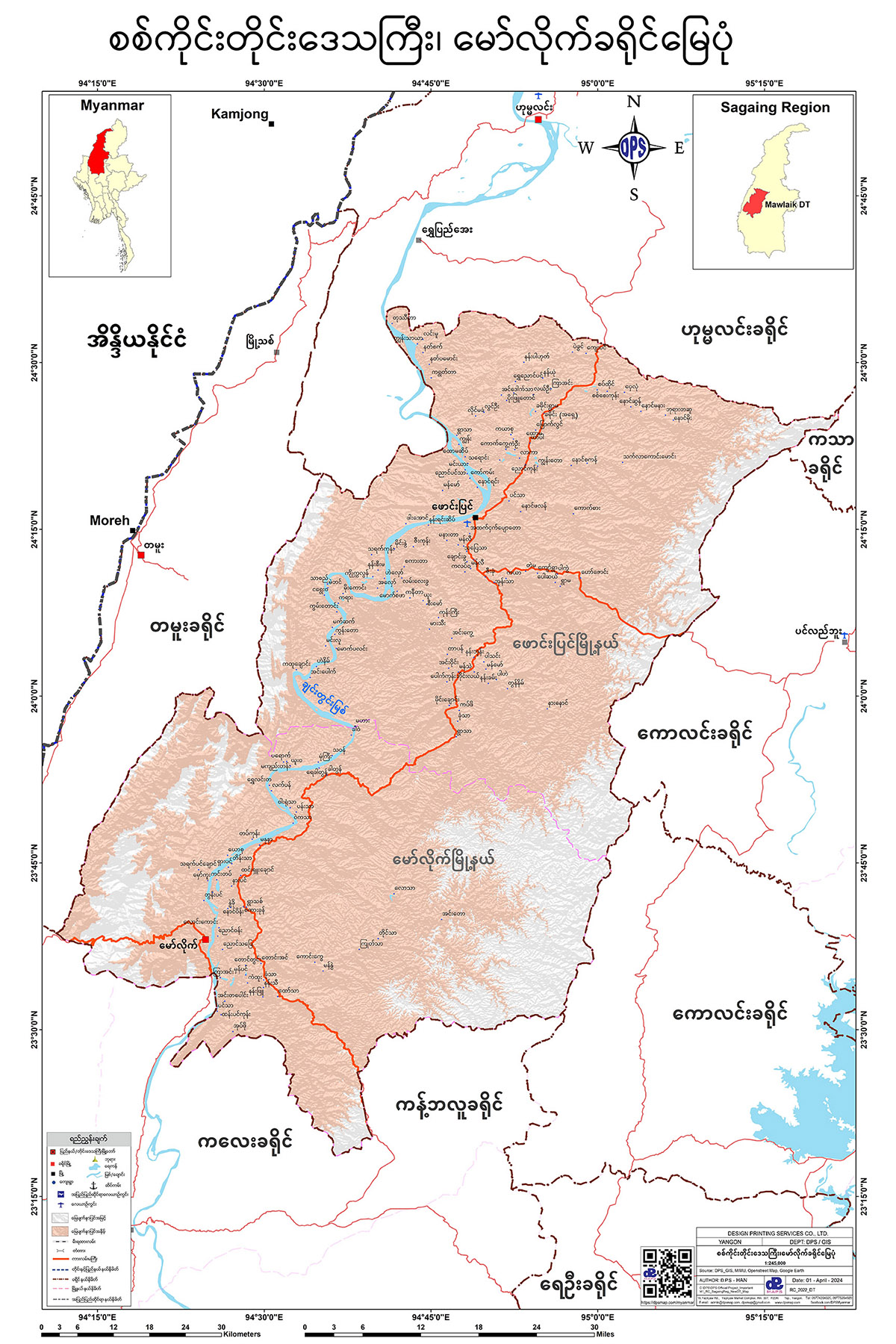
မော်လိုက်ခရိုင် မြေပုံ
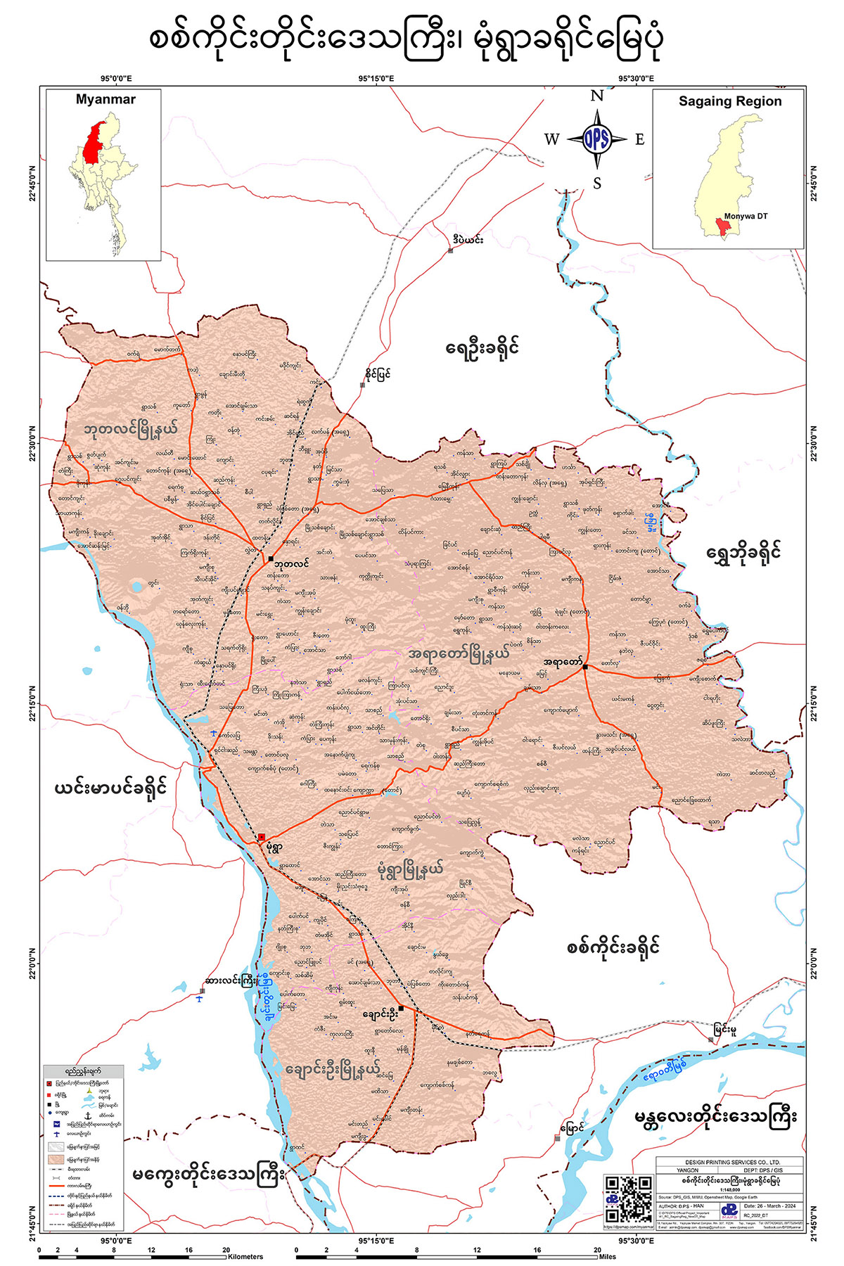
မုံရွာခရိုင် မြေပုံ
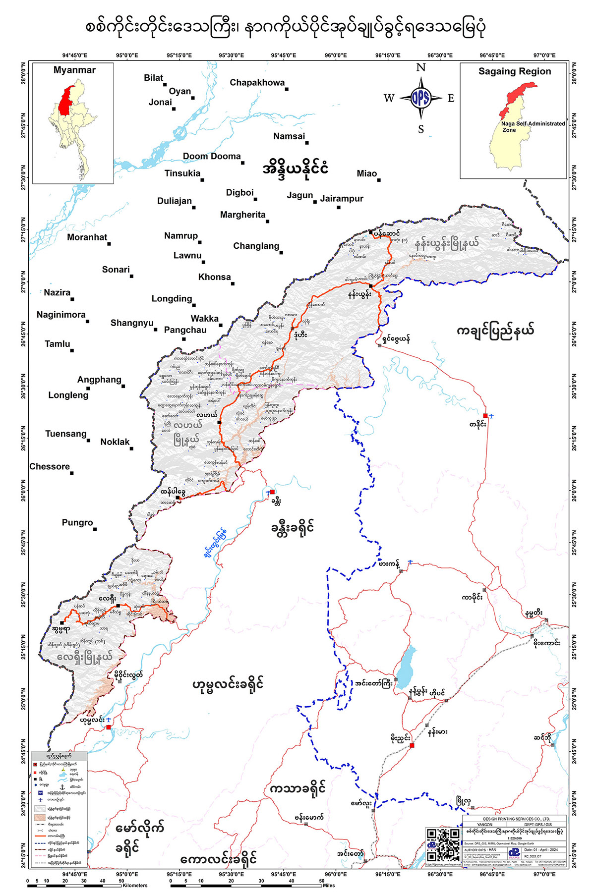
နာဂကိုယ်ပိုင်အုပ်ချုပ်ခွင့်ရဒေသ မြေပုံ
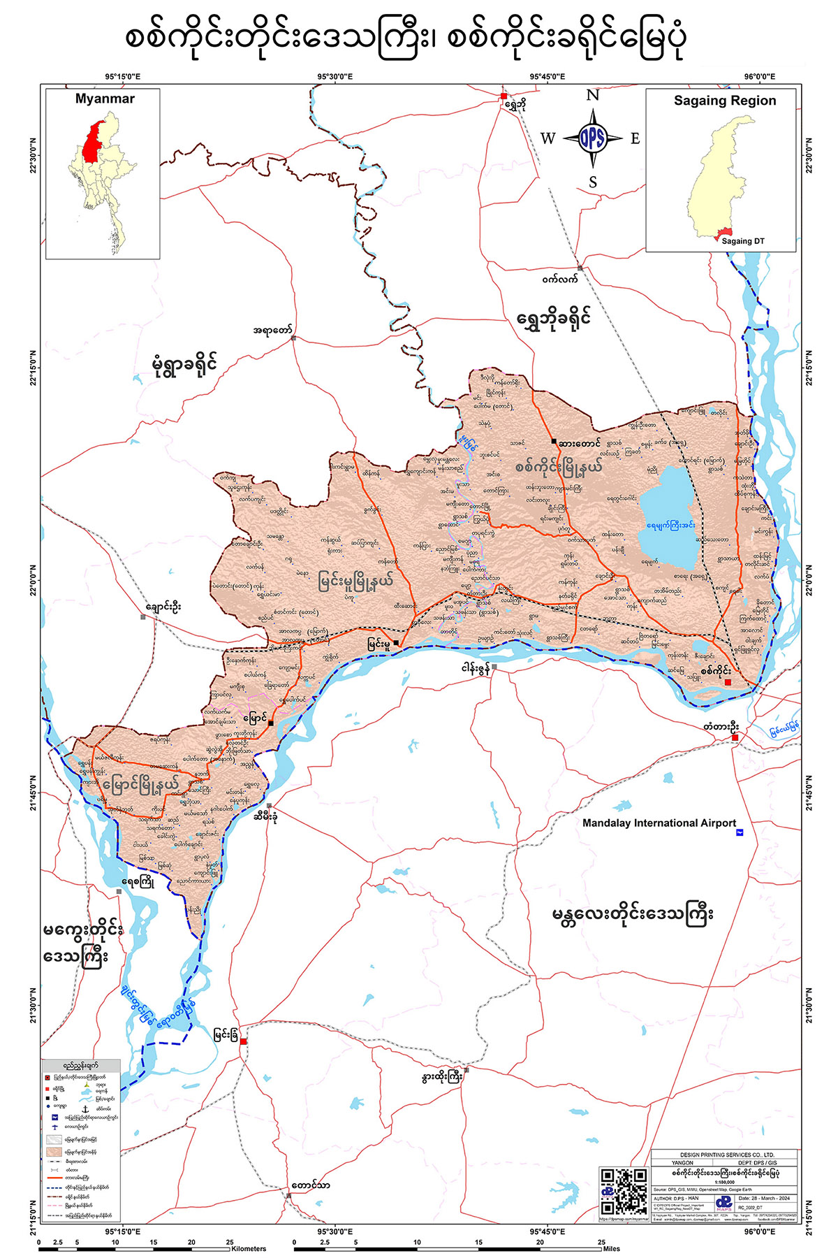
စစ်ကိုင်းခရိုင် မြေပုံ
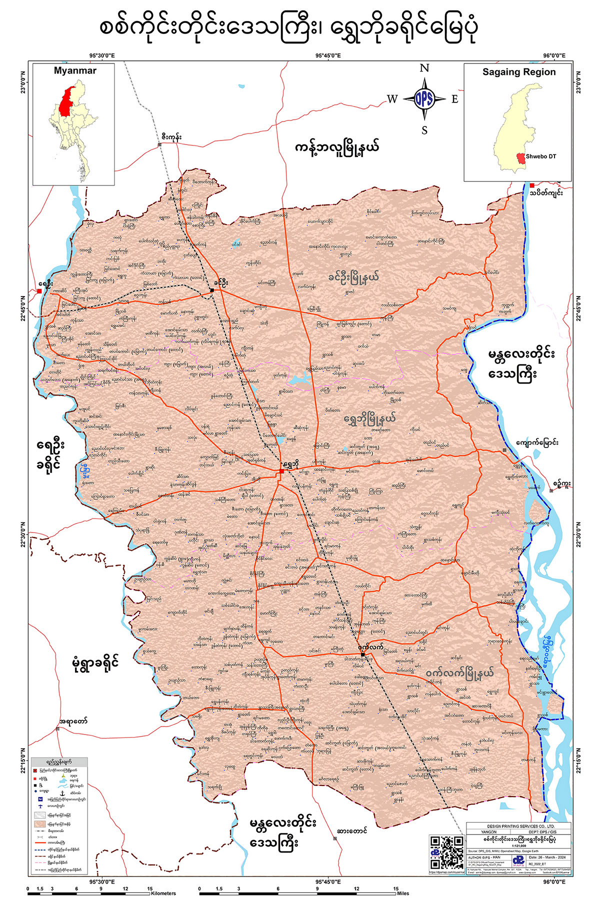
ရွှေဘိုခရိုင် မြေပုံ
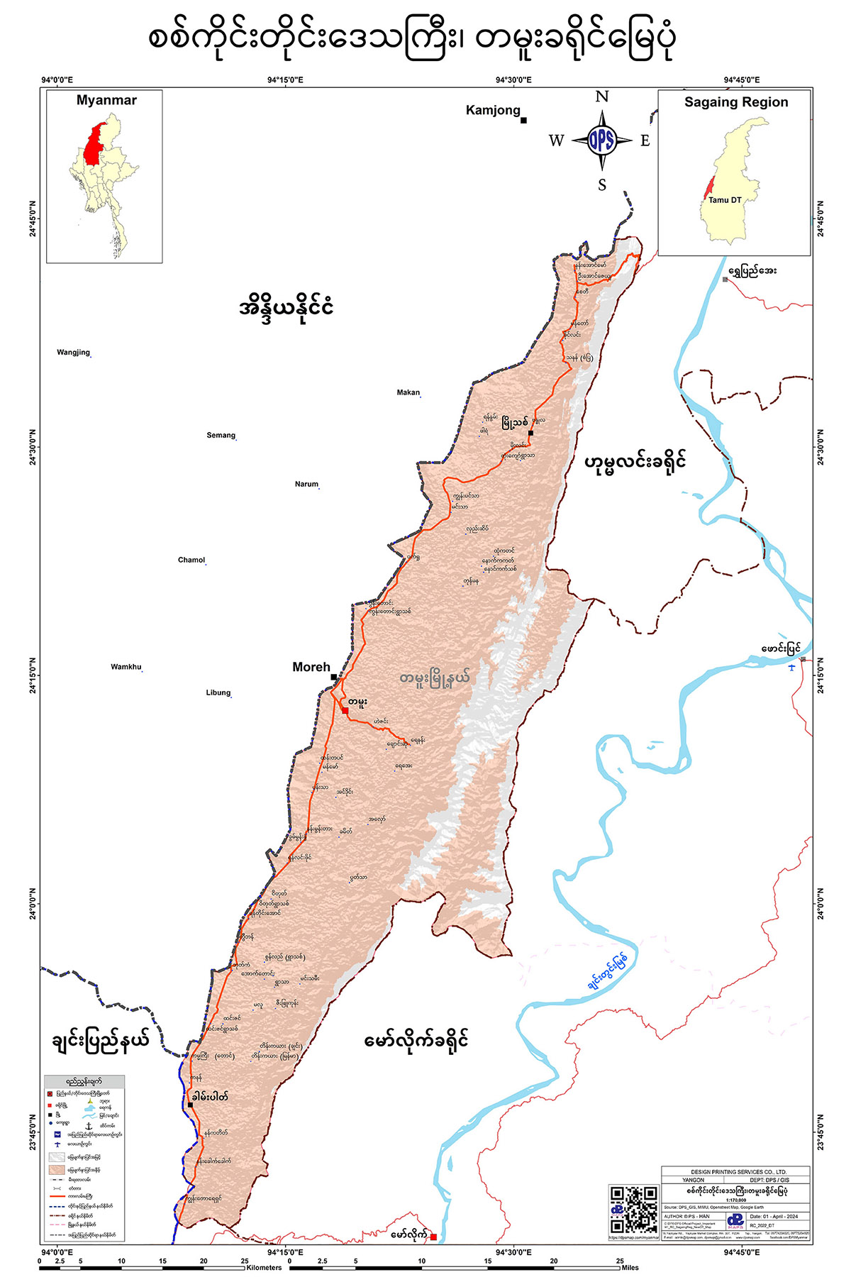
တမူးခရိုင် မြေပုံ
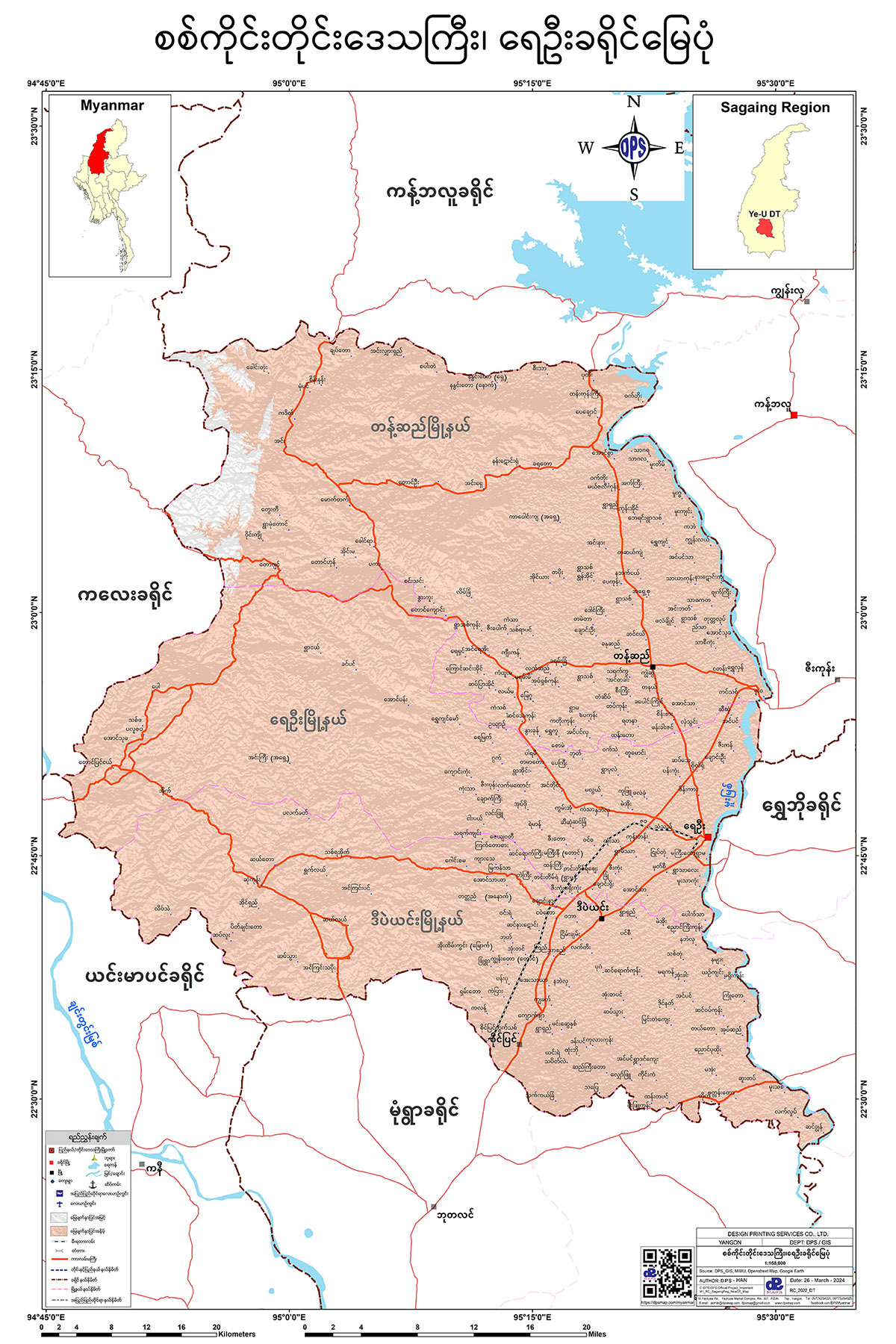
ရေဦးခရိုင် မြေပုံ
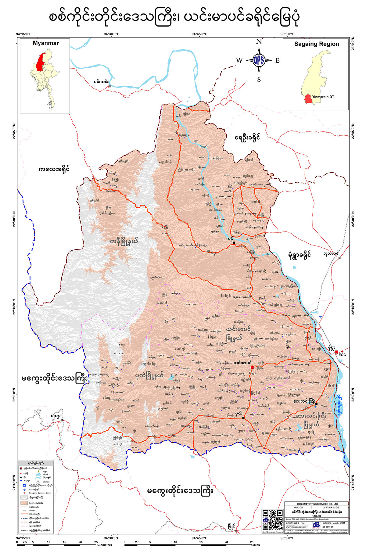
ယင်းမာပင်ခရိုင် မြေပုံ
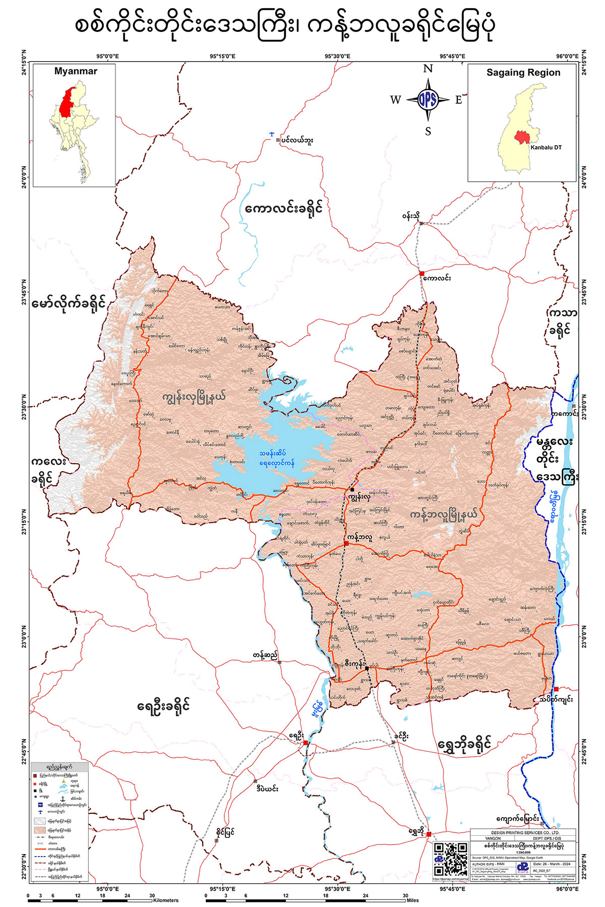
ကန့်ဘလူခရိုင် မြေပုံ
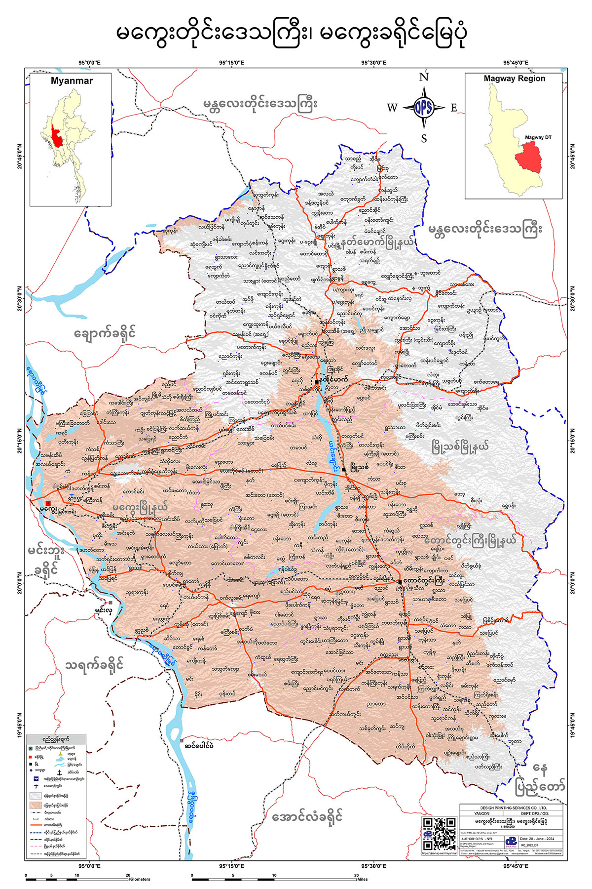
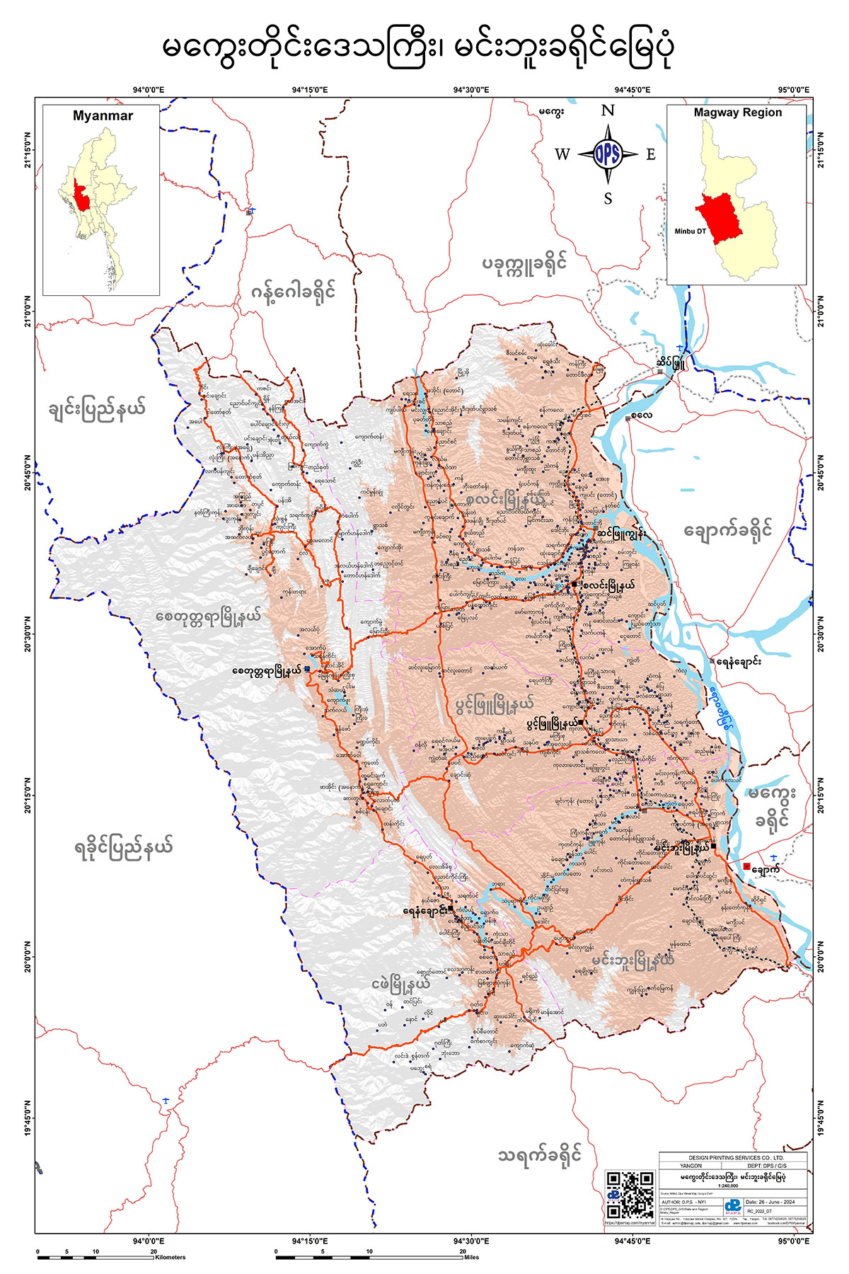
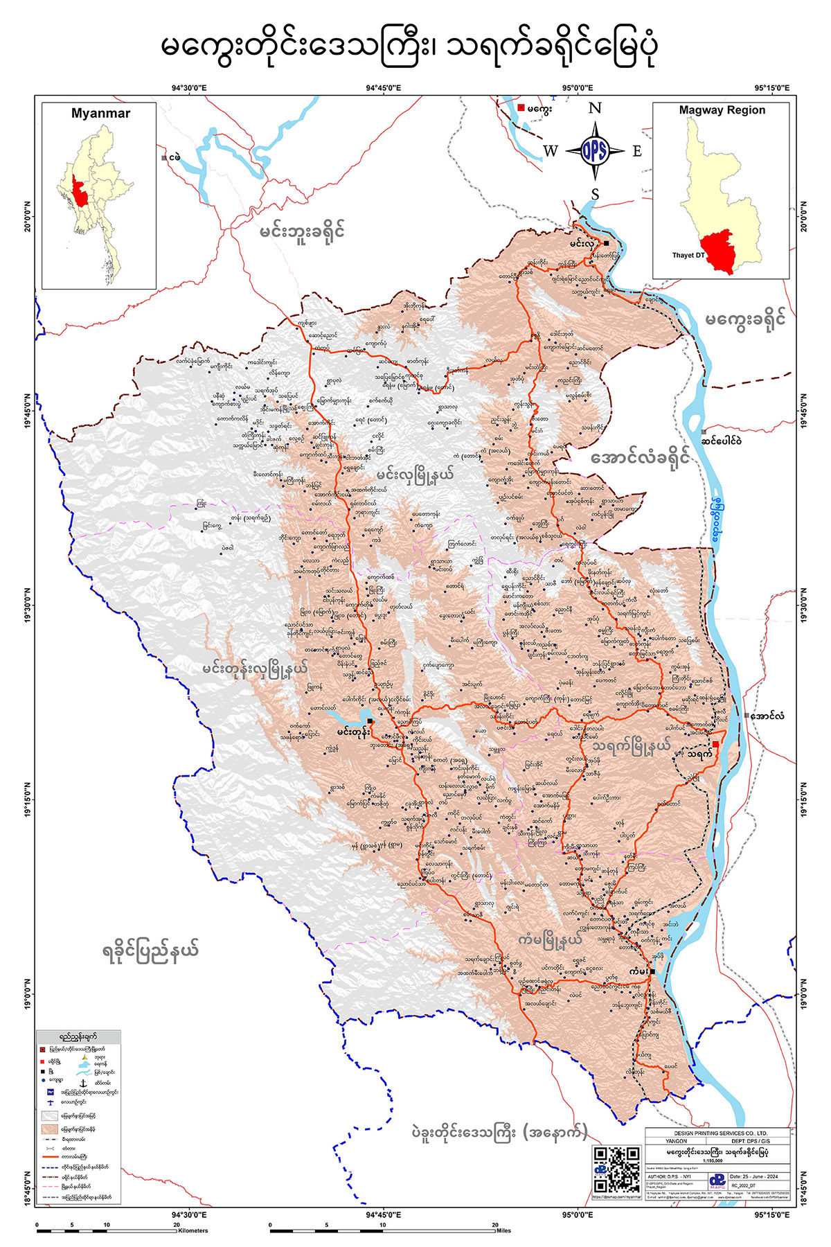
Magwe Region
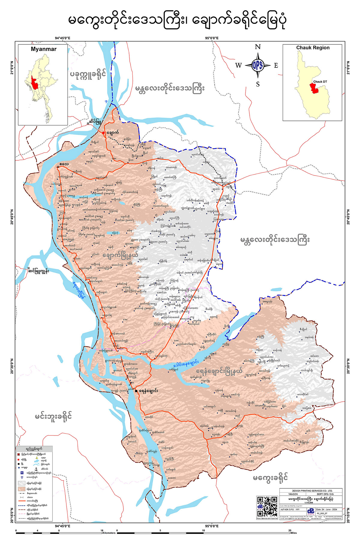
ချောက်ခရိုင် မြေပုံ
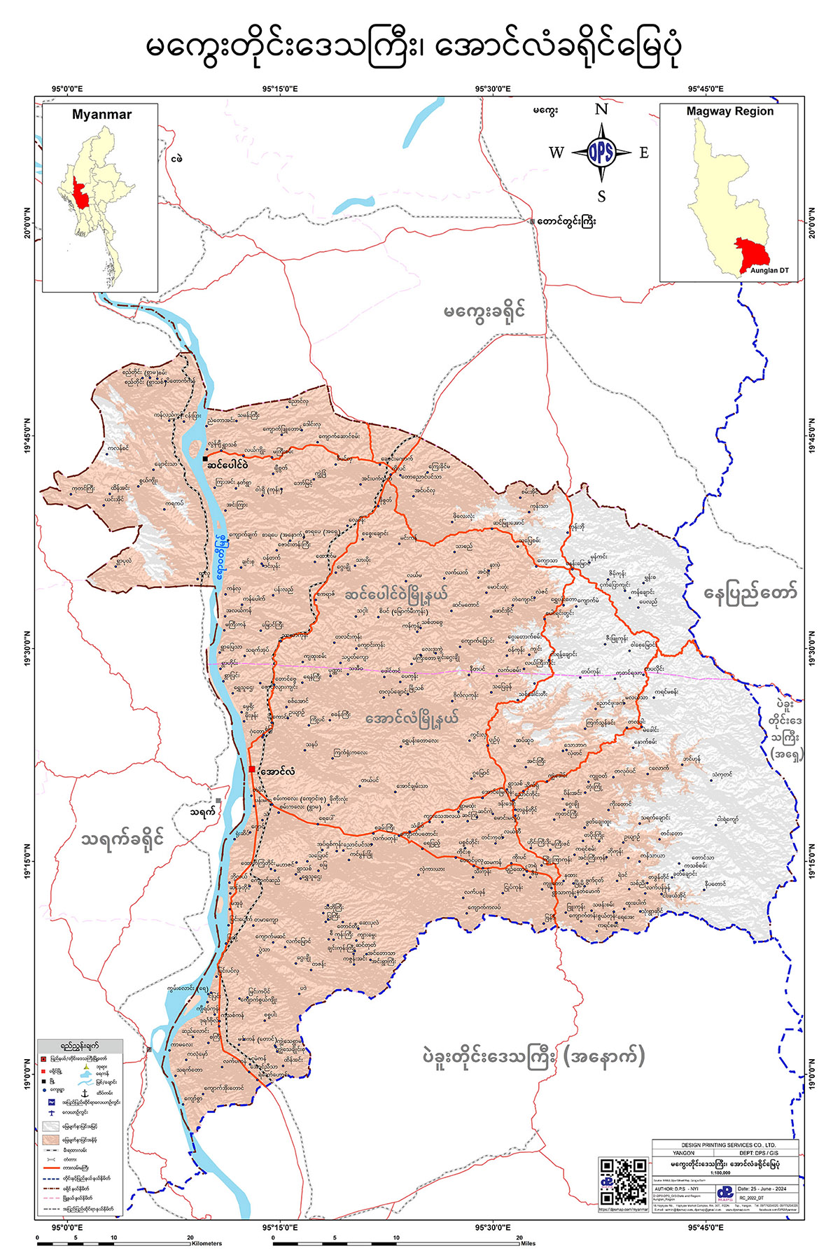
အောင်လံခရိုင် မြေပုံ
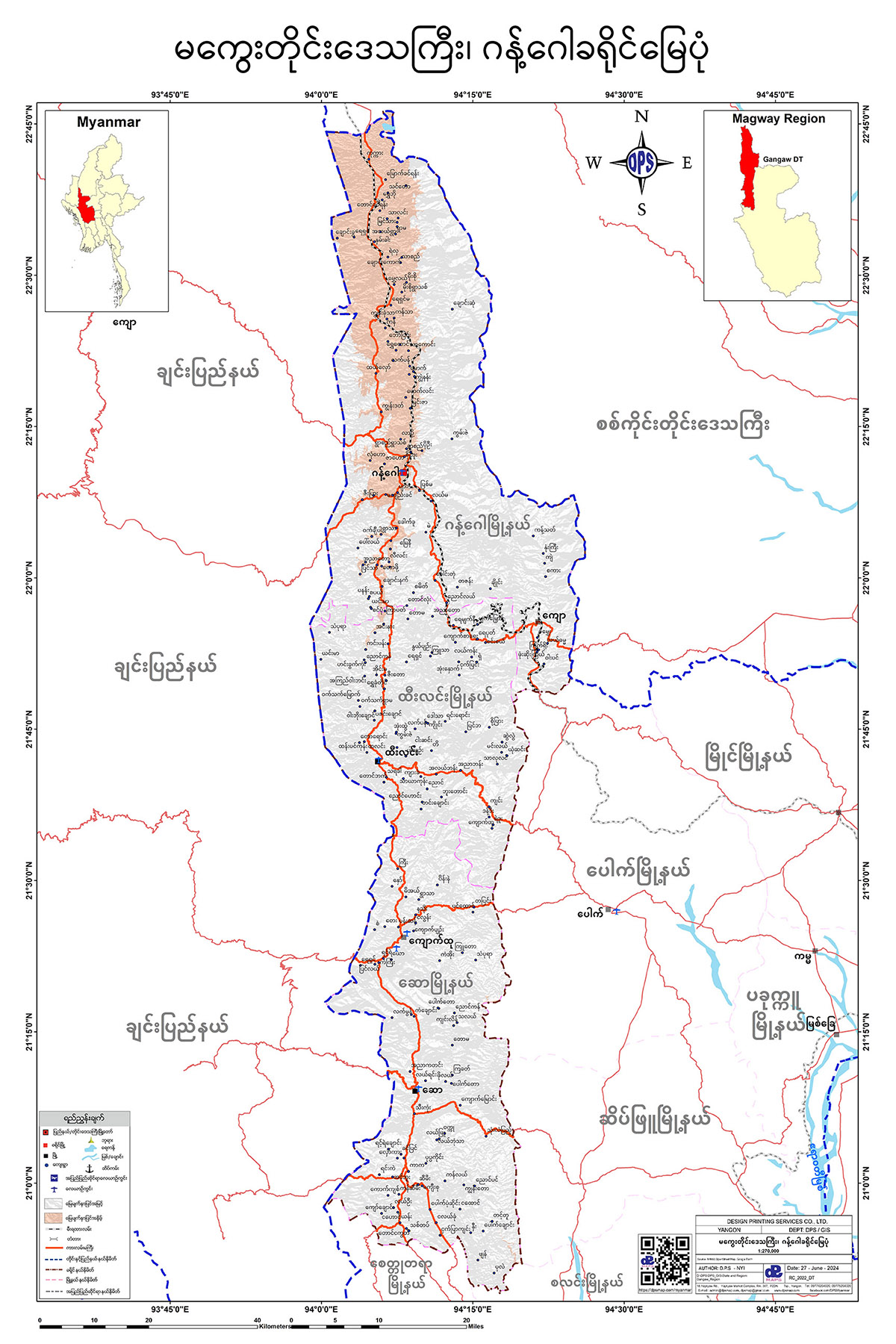
ဂန့်ဂေါခရိုင် မြေပုံ
မကွေးခရိုင် မြေပုံ
မင်းဘူးခရိုင် မြေပုံ
ပခုက္ကူခရိုင် မြေပုံ

သရက်ခရိုင် မြေပုံ
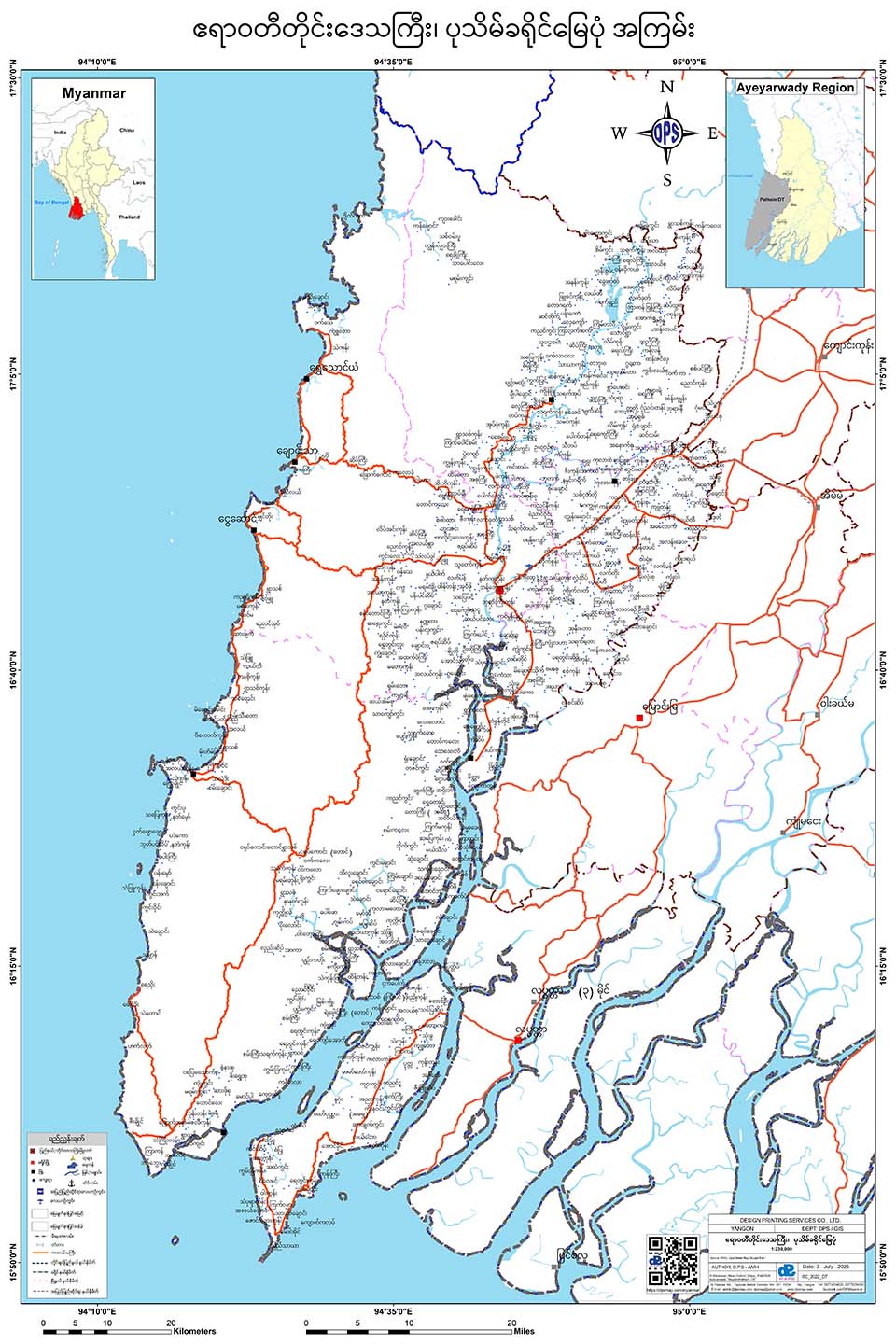
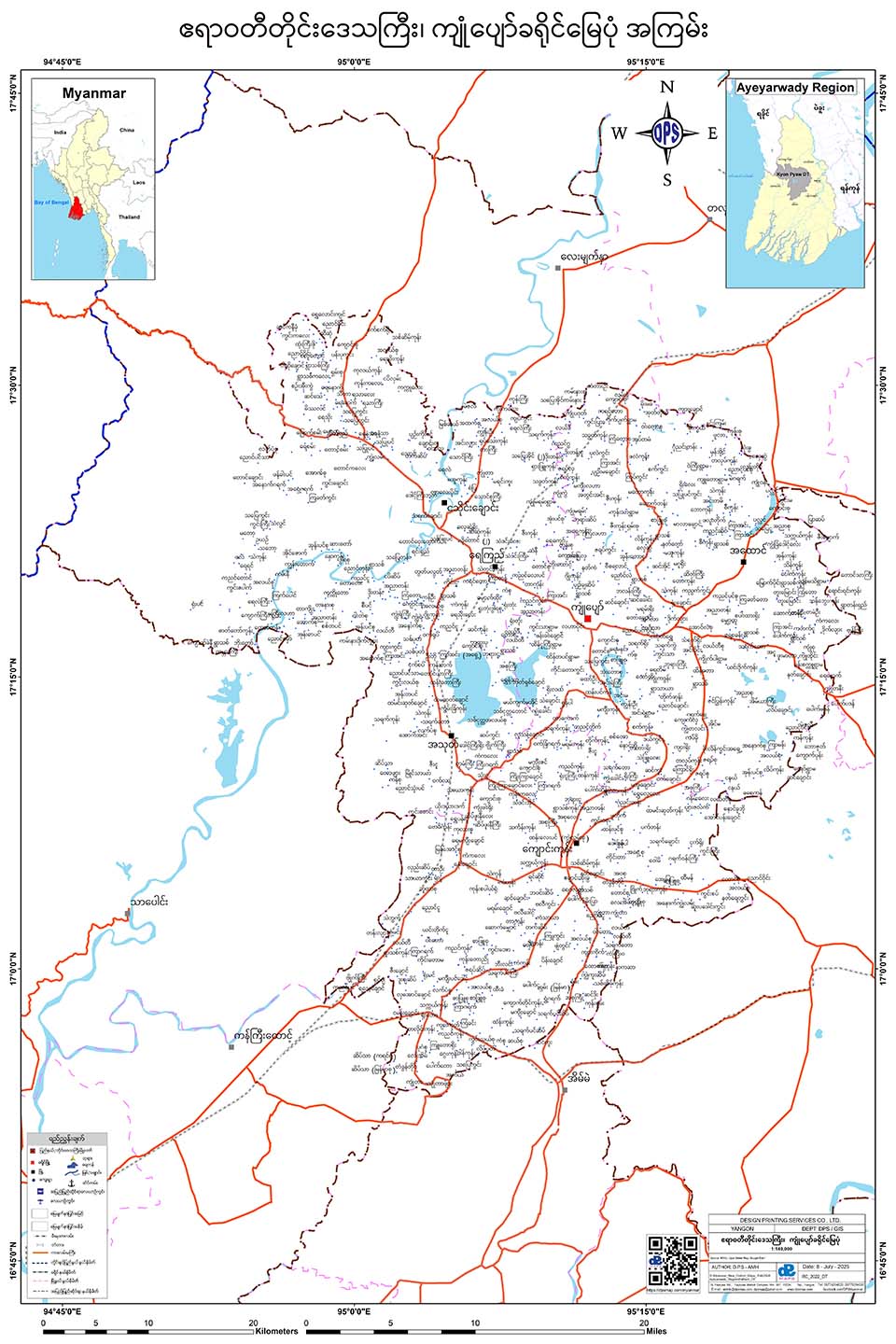
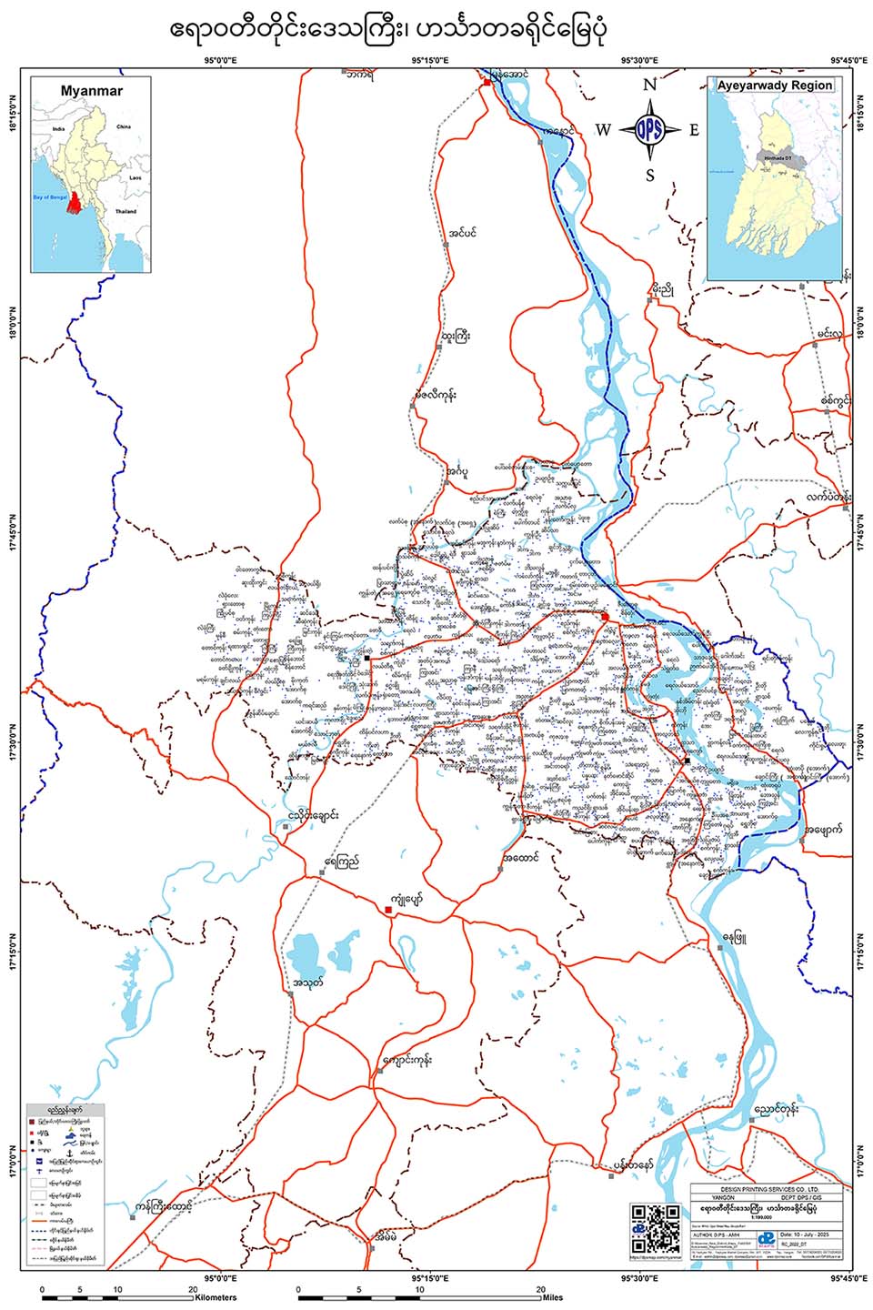
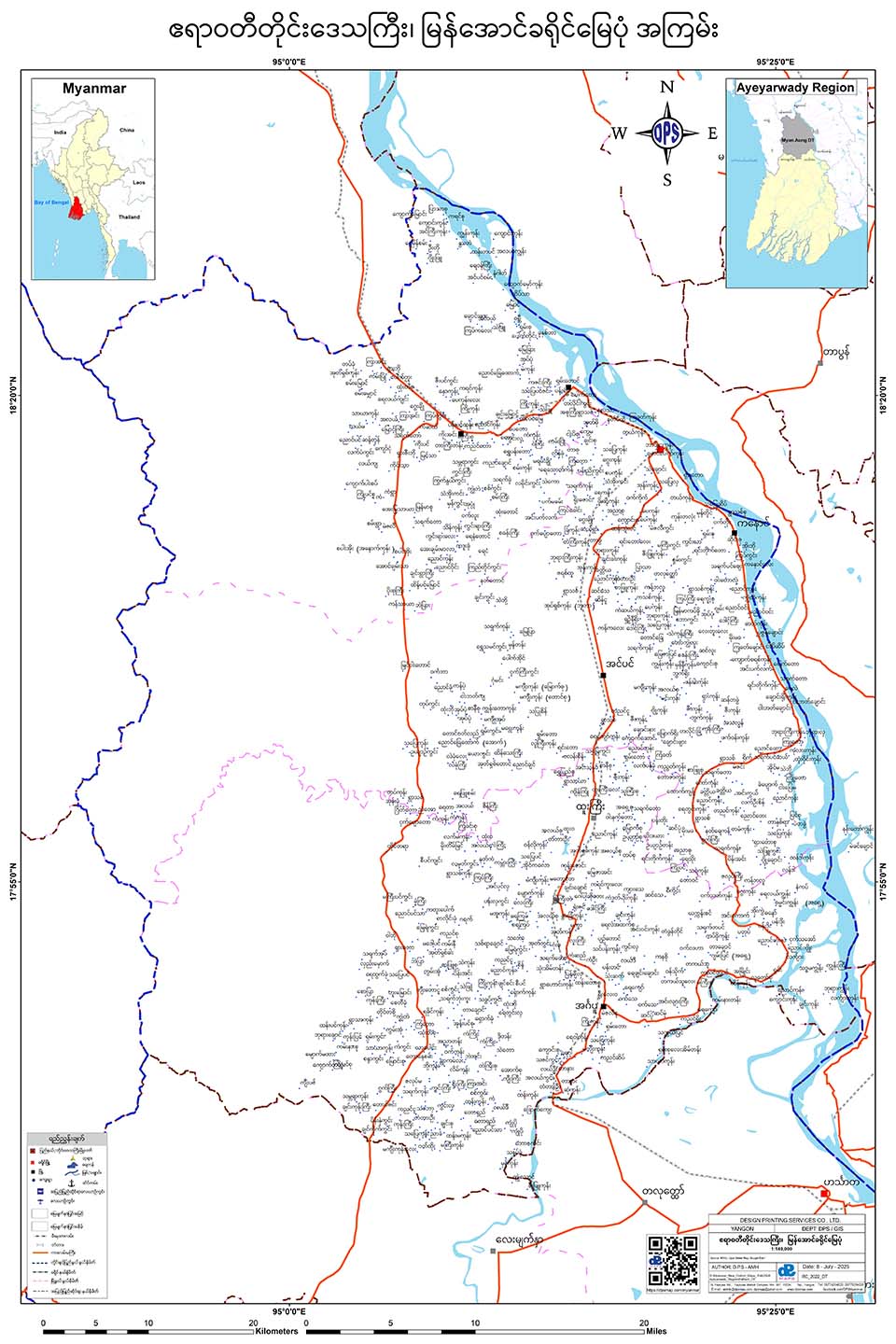
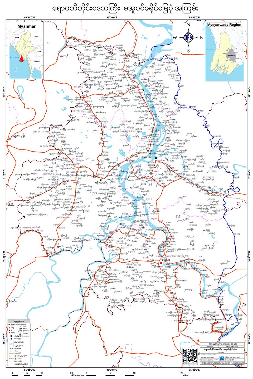
Ayeyarwady Region
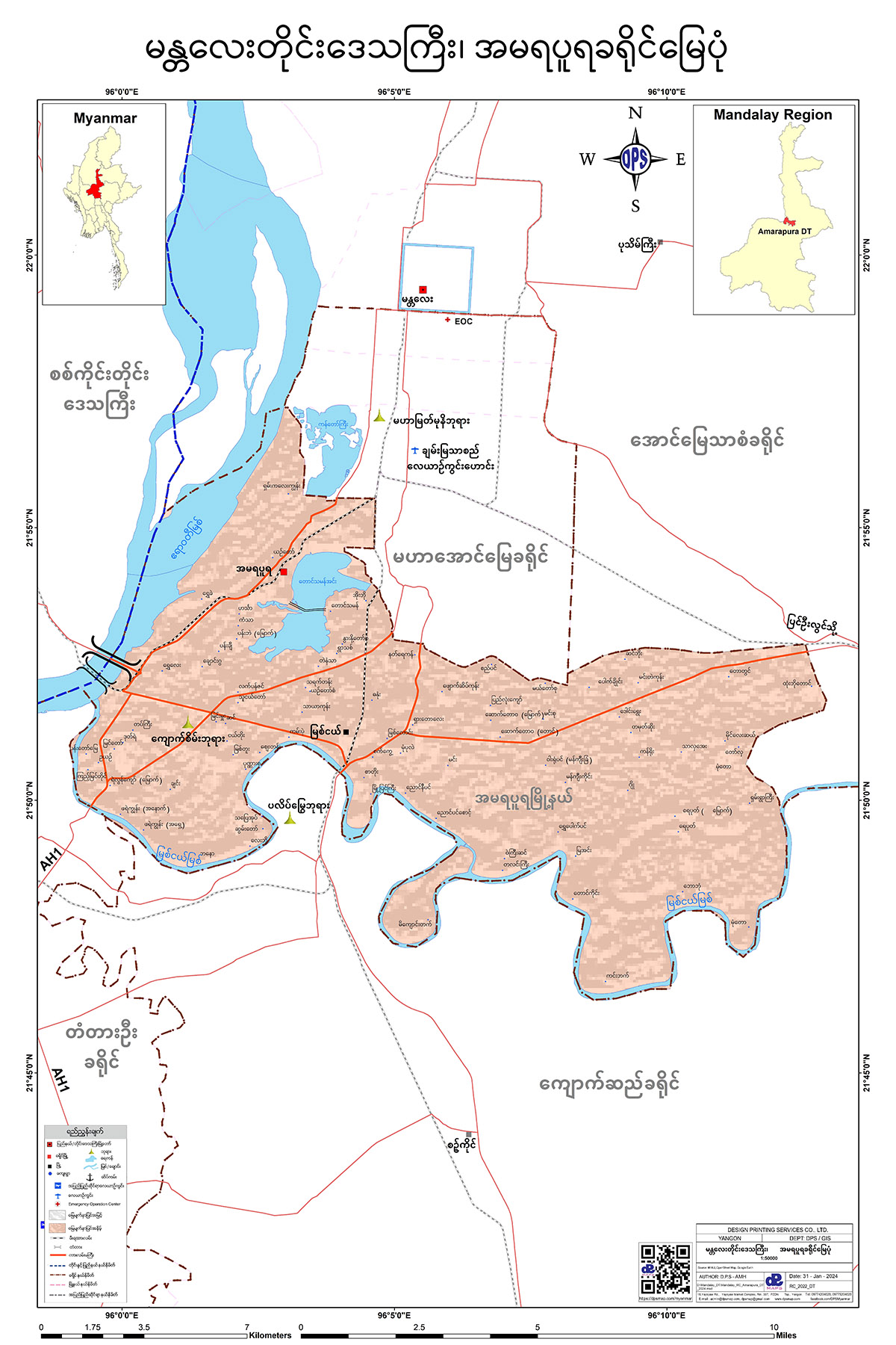
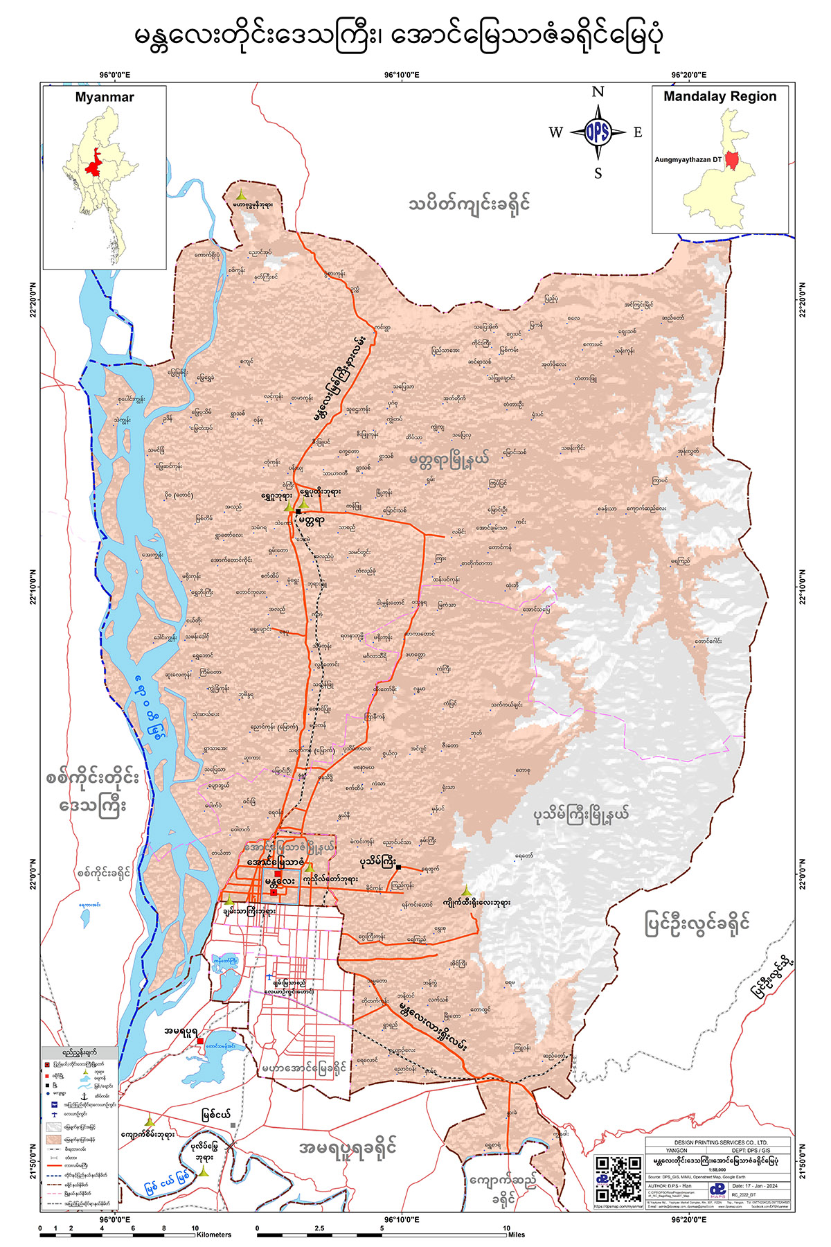
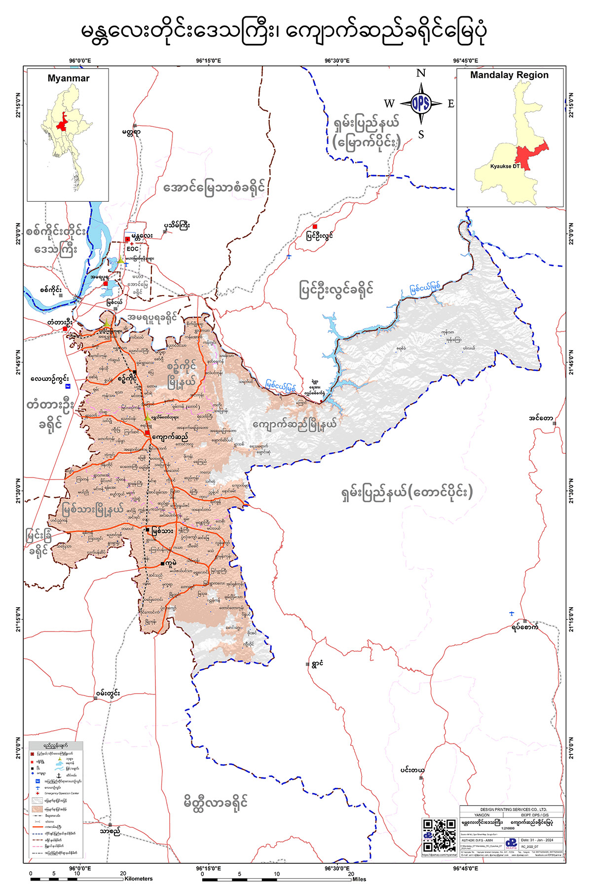
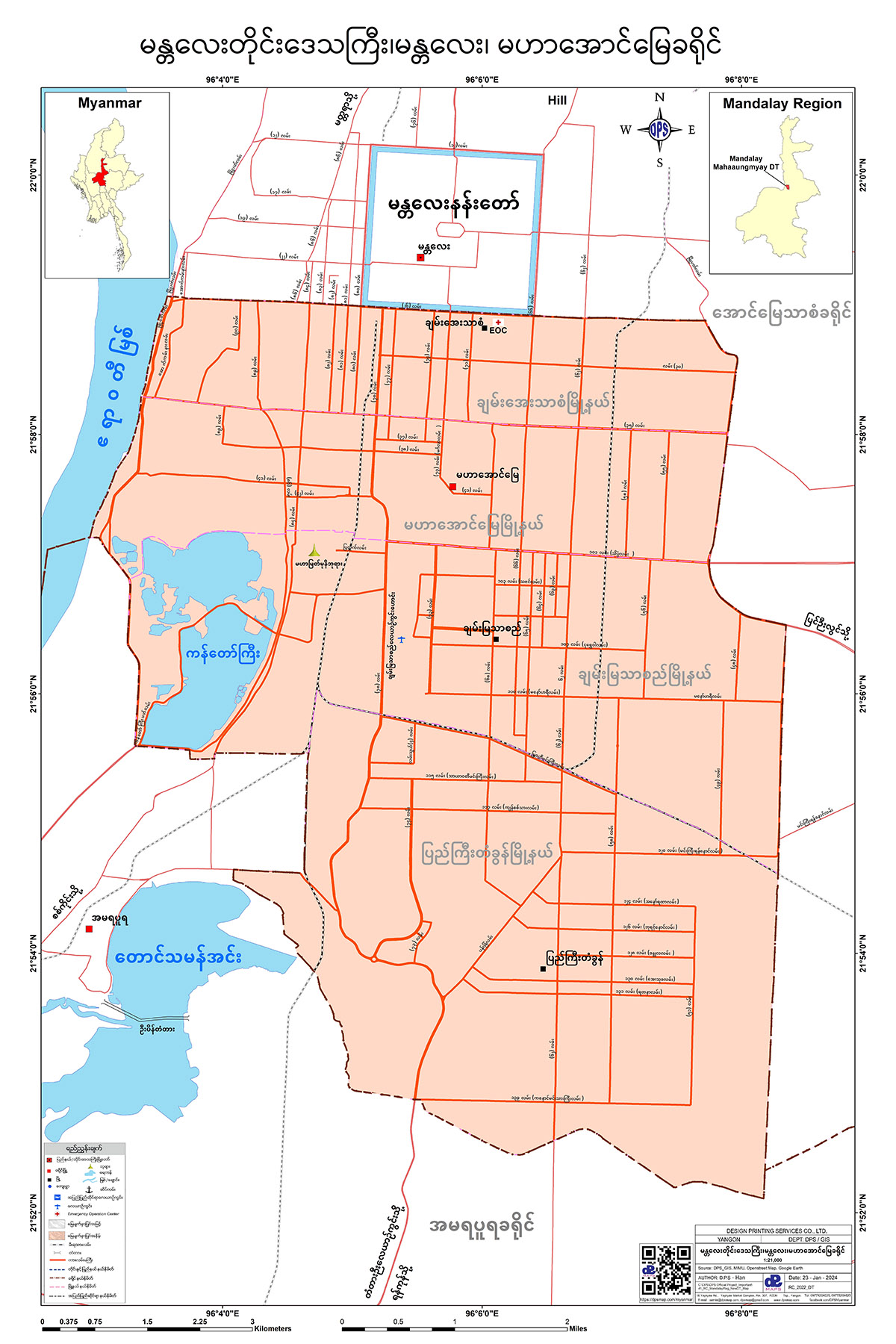
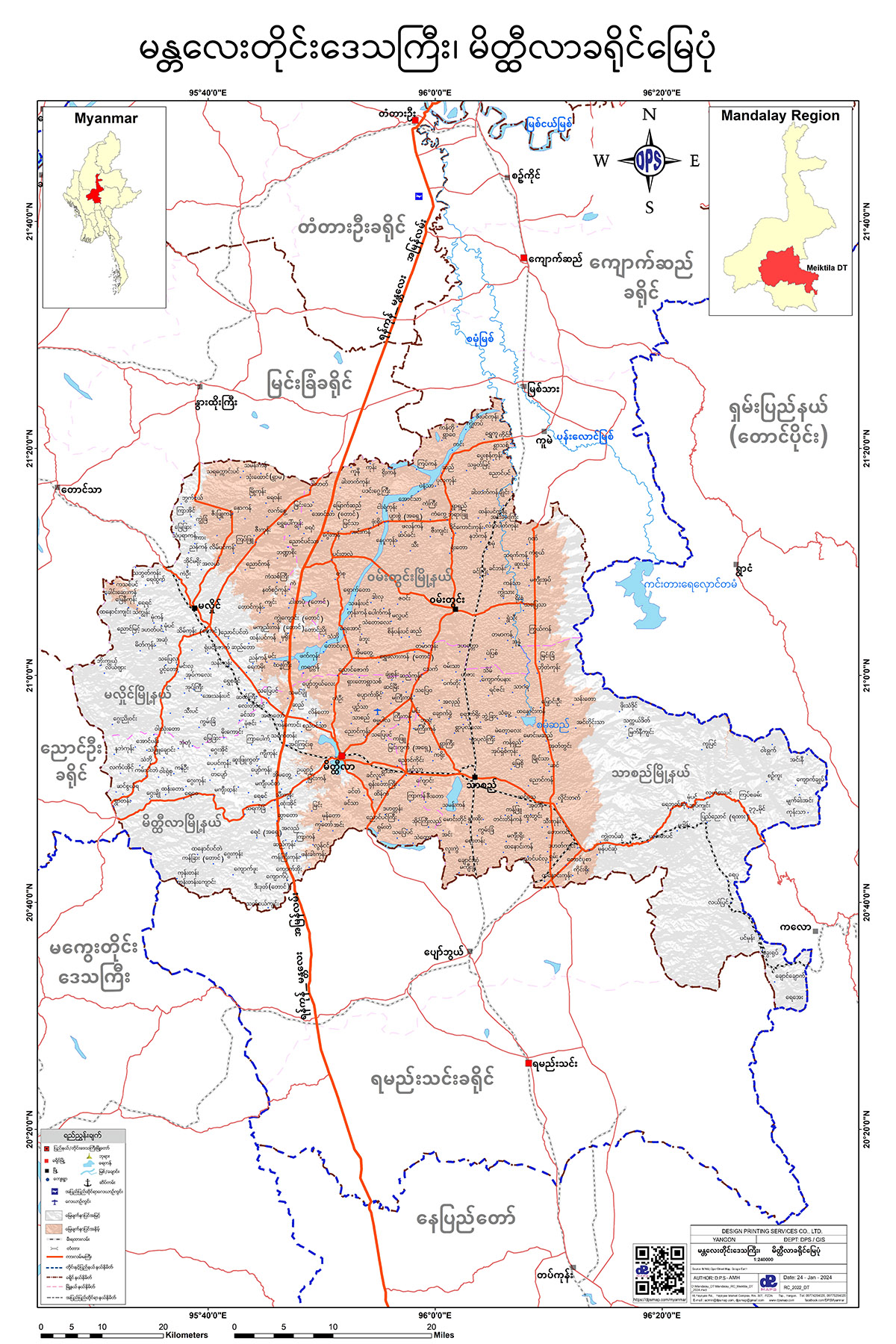
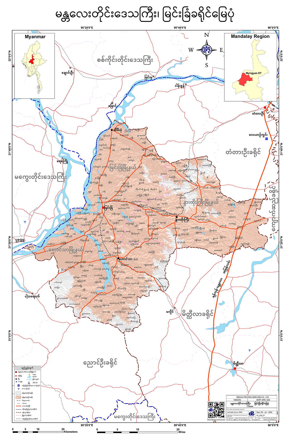
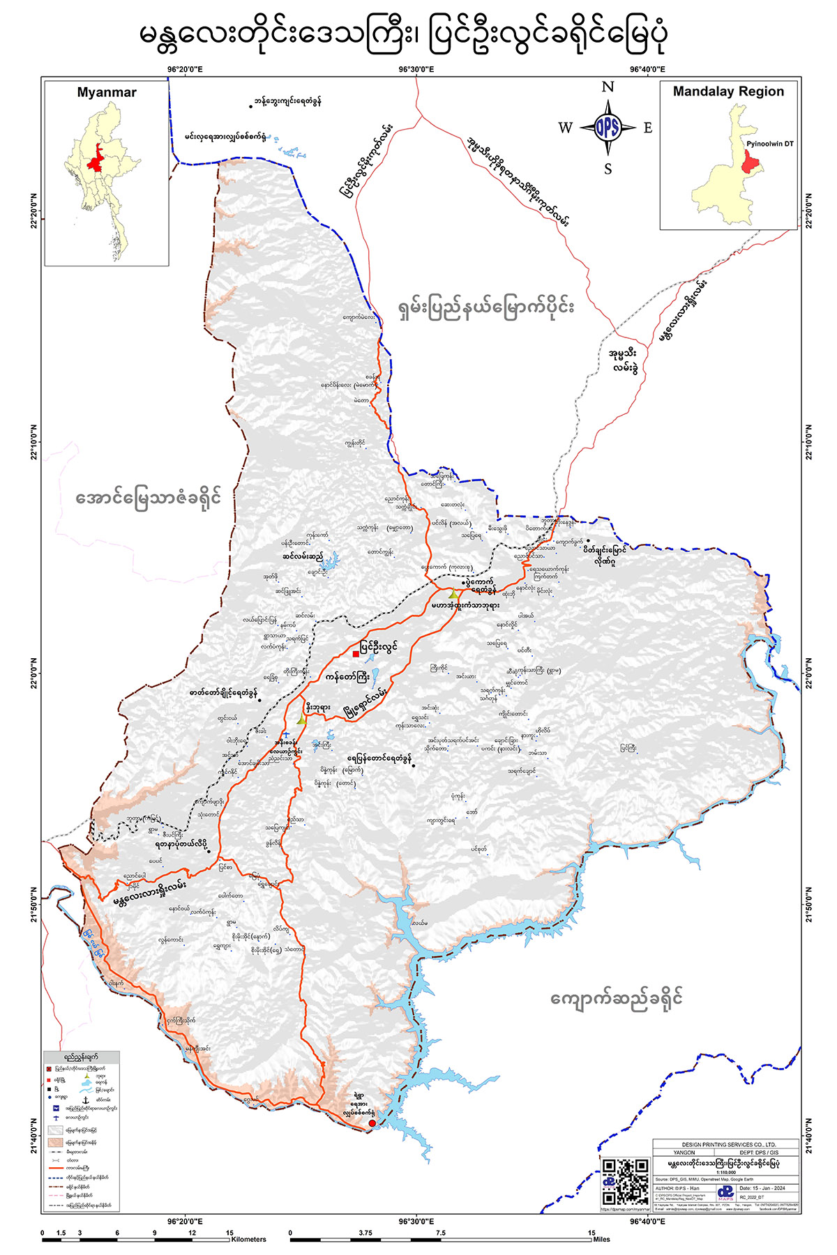
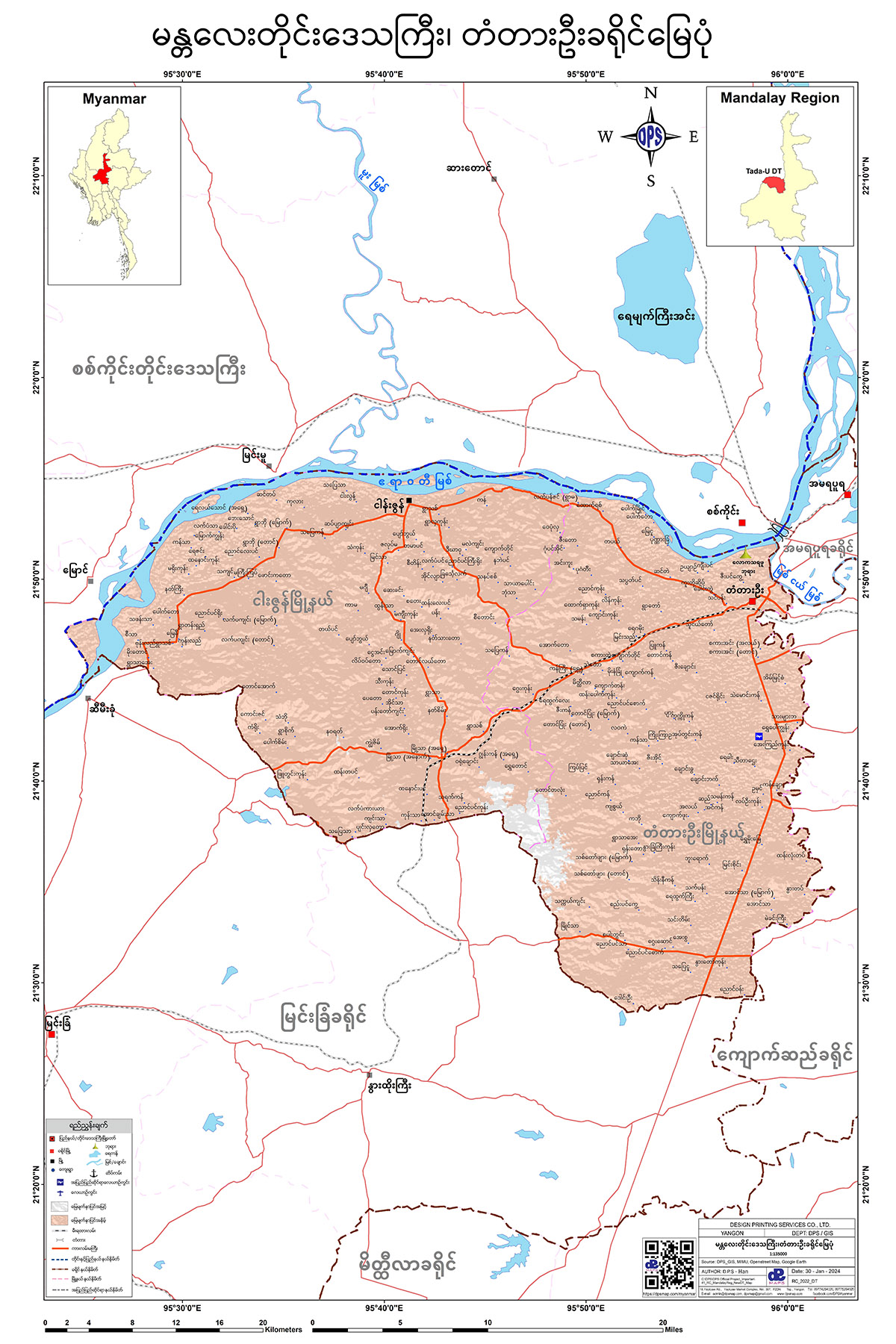
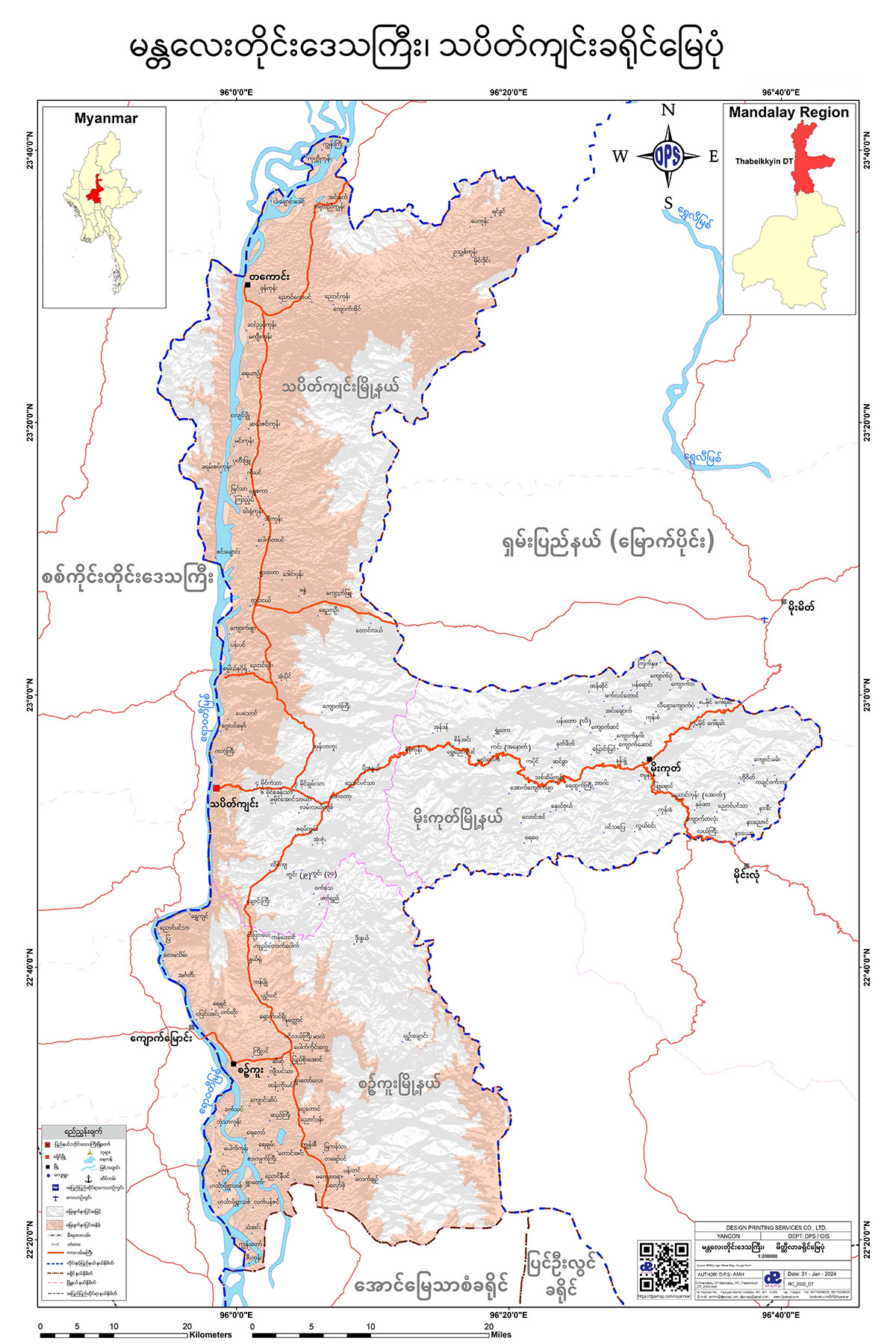
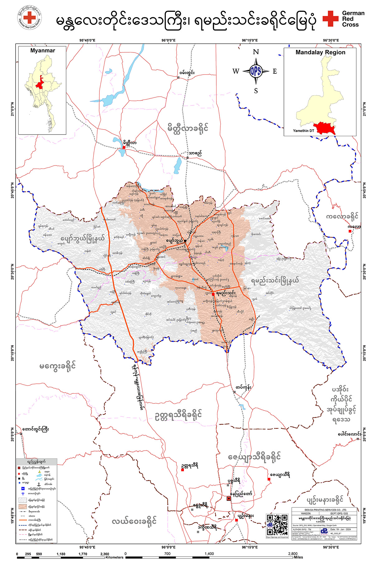
Mandalay Region
အမရပူရခရိုင် မြေပုံ
အောင်မြေသာဇံခရိုင် မြေပုံ
ကျောက်ဆည်ခရိုင် မြေပုံ
မဟာအောင်မြေခရိုင် မြေပုံ
မိတ္ထီလာခရိုင် မြေပုံ
မြင်းခြံခရိုင် မြေပုံ
ပြင်ဦးလွင်ခရိုင် မြေပုံ
တံတားဦးခရိုင် မြေပုံ
သပိတ်ကျင်းခရိုင် မြေပုံ
ရမည်းသင်းခရိုင် မြေပုံ
ညောင်ဦးခရိုင် မြေပုံ

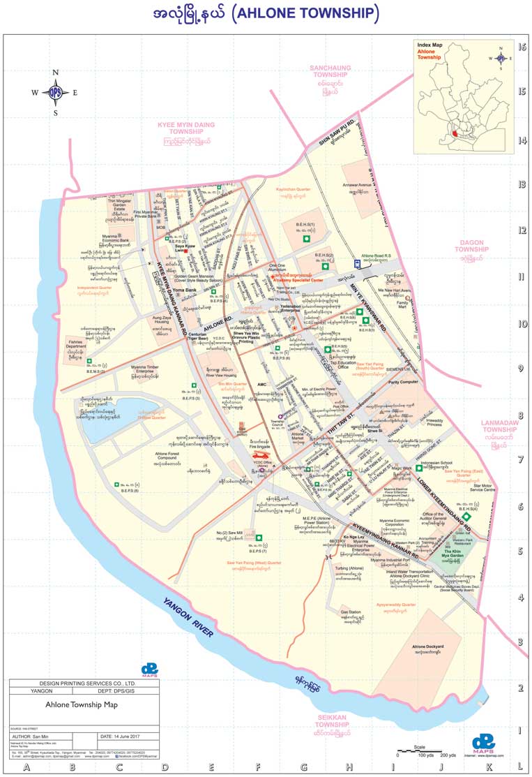
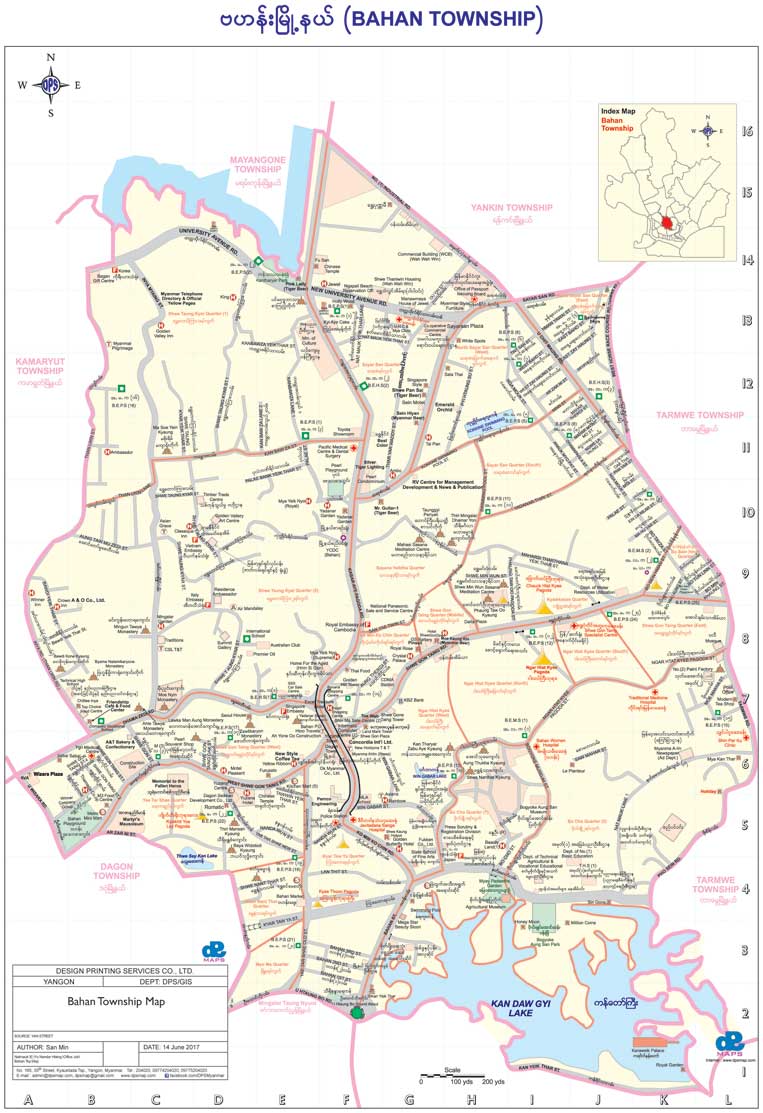
Yangon Map
Ahlone Township
Bahan Township
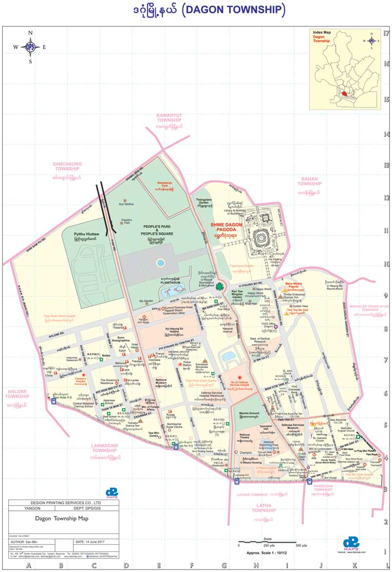
Dagon Township
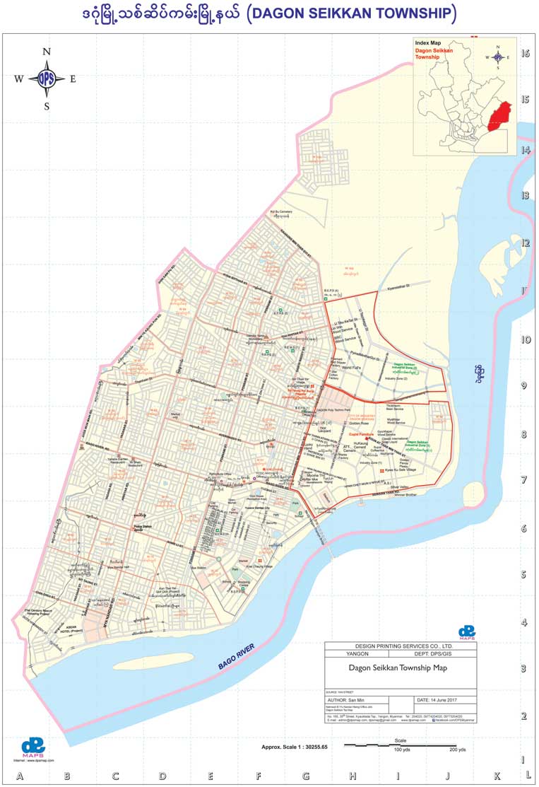
Dagon Seikkan
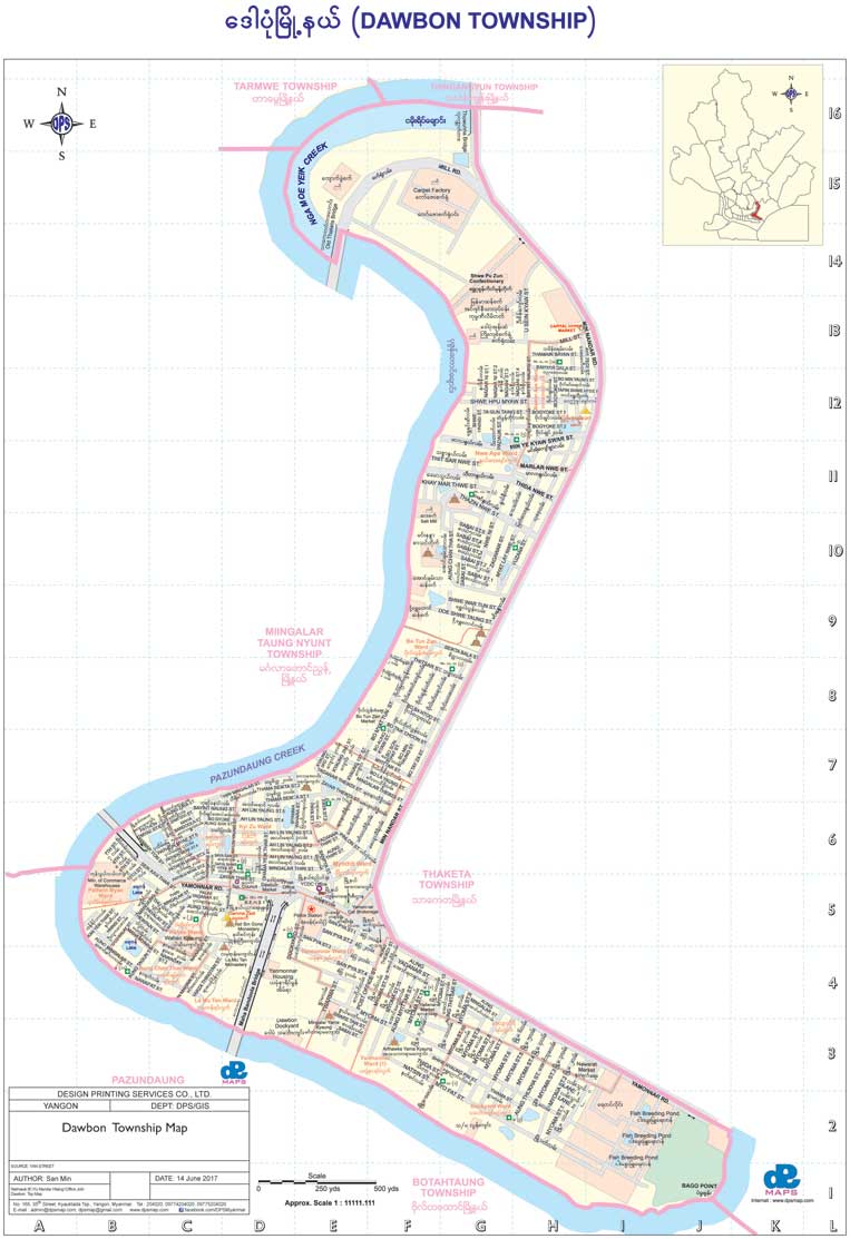
Dawbon Township
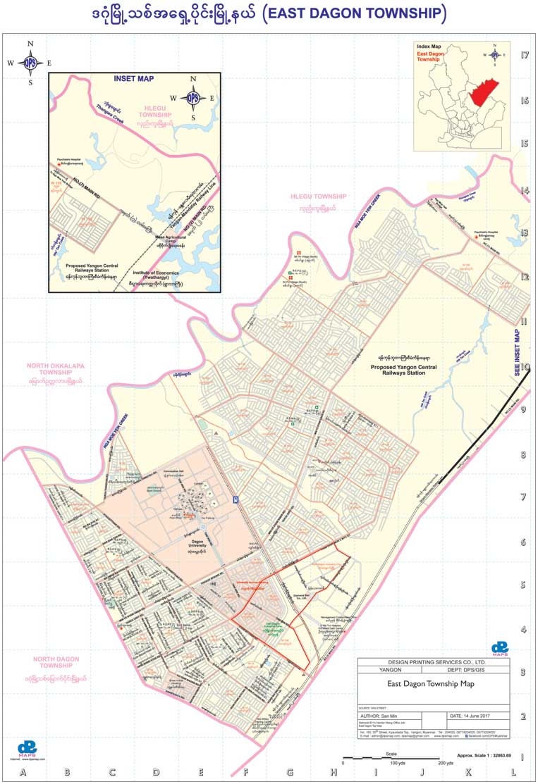
East Dagon Township
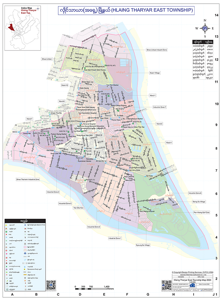
Hlaing Tharyar Township (East)
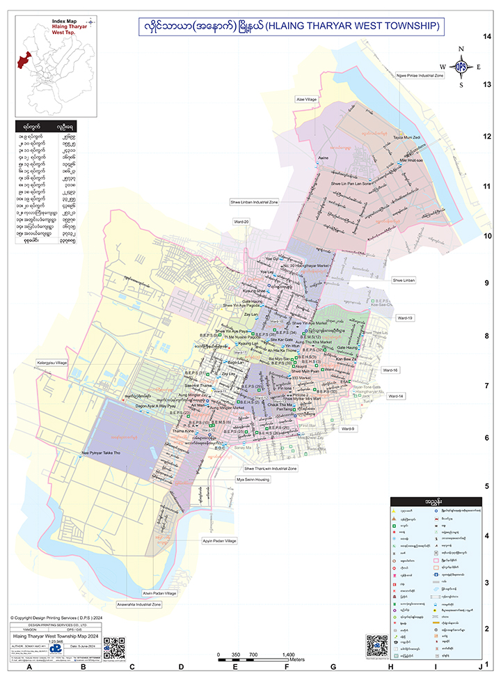
Hlaing Tharyar Township (West)
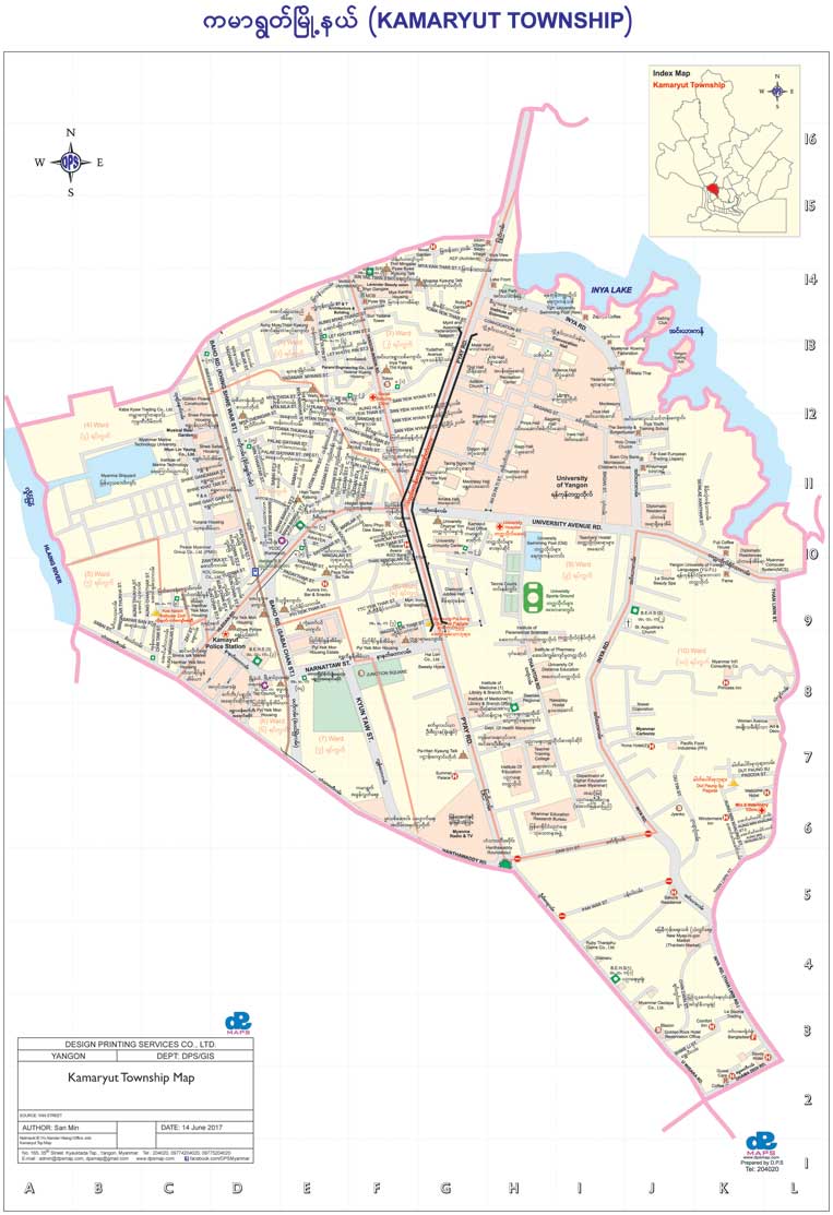
Kamaryut Township Map
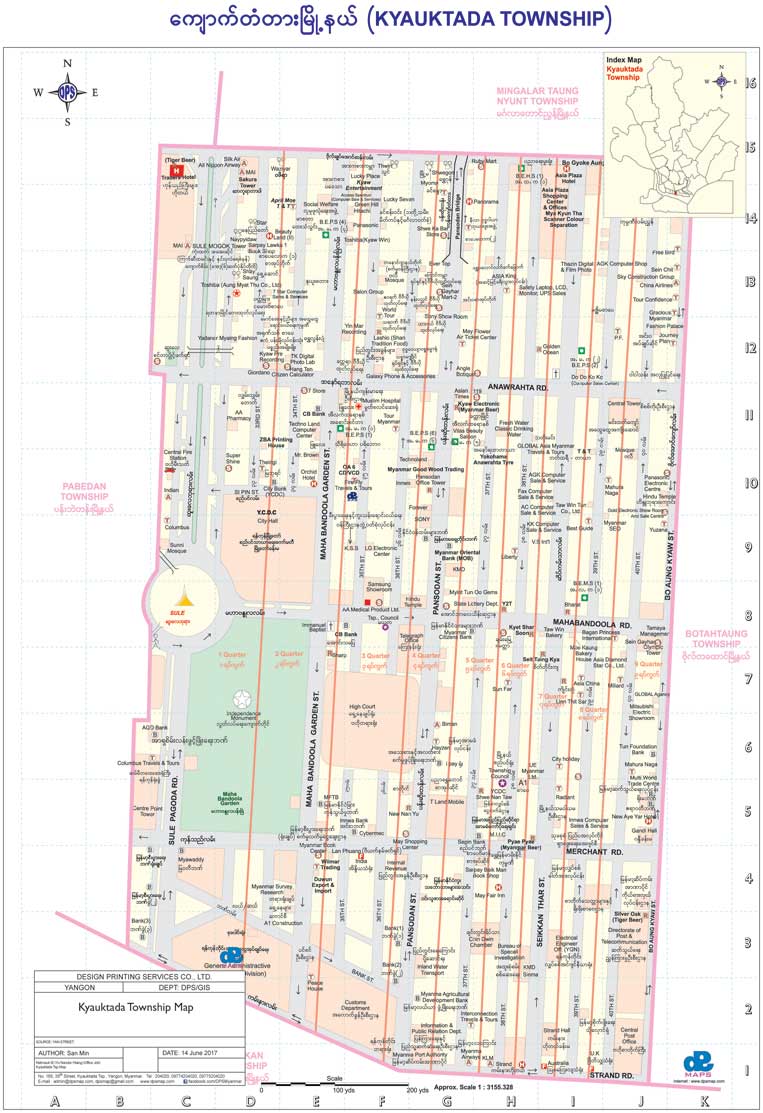
Kyauk Tada Township
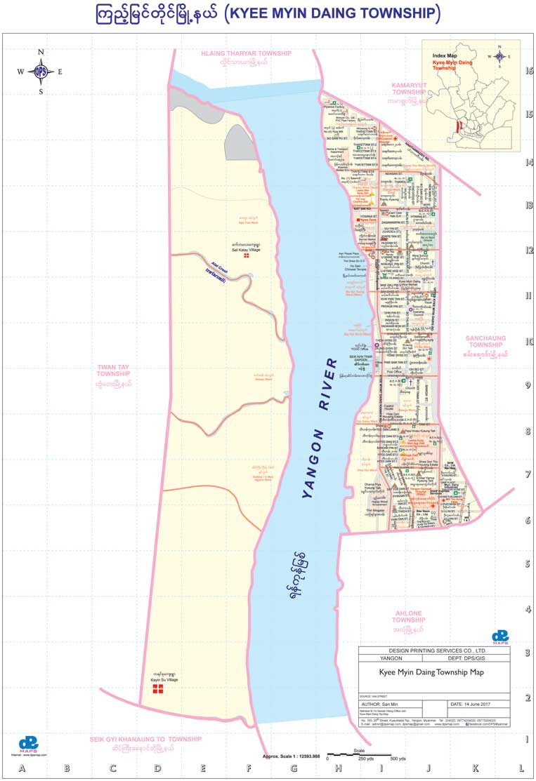
Kyee Myin Daing Township Map
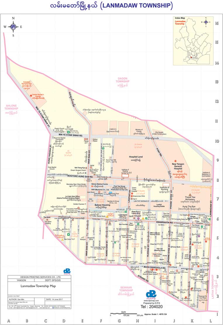
Lanmadaw Township Map
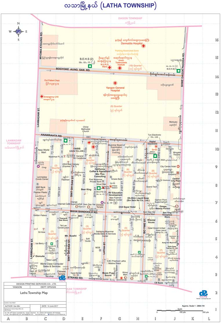
Latha Township Map
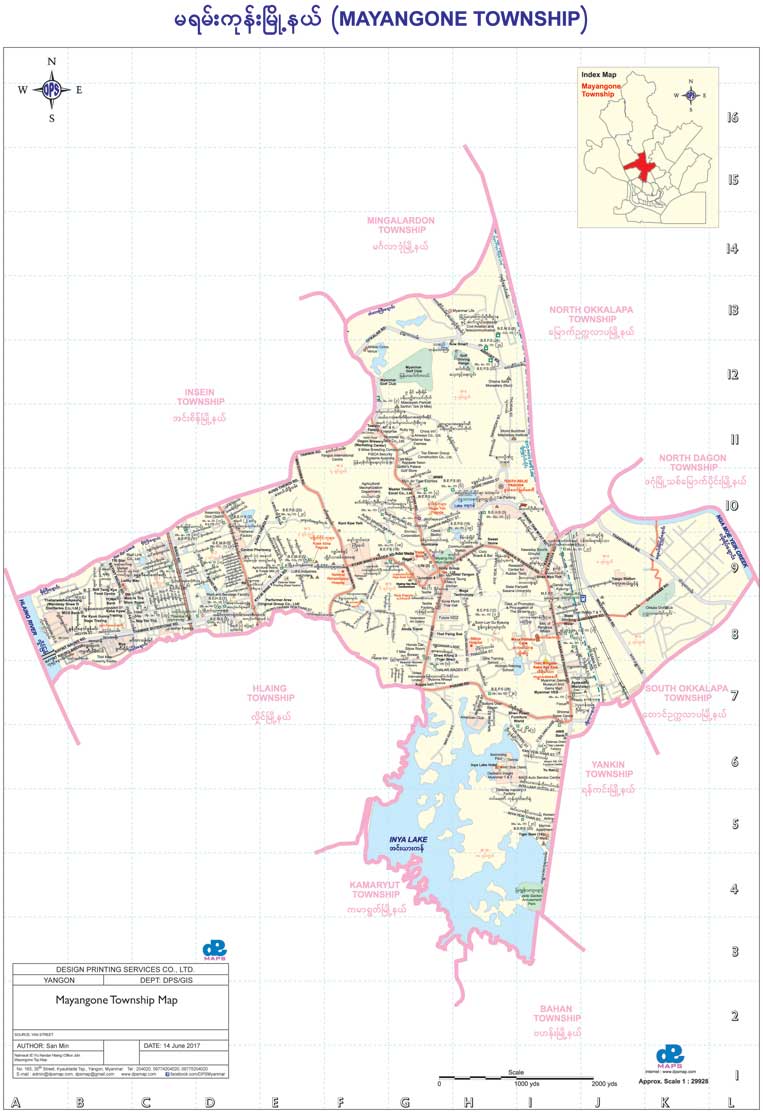
Mayangone Township Map
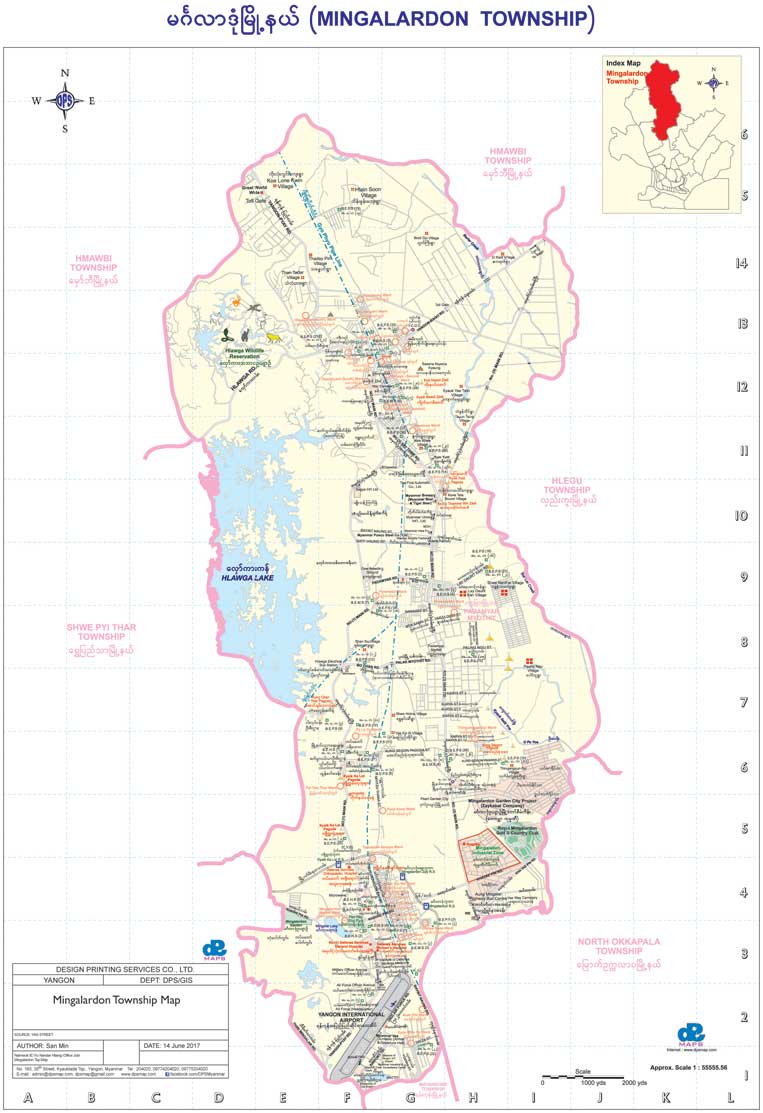
Mingalardon Township Map
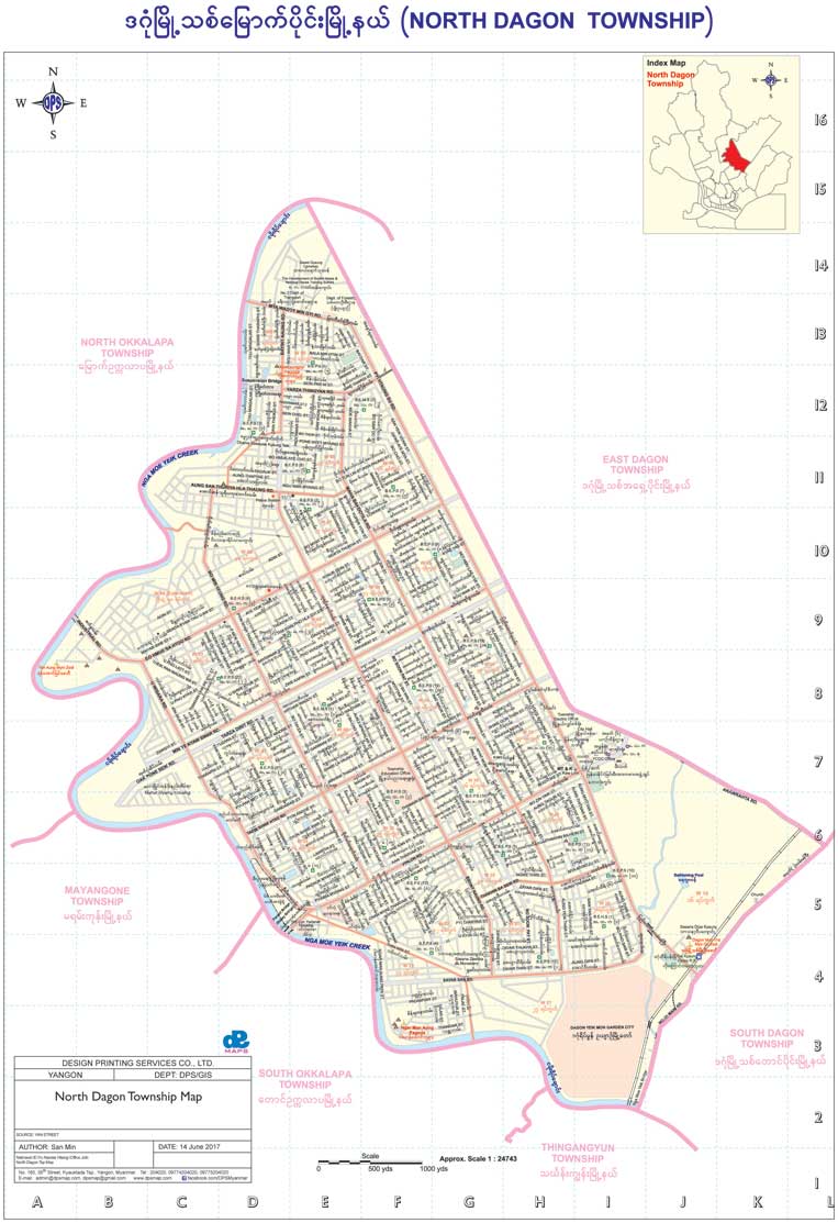
North Dagon Township Map
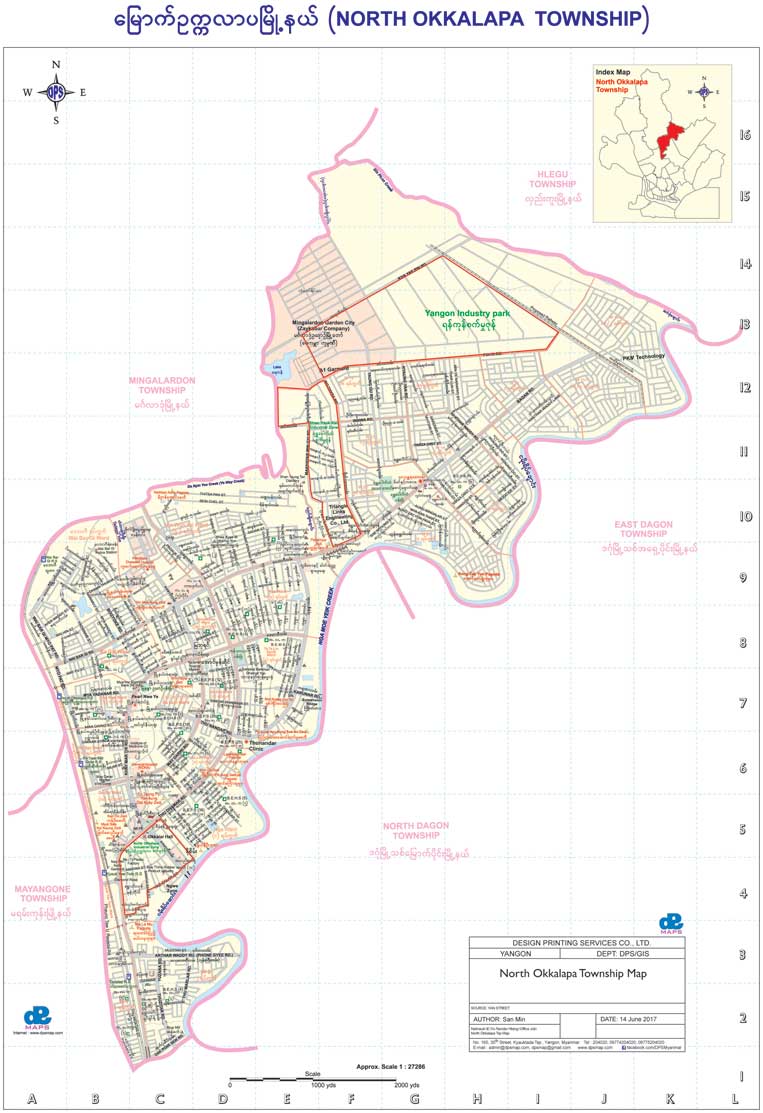
North Okkalapa Township Map
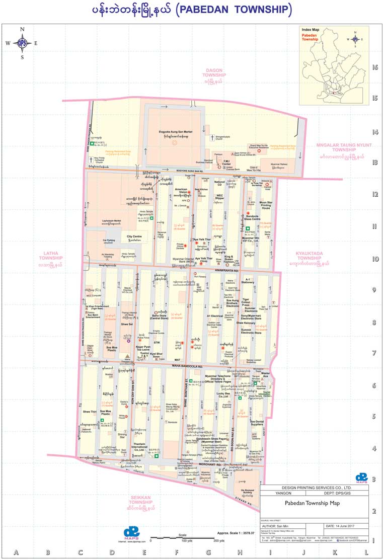
Pabedan Township Map
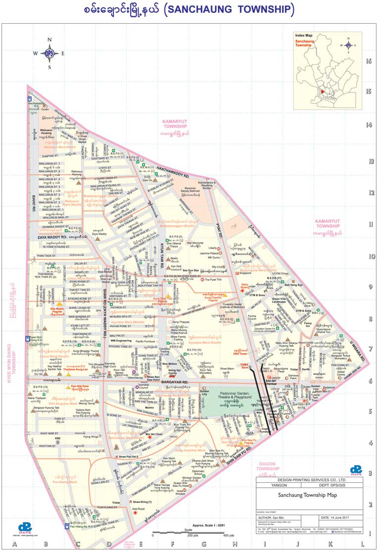
Sanchaung Township Map
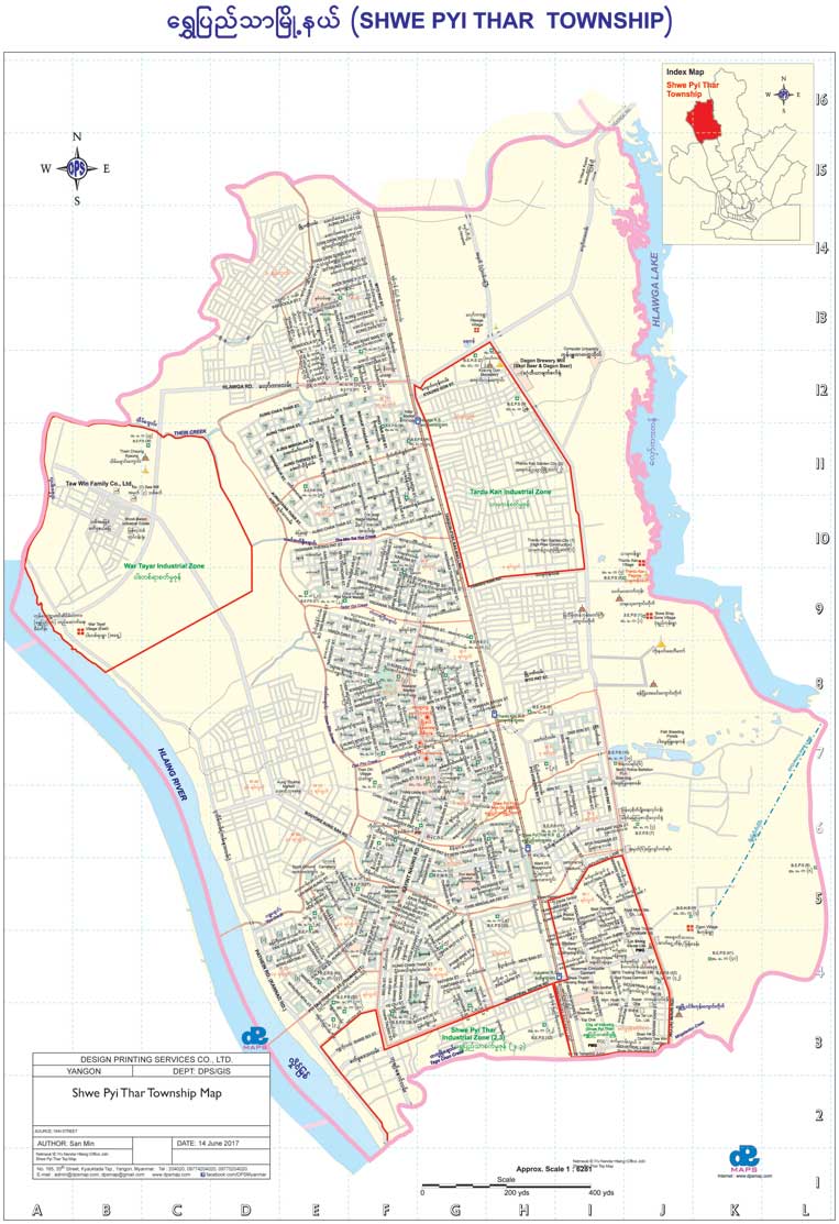
Shwe Pyi Thar Township Map
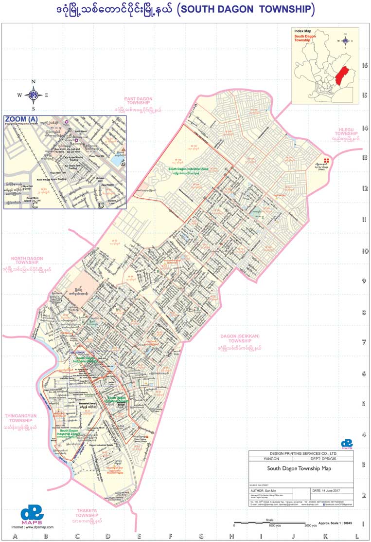
South Dagon Township Map
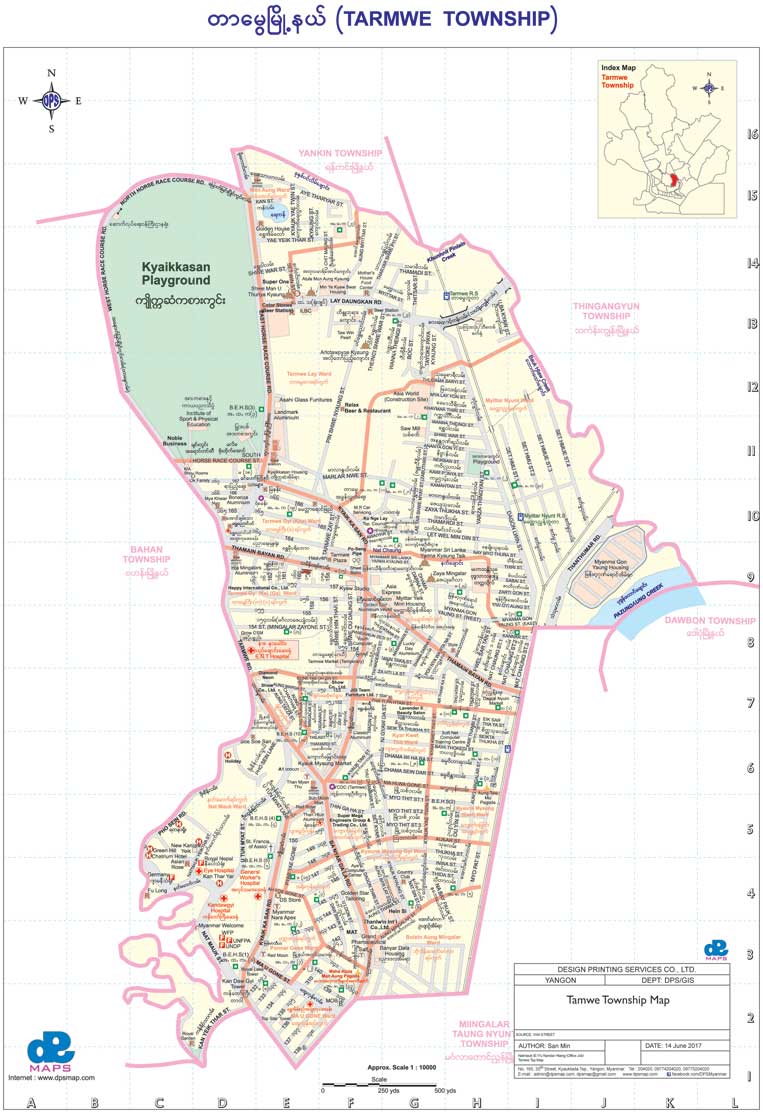
Tarmwe Township Map
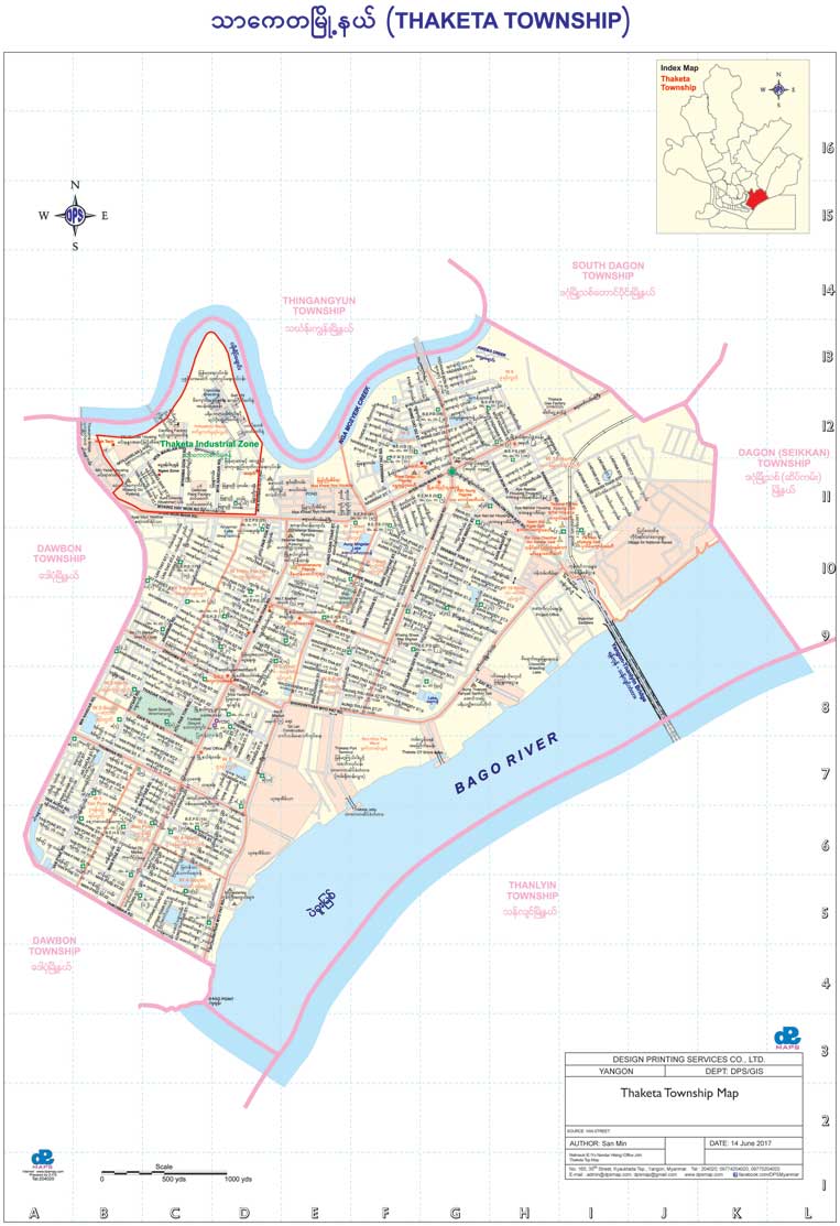
Thaketa Township Map
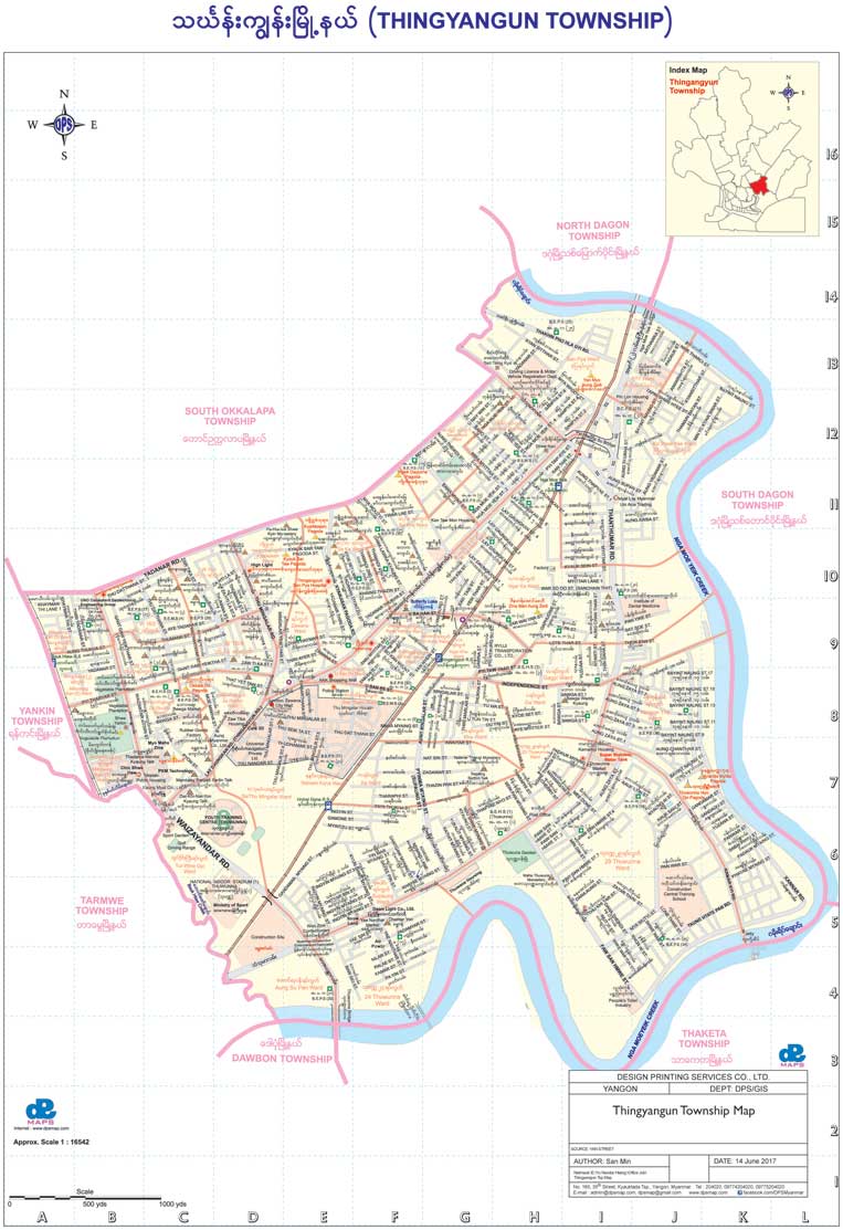
Thingangyun Township Map
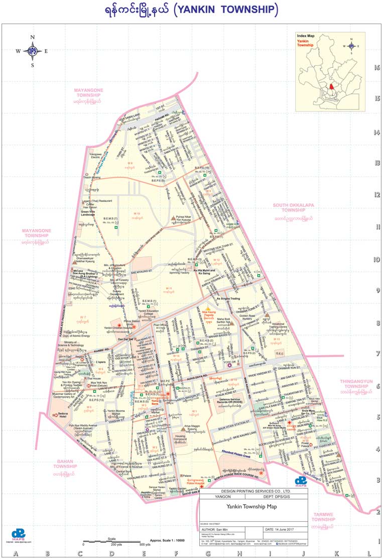
Yankin Township Map
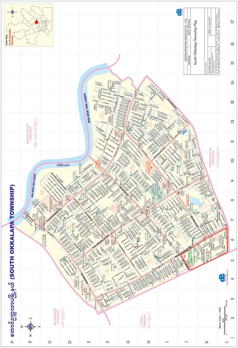
South Okkalapa Township Map
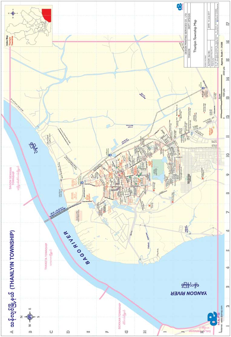
Thanlyin Township Map
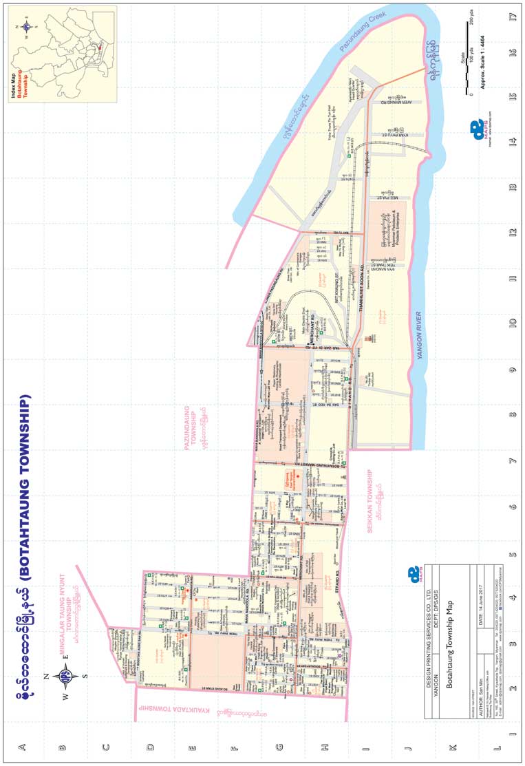
Botahtaung Township Map
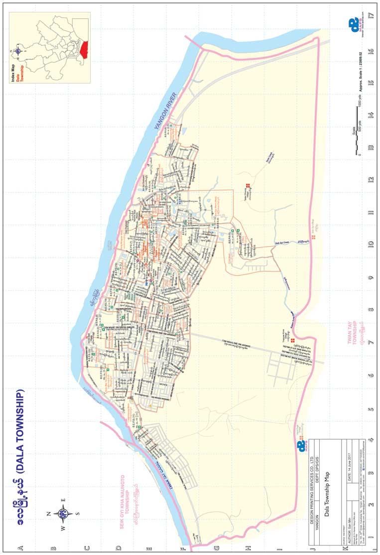
Dala Township Map
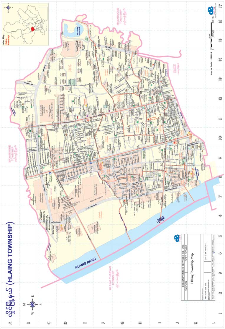
Hlaing Township Map
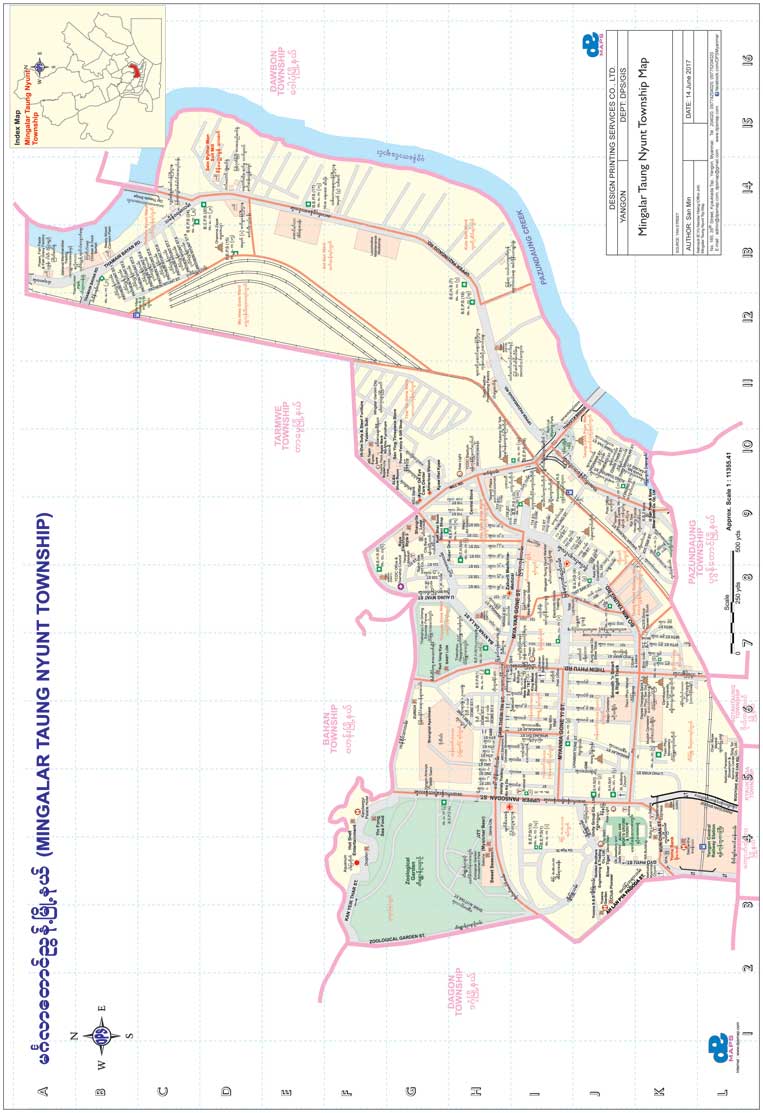
Mingalar Taung Nyunt Township Ma
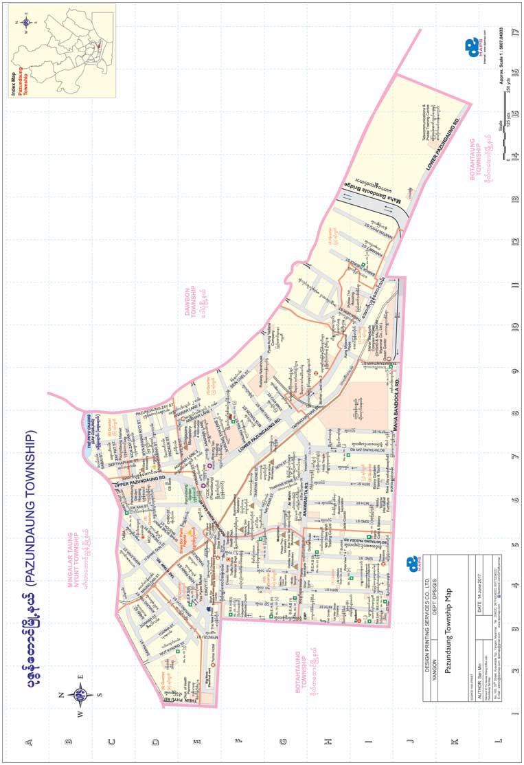
Pazundaung Township Map
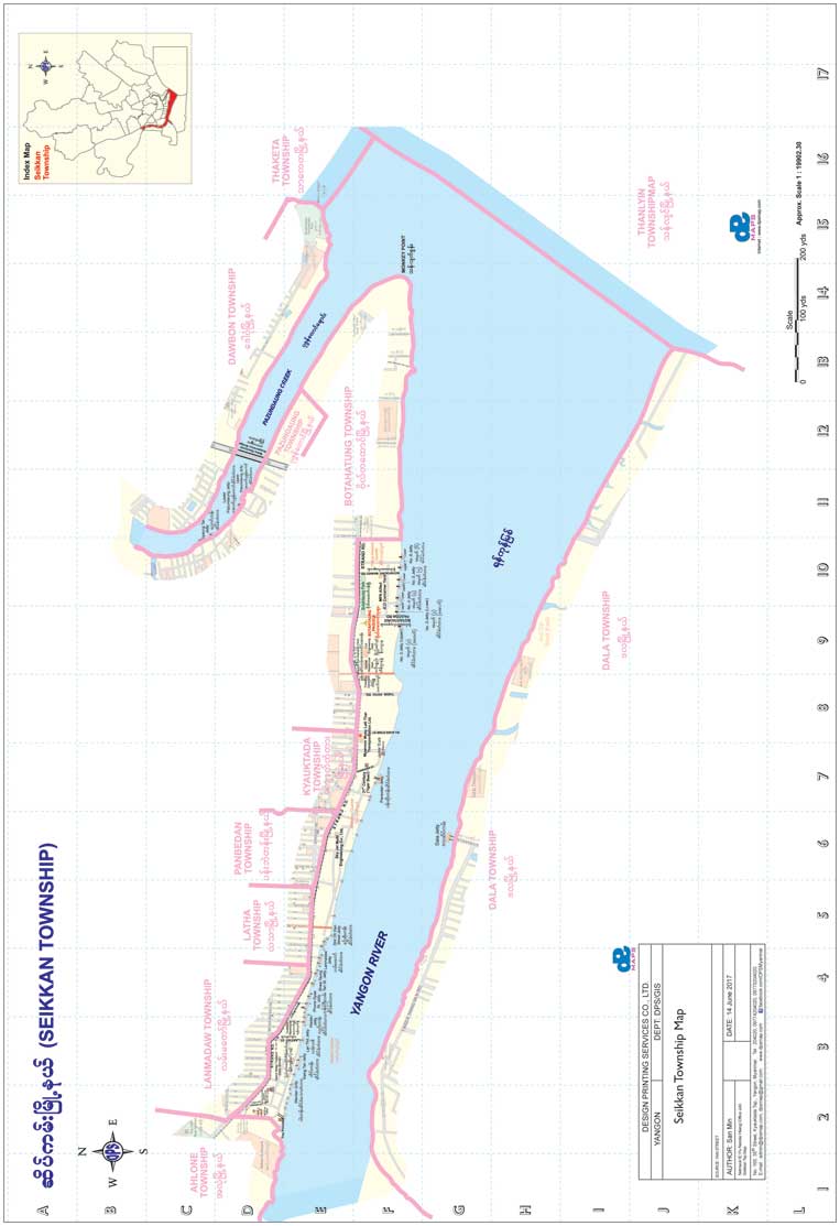
Seikkan Township Map
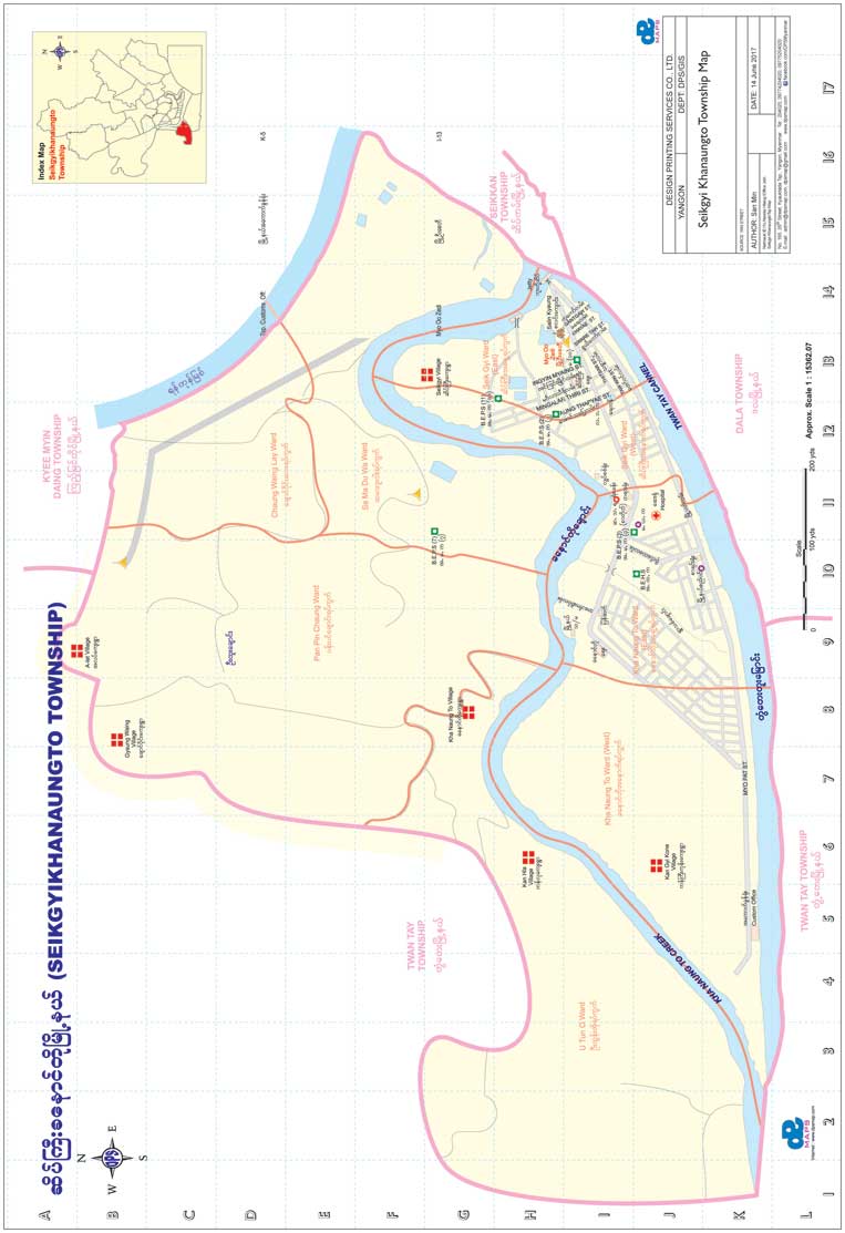
Seikkyi Khanaungto Township Map
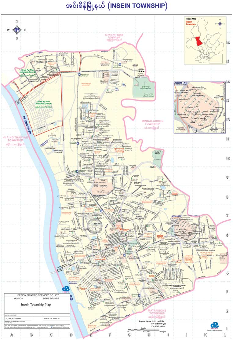
Insein Township
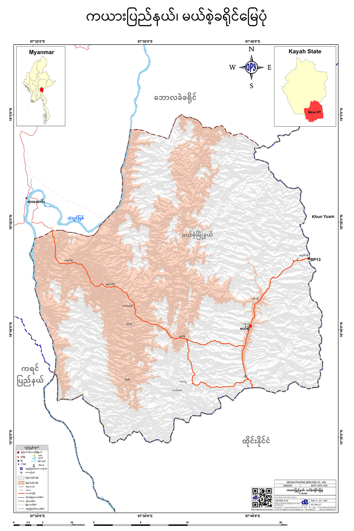
Kayah State
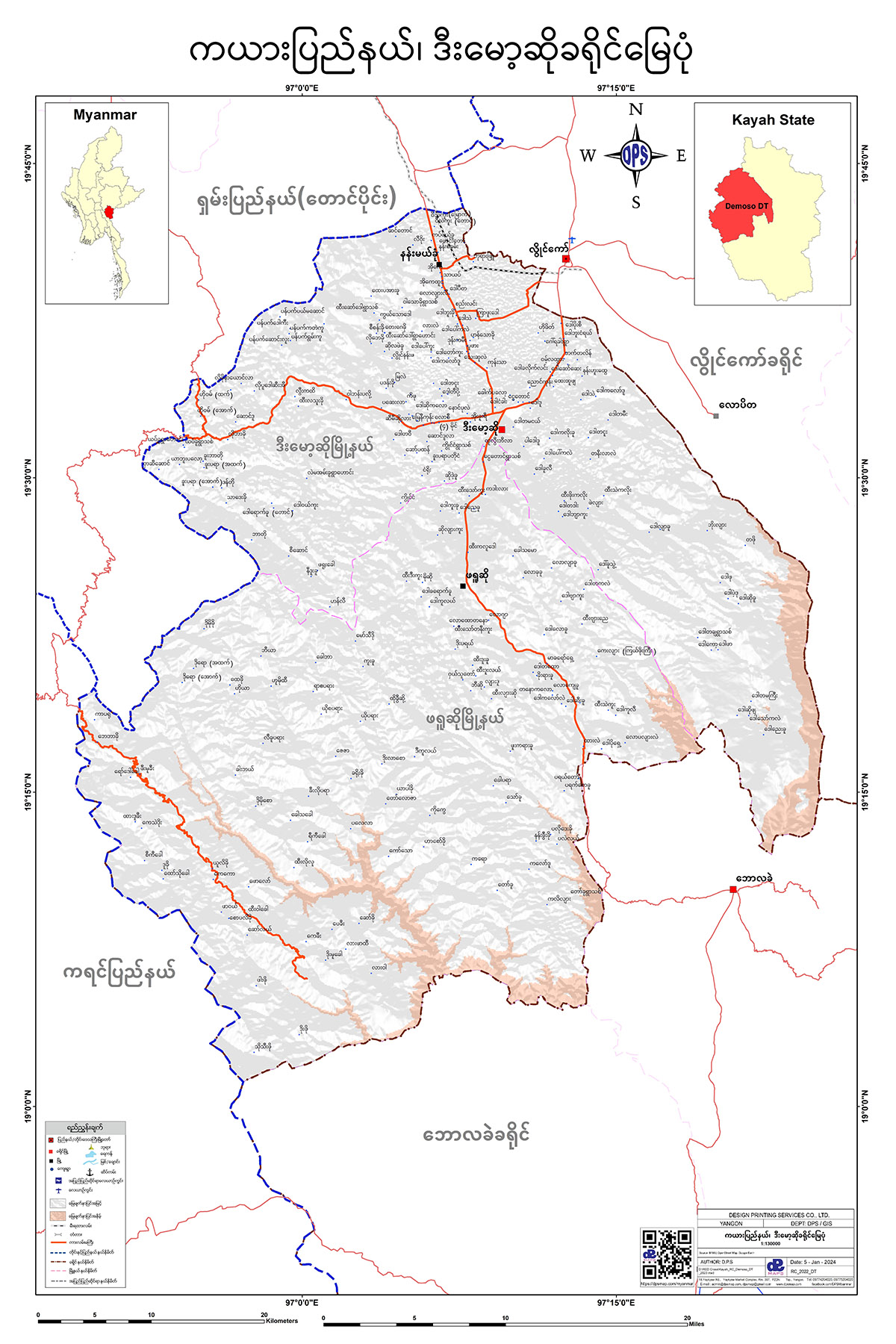
ဒီးမော့ဆိုခရိုင် မြေပုံ
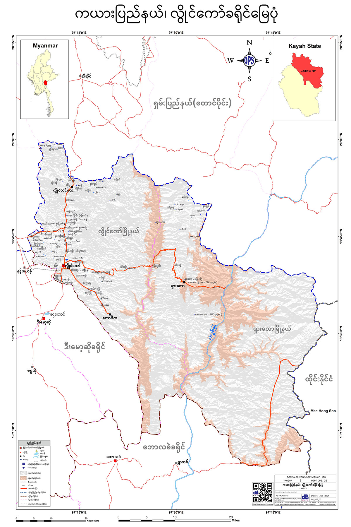
လွိုင်ကော်ခရိုင် မြေပုံ
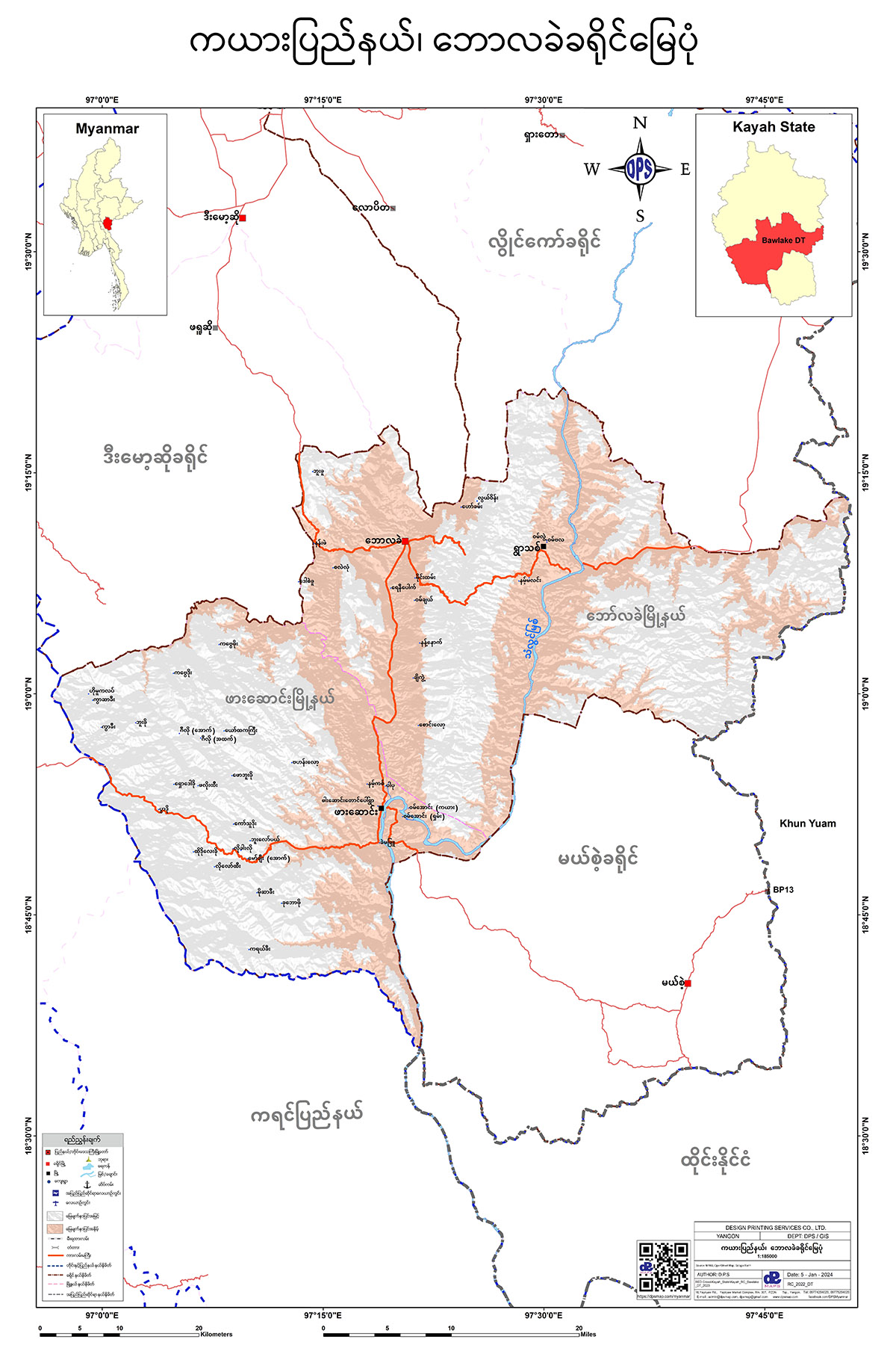
ဘောလခဲခရိုင် မြေပုံ
မယ်စဲ့ခရိုင် မြေပုံ
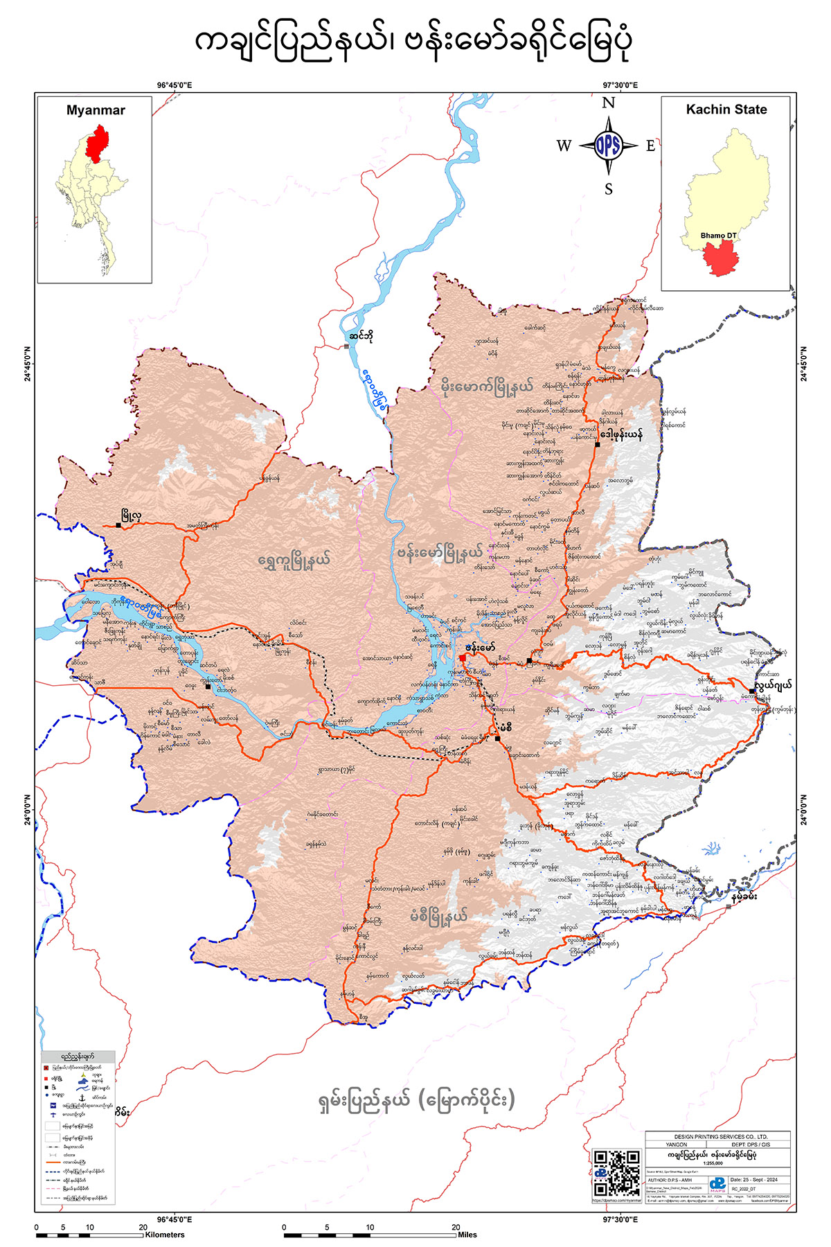
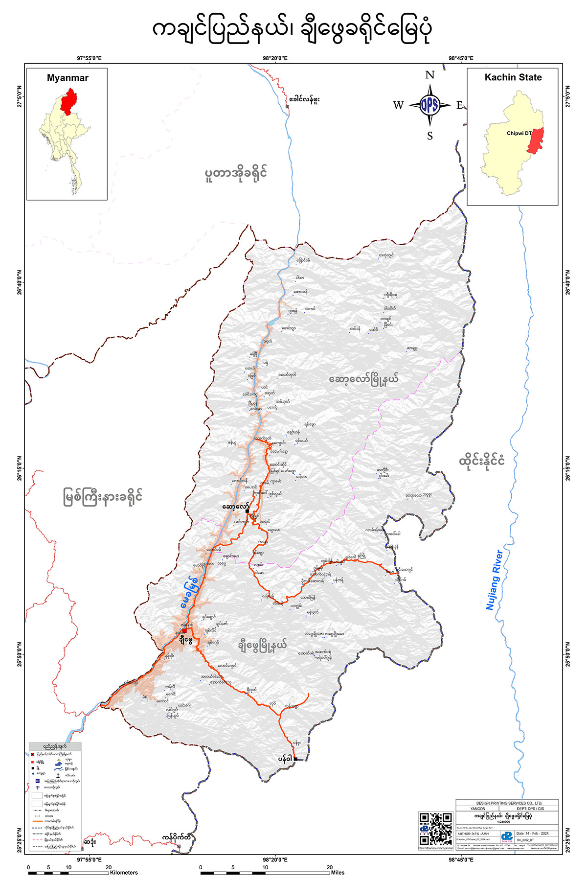
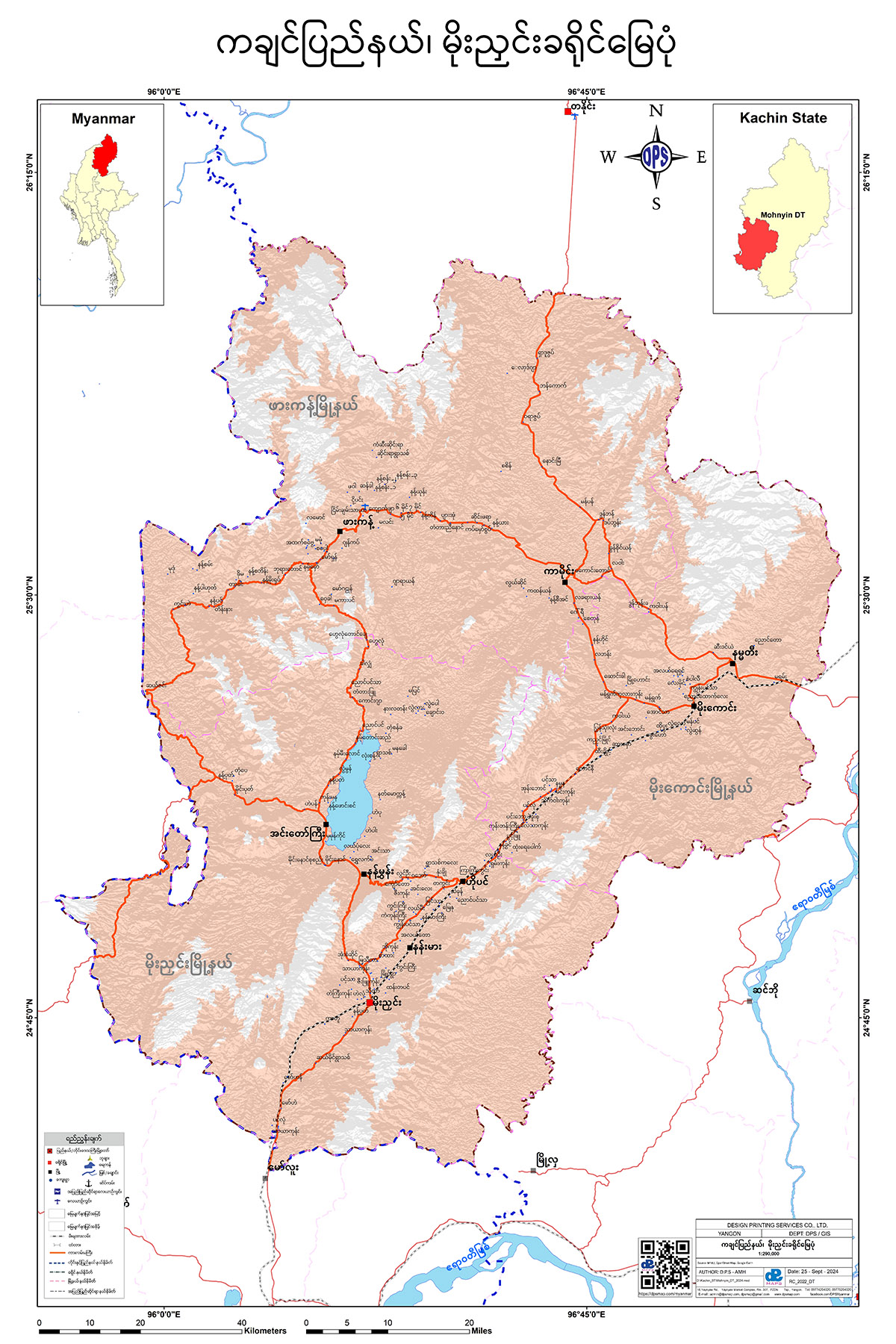
Kachin State
ဗန်းမော်ခရိုင် မြေပုံ
ချီဖွေခရိုင် မြေပုံ
မိုးညှင်းခရိုင် မြေပုံ
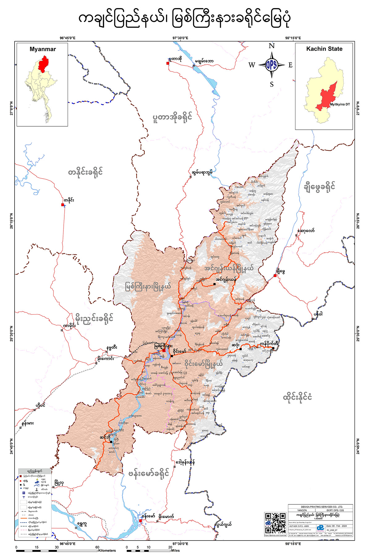
မြစ်ကြီးနားခရိုင် မြေပုံ
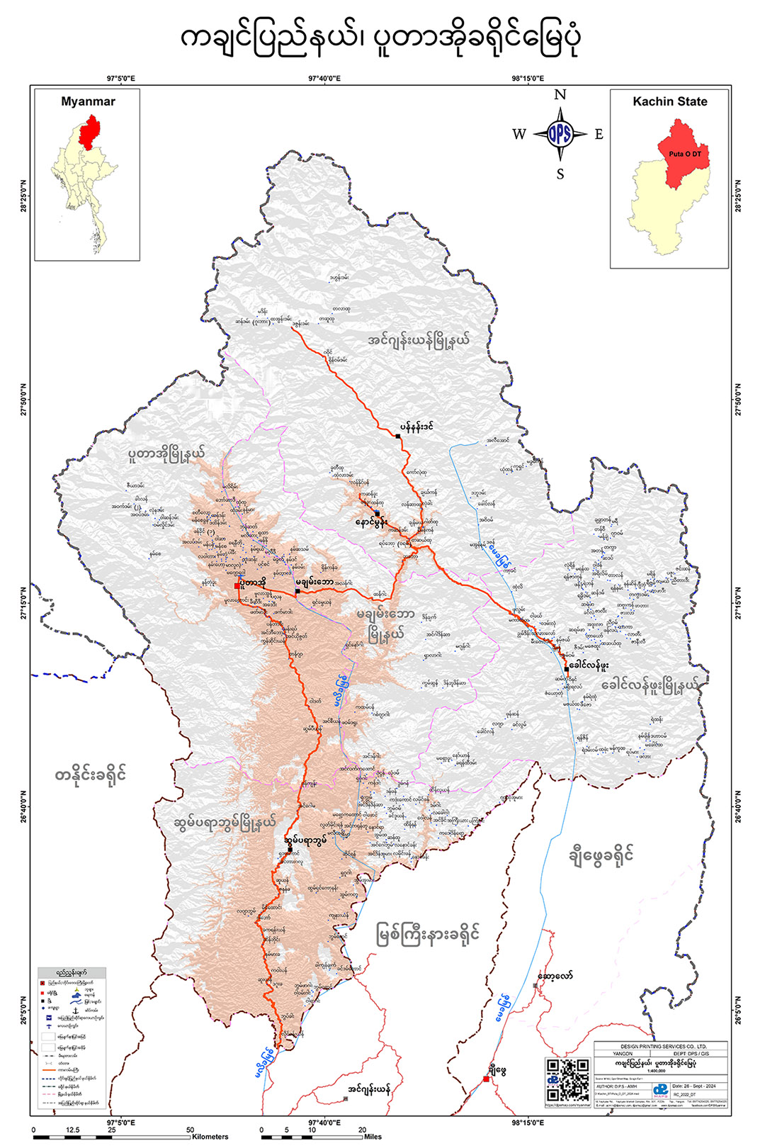
ပူတာအိုခရိုင် မြေပုံ
ပခုက္ကူခရိုင် မြေပုံ
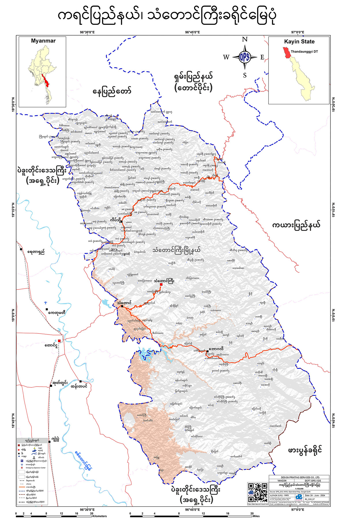
Kayin State
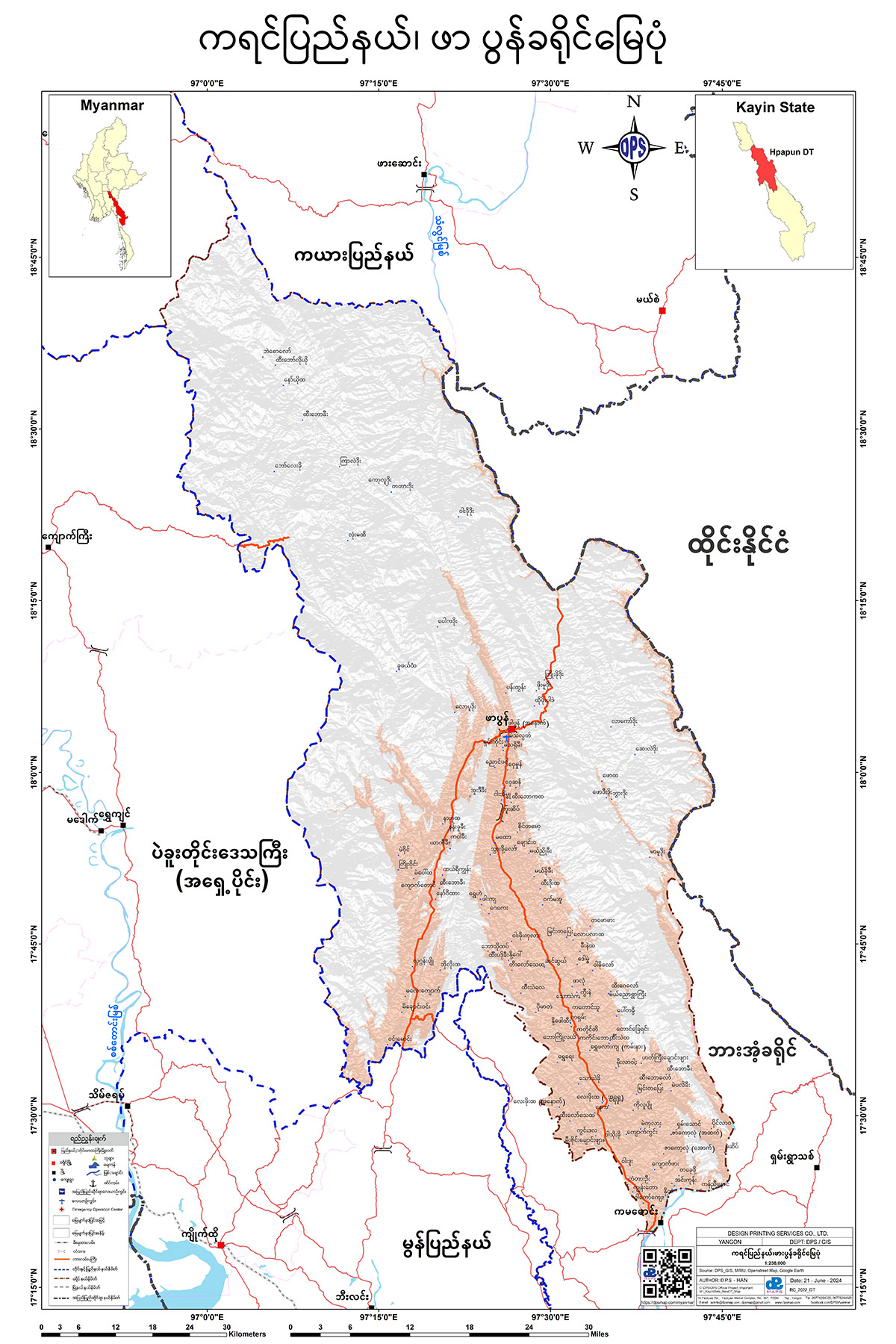
ဖာပွန်ခရိုင် မြေပုံ
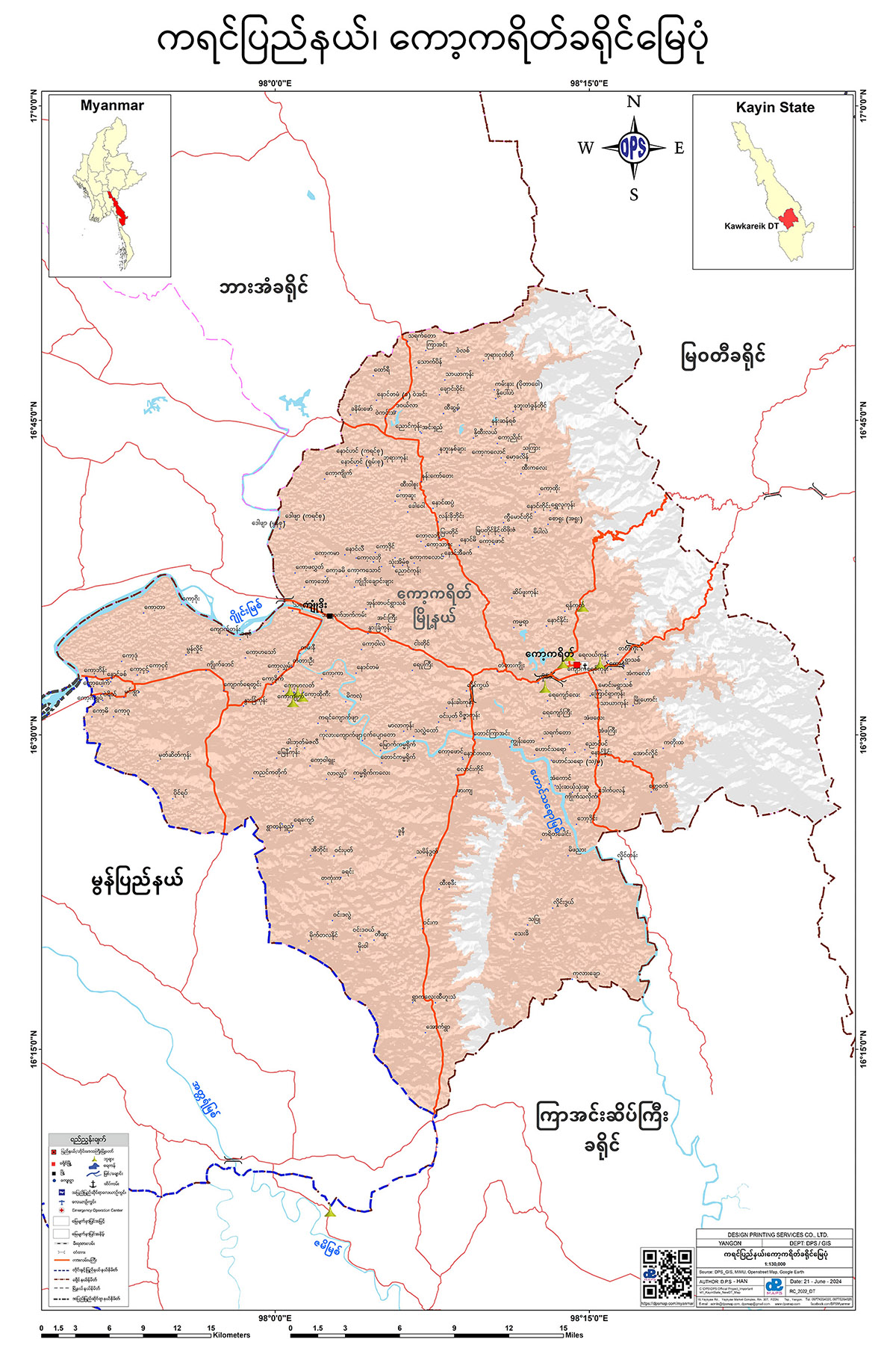
ကော့ကရိတ်ခရိုင် မြေပုံ
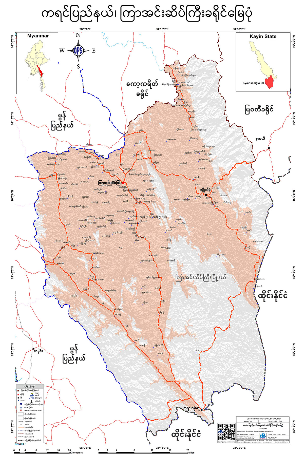
ကြာအင်းဆိပ်ကြီးခရိုင် မြေပုံ
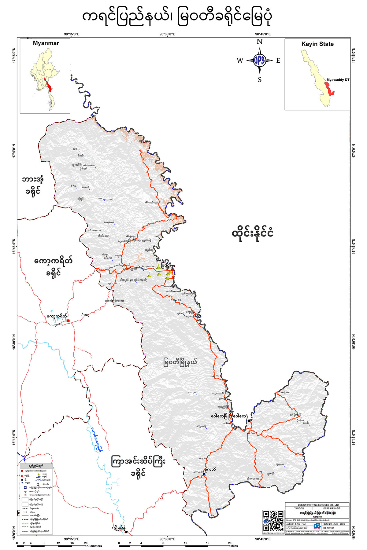
မြဝတီခရိုင် မြေပုံ
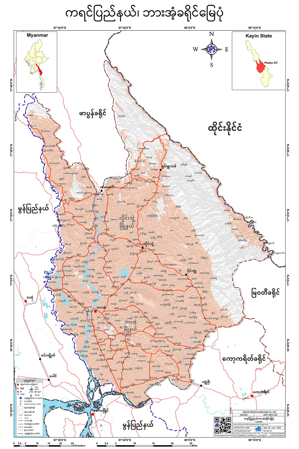
ဘားအံခရိုင် မြေပုံ
သံတောင်ကြီးခရိုင် မြေပုံ
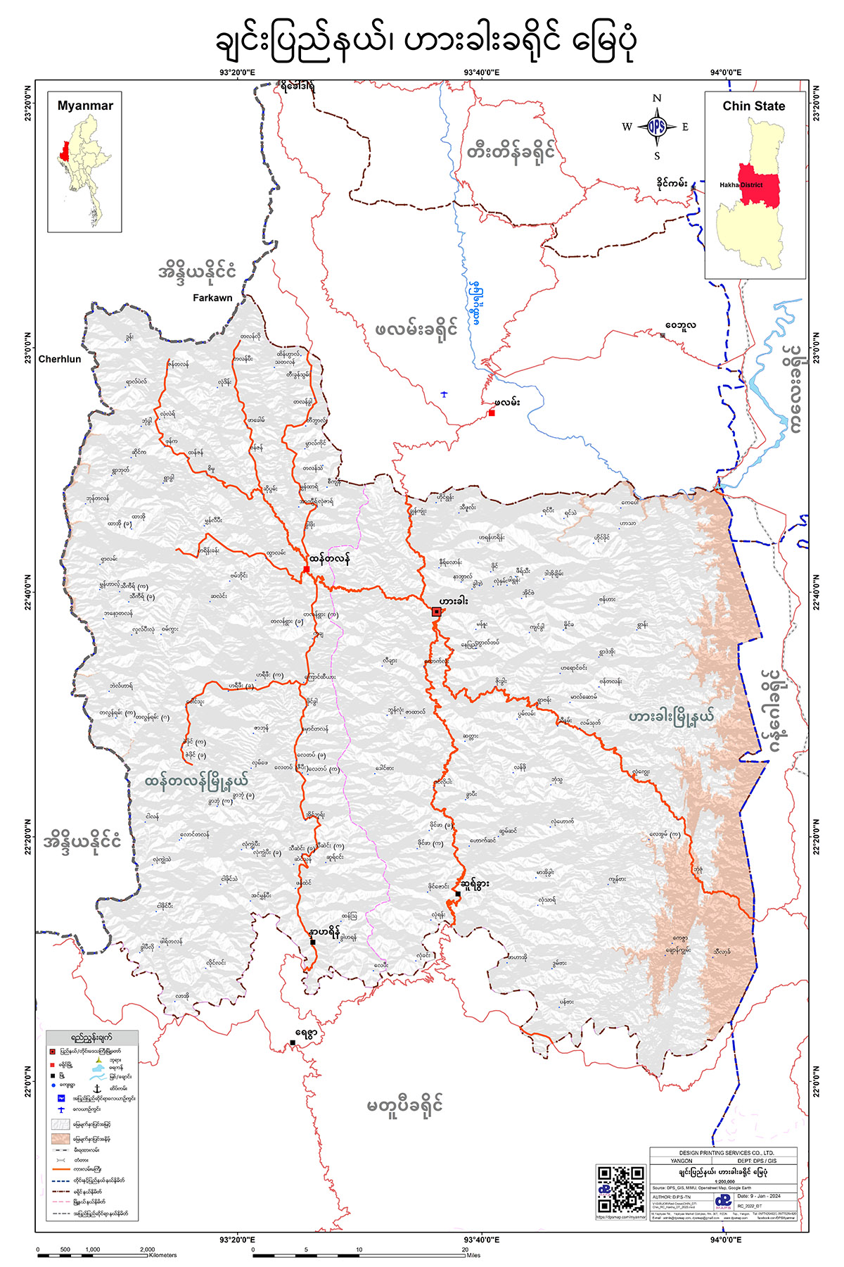
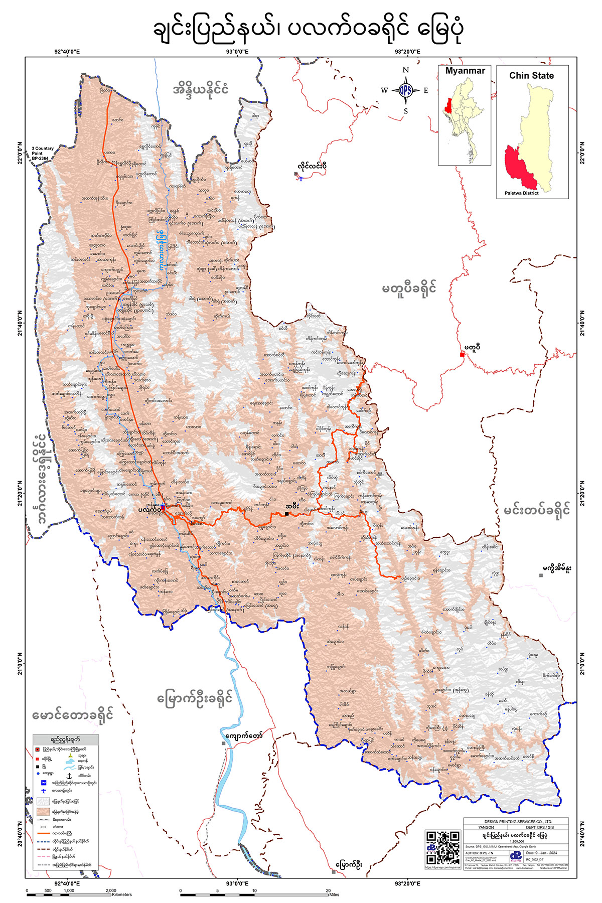
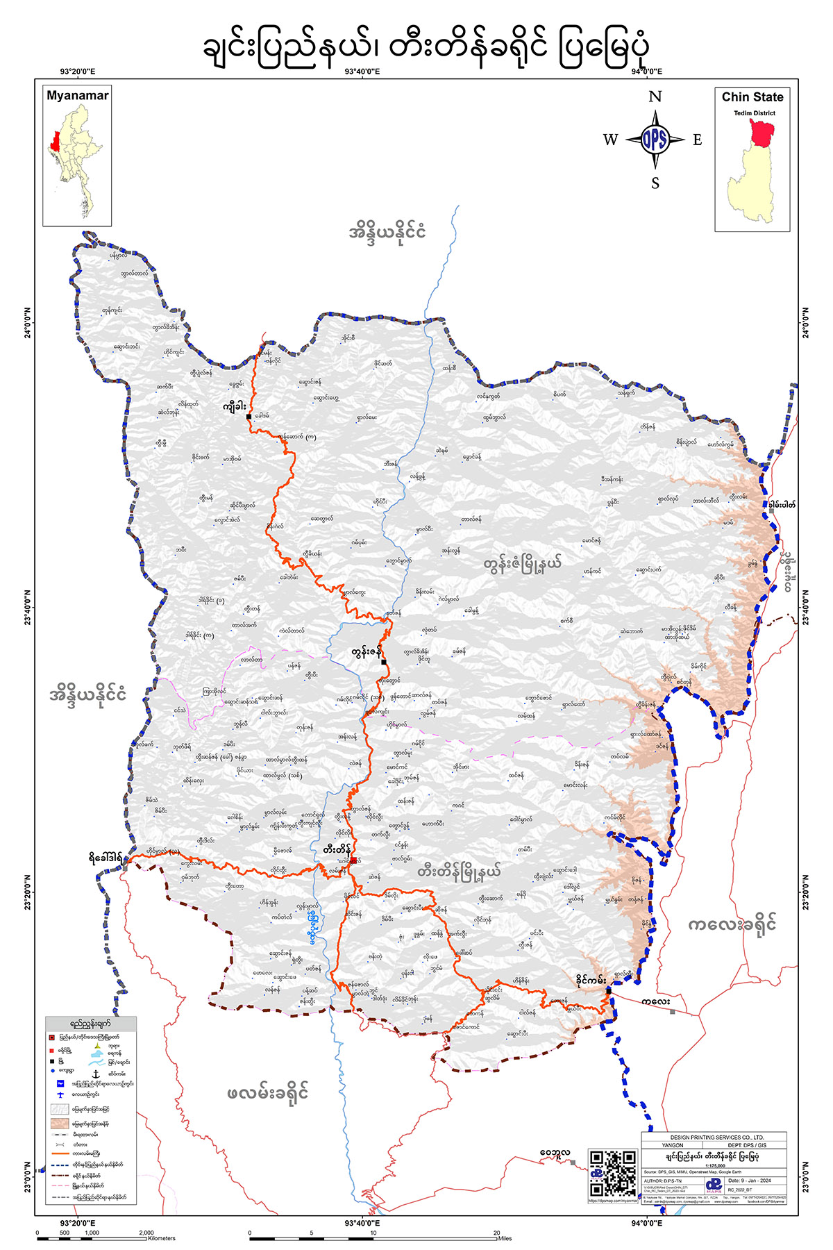
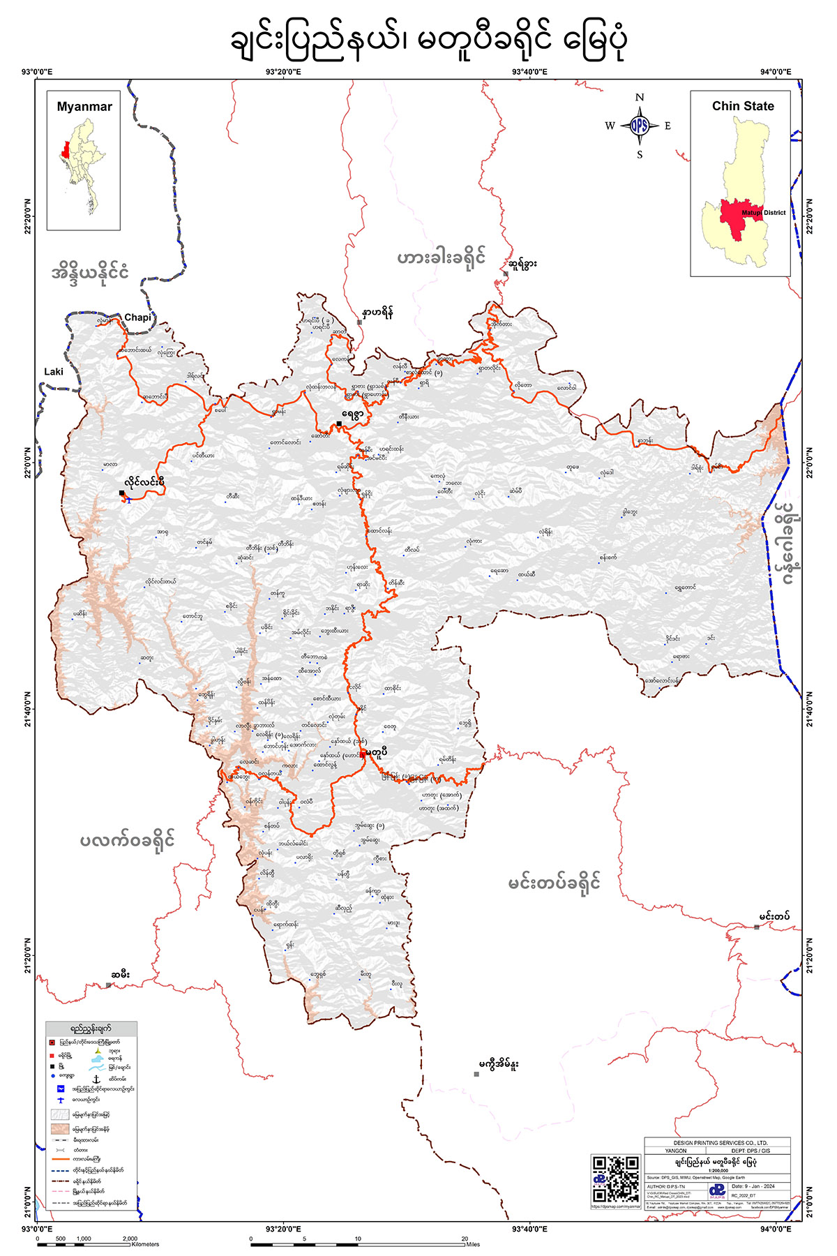
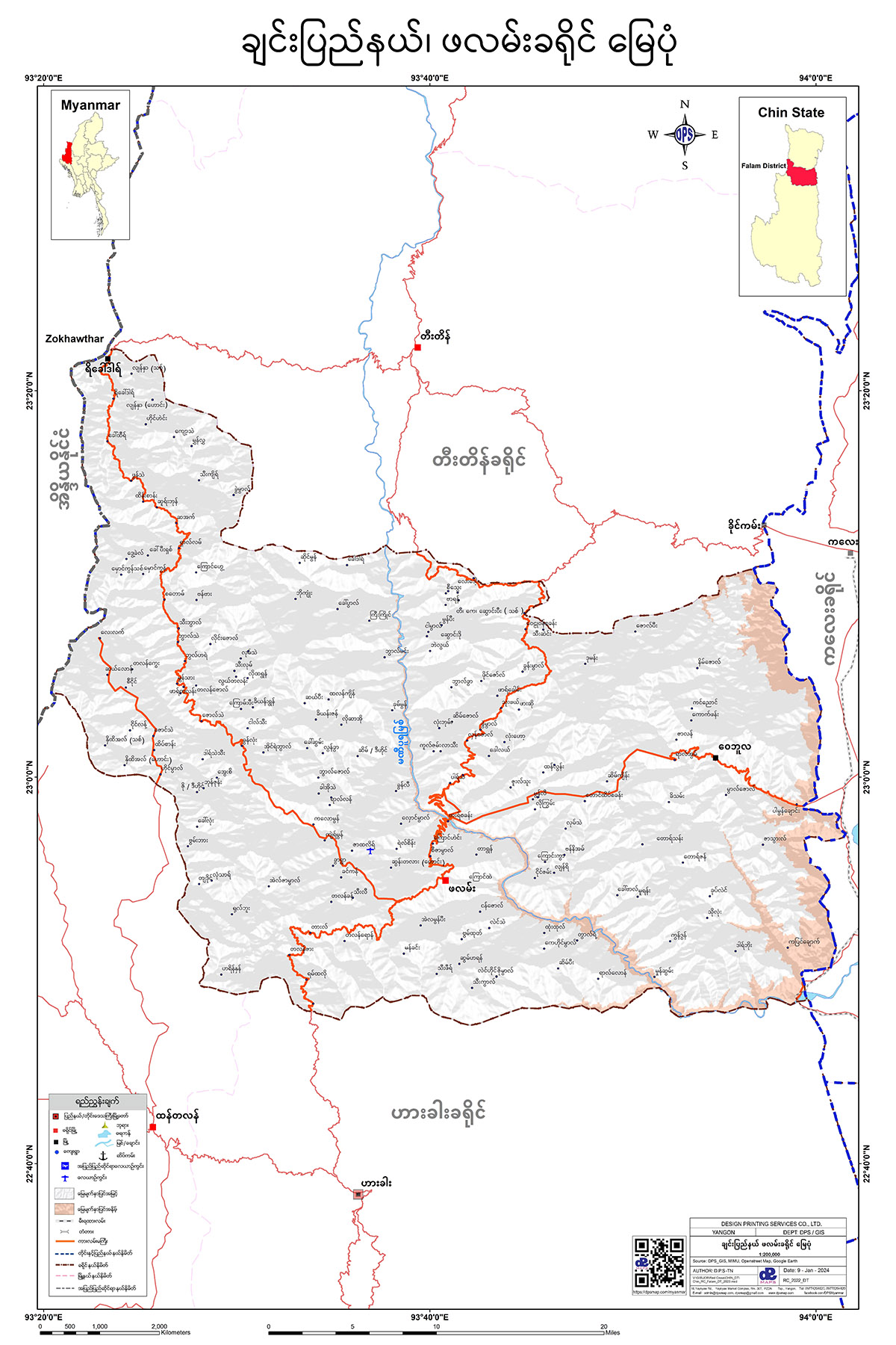
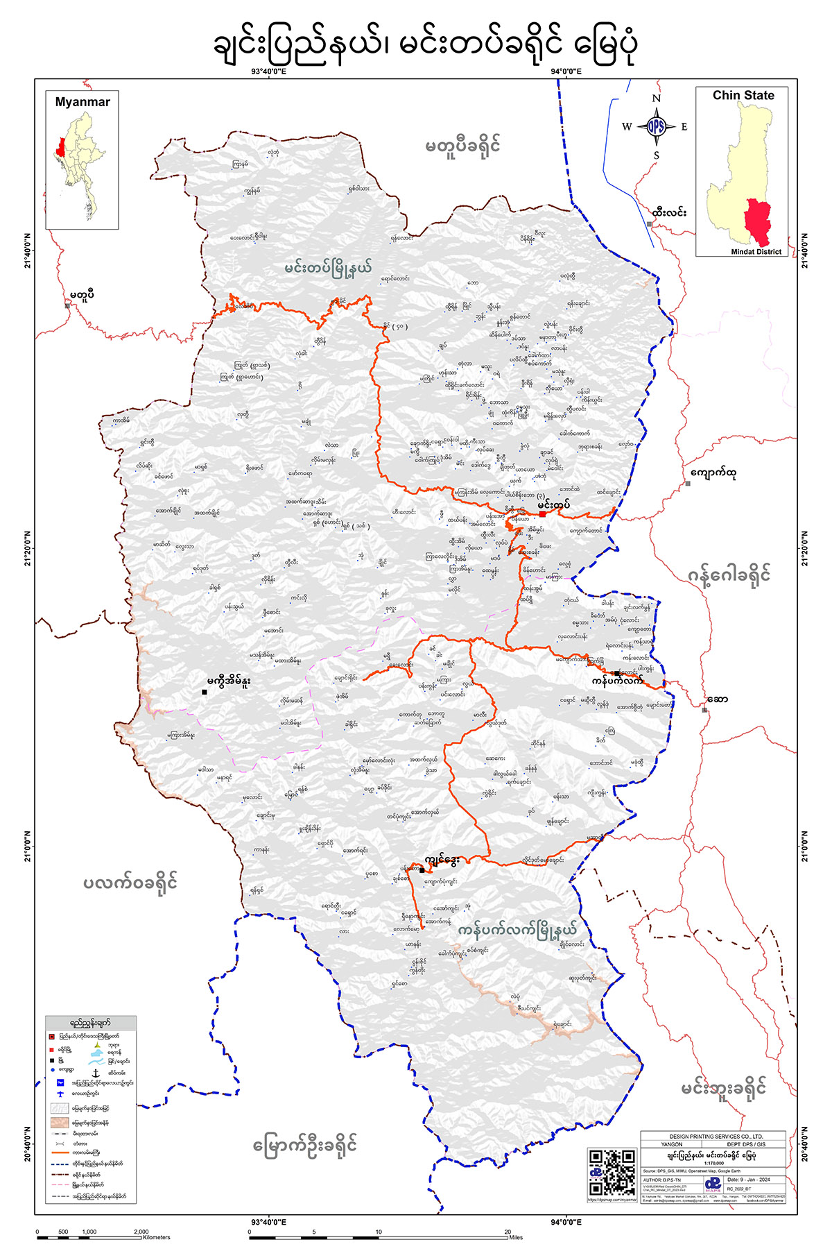
Chin State
ဟားခါးခရိုင် မြေပုံ
ပလက်ဝခရိုင် မြေပုံ
တီးတိန်ခရိုင်ပြ မြေပုံ
မတူပီခရိုင် မြေပုံ
ဖလမ်းခရိုင် မြေပုံ
မင်းတပ်ခရိုင် မြေပုံ
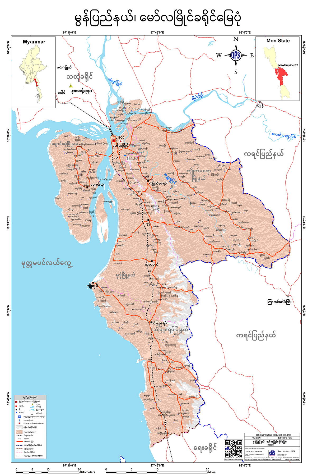
Mon State
မော်လမြိုင်ခရိုင် မြေပုံ
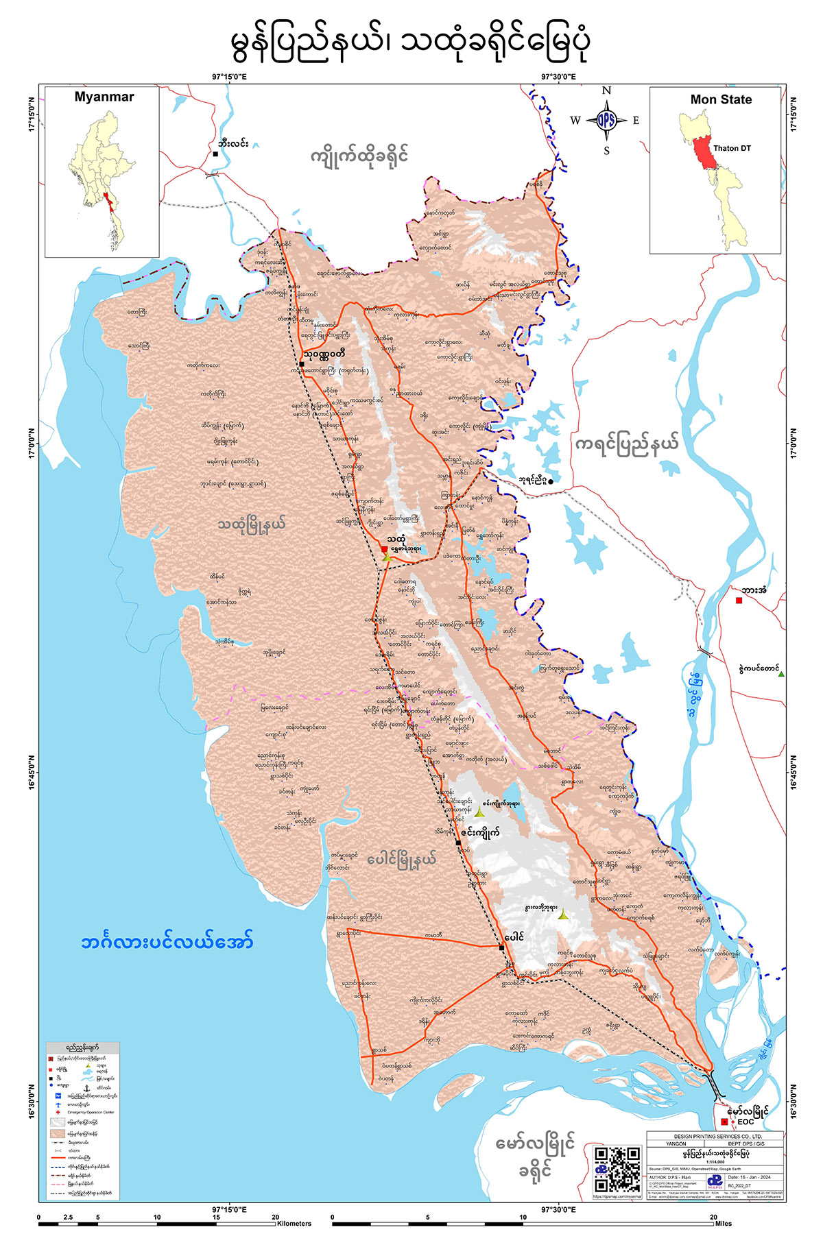
သထုံခရိုင် မြေပုံ
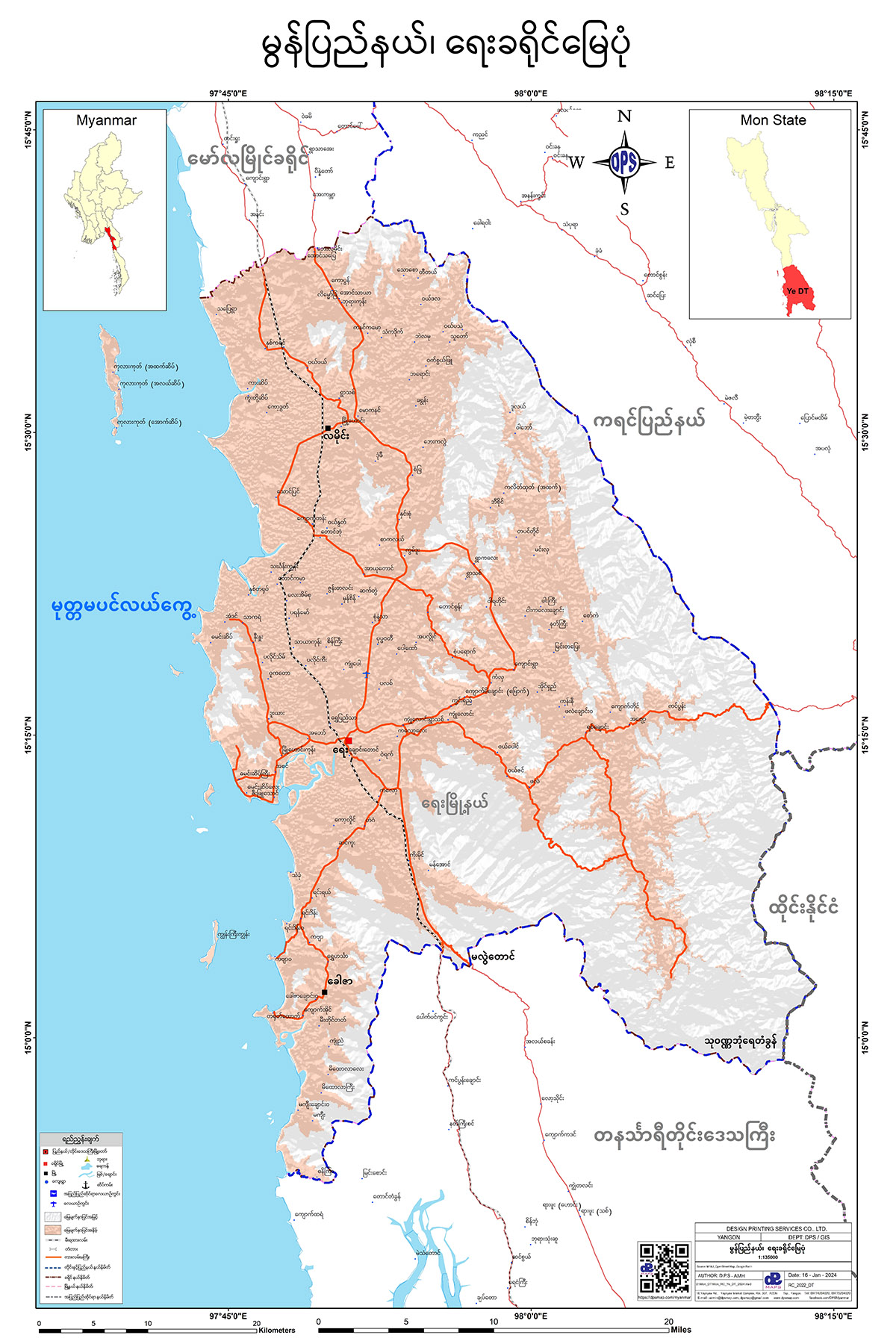
ရေးခရိုင် မြေပုံ
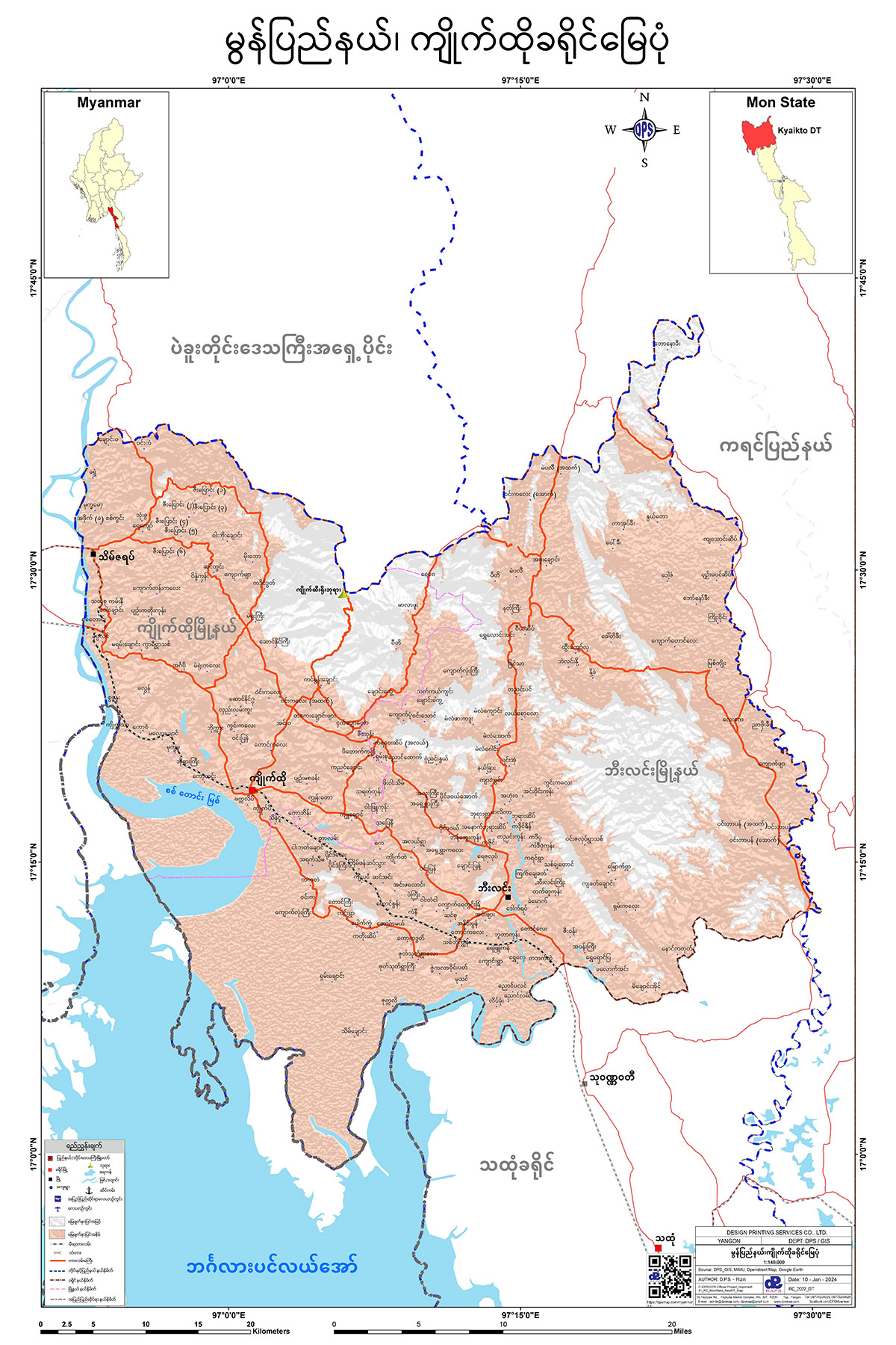
ကျိုက်ထိုခရိုင် မြေပုံ
Shan State
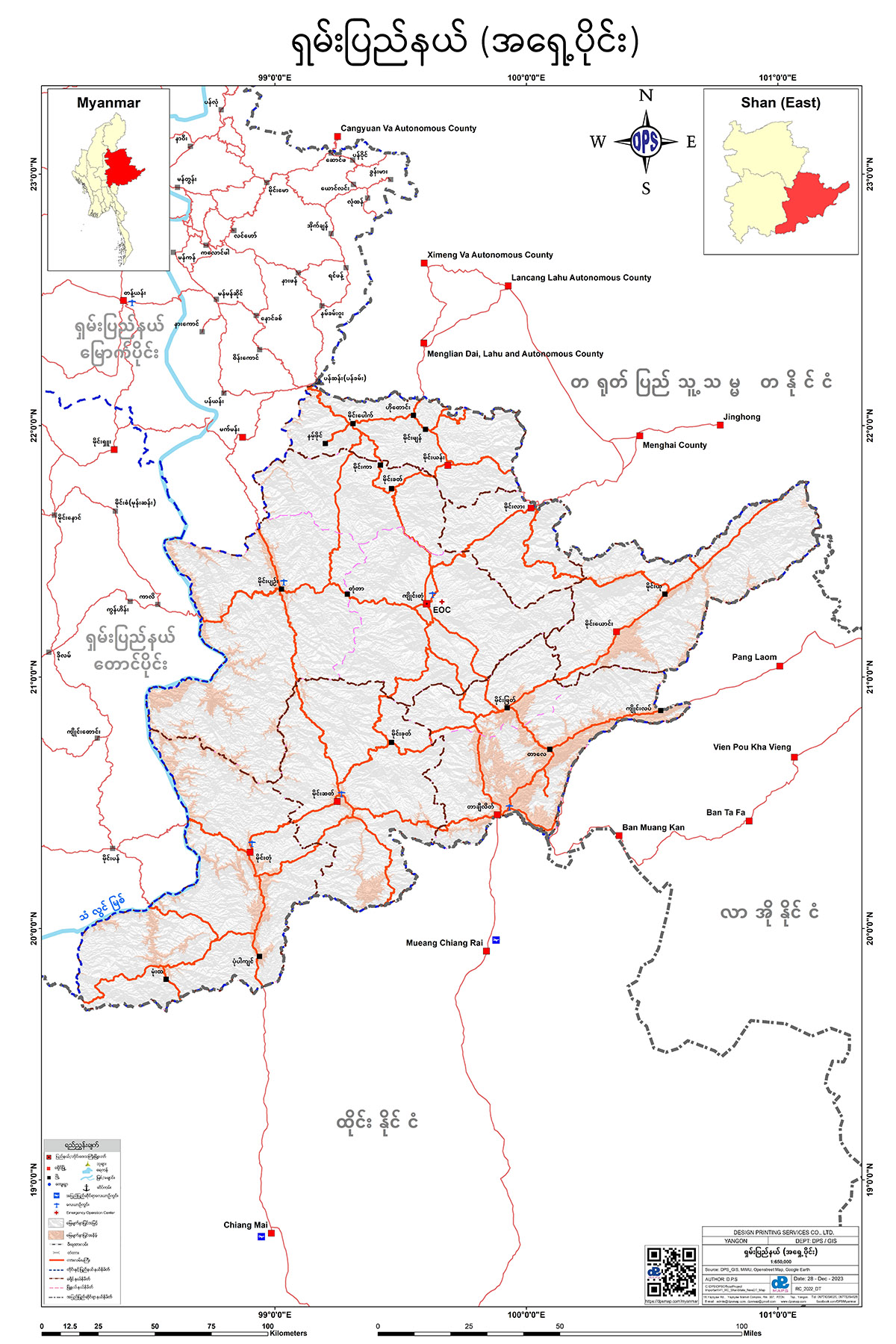
ရှမ်းပြည်နယ် (အရှေ့ပိုင်း)
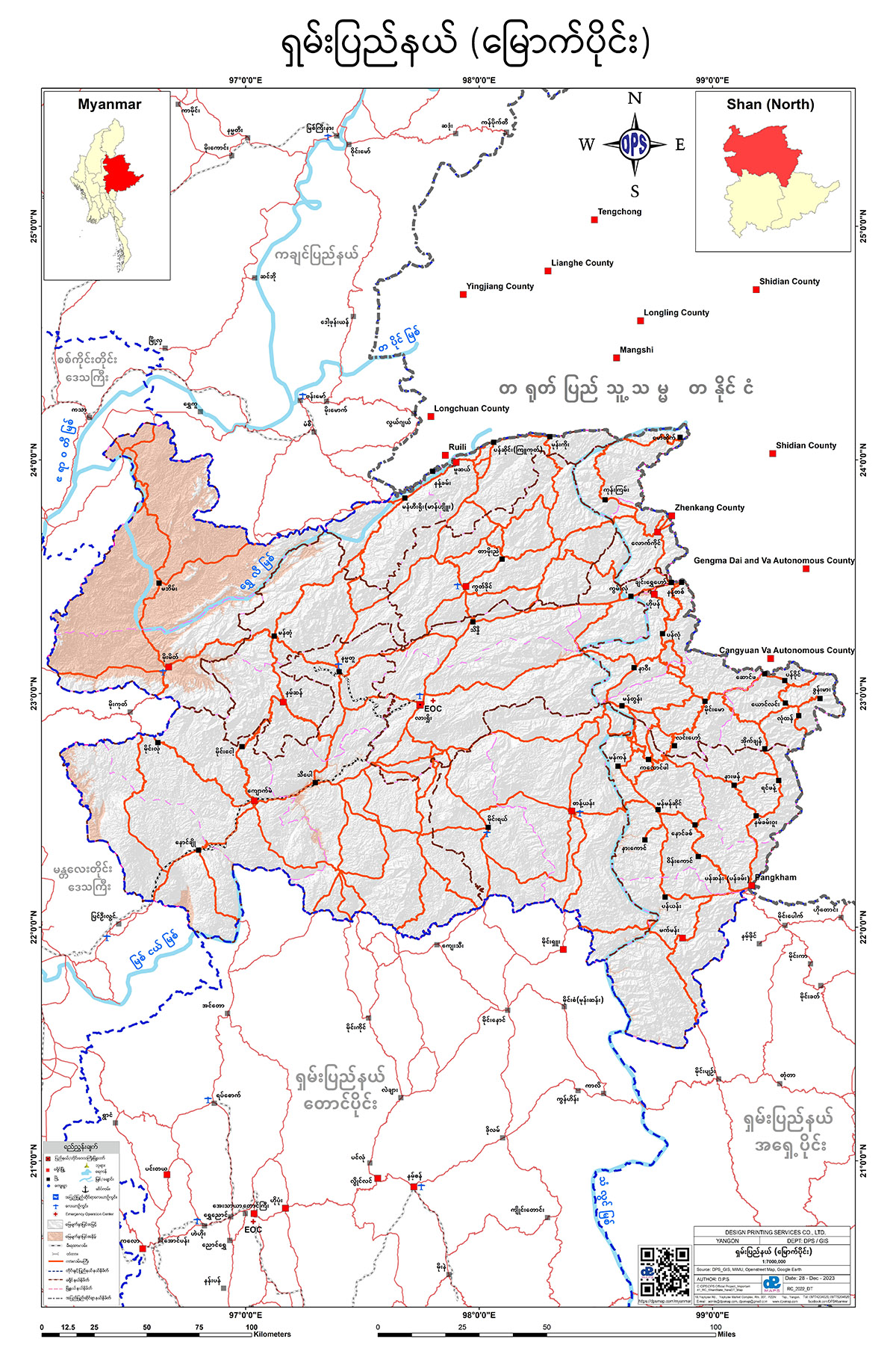
ရှမ်းပြည်နယ် (မြောက်ပိုင်း)
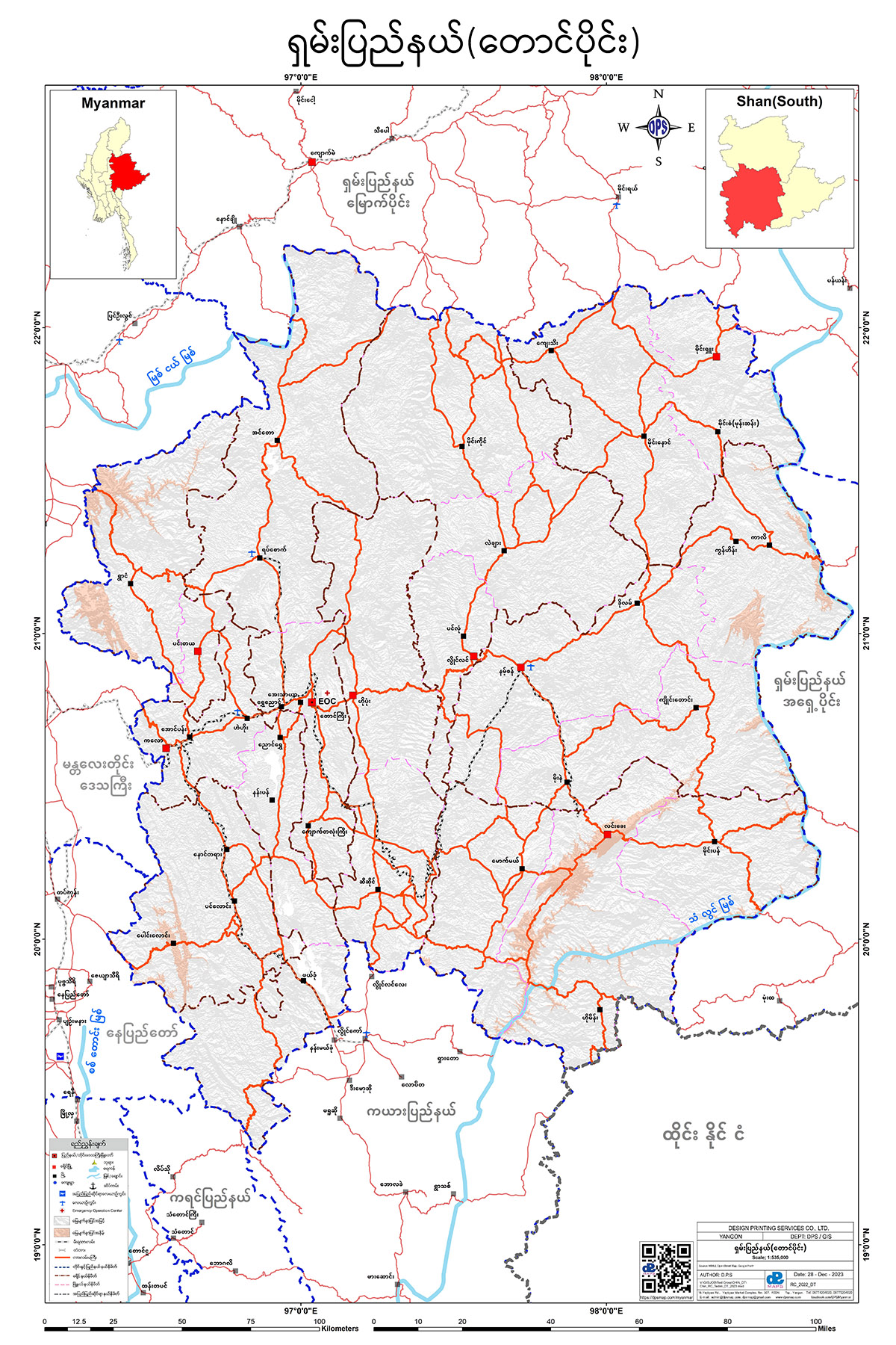
ရှမ်းပြည်နယ် (တောင်ပိုင်း)
Rakhine State