Kyaikthanlan Pagoda
The highest pagoda on the ridge overlooking the entire city, Thanlwin River, and Bilu Island.
Explore Mawlamyaing, the capital of Mon State and a historic port city on the Thanlwin River.
Mawlamyaing, formerly known as Moulmein, is the capital of Mon State, Myanmar. It served as the administrative capital of British Lower Burma and became a thriving teak port from 1826 to 1862. Its strategic position made it the first British seaport in Southeast Asia.
Originally a Mon city, Mawlamyaing has a long history shaped by conflict, trade and cultural exchange. Its best-known landmark is Kyaikthanlan Pagoda, traditionally dated to 875 AD, alongside colonial-era architecture and scenic viewpoints.
State Capital
Historic Port
Kyaikthanlan Era
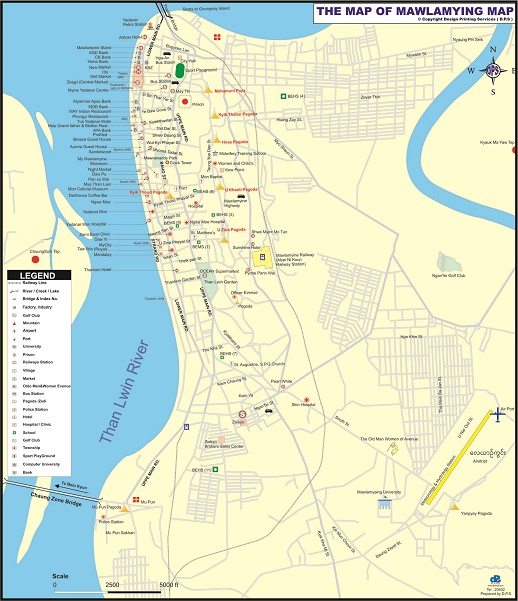
To download the full and complete Mawlamyaing Map:
Famous attractions across Mawlamyaing and the Thanlwin River waterfront.
The highest pagoda on the ridge overlooking the entire city, Thanlwin River, and Bilu Island.
Scenic river promenade with sunset viewpoints, historic docks, local eateries, and night market life.
A picturesque rocky islet on the Thanlwin River famous for Inzabu Pagoda and royal hair-washing ceremonies.